Ozark National Scenic Riverways in Missouri is one of the best-kept secrets for nature lovers and adventure seekers alike. This incredible park is a haven of crystal-clear springs, breathtaking waterfalls, historic mills, and mysterious caves- all set against the backdrop of the stunning Ozark landscape. Whether you’re a fan of hiking, kayaking, or just soaking in the beauty of the outdoors, the Ozark Riverways has something for everyone. In this post, I’ll take you through 8 must-see spots within the park, from the iconic blue waters of Big Spring to the historic ruins of Welch Spring Hospital. Grab your hiking boots and let’s dive into some of the most beautiful and unique spots in Missouri!
About Ozark National Scenic Riverways
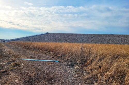
The Ozark National Scenic Riverways was the first nationally protected river system in the U.S., and it all started with a grassroots effort to save Missouri’s Current River. When Congress established the park in 1964, it expanded to include both the Current and Jacks Fork Rivers. Missouri even donated three state parks (Alley Spring, Big Spring, and Round Spring) to the National Park Service, and land along the rivers between these parks was purchased to protect even more of the area. The park is famous for its incredible geology, with caves, springs, and a stunning karst landscape. It actually has more first-magnitude springs (springs that push out over 65 million gallons of water daily) in one area than anywhere else on Earth! The karst landscape formed as water dissolved the bedrock, creating underground chambers that eventually became massive cave systems. Today, there are over 400 caves in the park, plus sinkholes and other cool karst features.
Does Ozark NSR have National Park passport stamps?
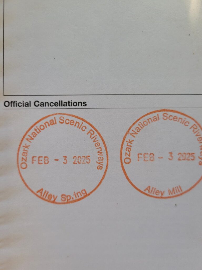
Yes! We’re big fans of the National Park passport program! Ozark National Scenic Riverways has four stamp locations:
- Alley Spring & Alley Mill stamps are available 24/7 on the screened porch of the Alley general store
- At the Big Spring Entrance Station
- At the Pulltite Campground Ranger Station
- At Round Spring Ranger Station
Does Ozark NSR have a Junior Ranger program?
Ozark NSR offers a Junior Ranger program. Booklets can be picked up at the Mill, Big Spring Entrance Station, or from a campground host.
Is there a fee to use Ozark NSR?
Ozark NSR does not have a fee to enter or park!
Is there cell service in Ozark NSR?
Some units might have cell service, but this area of the Ozarks is known for having very bad or no cell service. Be prepared with either a good printed map or with an AllTrails+ membership, which allows you to download maps for offline use on your phone.
Camping at Ozark National Scenic Riverways
Ozark National Scenic Riverways has a ton of camping options! There are developed campsites with electric, as well as undeveloped camping. There is backcountry camping, primitive camping, gravel bar camping, and camping along the Ozark Trail.
Developed Campgrounds
Developed campsites can be reserved on recreation.gov
- Big Spring Campground: 123 total sites, mix of electric + non-electric
- Alley Spring Campground: 146 total sites, mix of electric + non-electric
- Round Spring Campground: 55 total sites, mix of electric + non-electric
- Pulltite Campground: 55 total sites, all non-electric. Currently closed due to flood damage
- Two Rivers Campground: 22 total sites, all non-electric
Backcountry Camping
Backcountry camping in the Ozark NSR is on a first-come, first-served basis and payed for through the Scan & Pay system on the recreation.gov app. There are 18 different areas that are open to backcountry camping, which can be found here.
Primitive Camping
Ozark NSR offers free non-reservable primitive camping. There are tooons of options for primitive camping here, which can all be found online here.
Gravel Bar Camping
Boaters and floaters can pull off the river and camp on gravel bars within the park boundaries. Gravel bar camping is free and non-reservable. There are some regulations on locations, though, so be sure to check online first.
Ozark Trail Camping
The Ozark Trail, a 430 mile long regional trail, runs through the Ozark National Scenic Riverways. There is free non-reservable camping available along the trail, check for more details here.
Ozark National Scenic Riverways Visitor Centers
There are four visitor center/ranger stations within Ozark NSR.
- Alley General Store
- 12185 Alley Hollow Road, Eminence, MO 65466
- Open 9am-5pm May 26-Septmeber 1
- Big Spring Entrance Station
- Highway 103, Van Buren, MO 63965
- Open 8:30am-5pm
- Closed on weekends September 2-May 25
- Pulltite Ranger Station
- 31104 County Road EE-356, Salem, MO 65560
- Has a kids center and park film
- Round Spring Ranger Station
- 13209 Round Spring Campground Rd, Eminence, MO 65466
- Open 8:30am-5pm May 26-September 1
- You can get cave tour tickets here
1. Devil’s Well
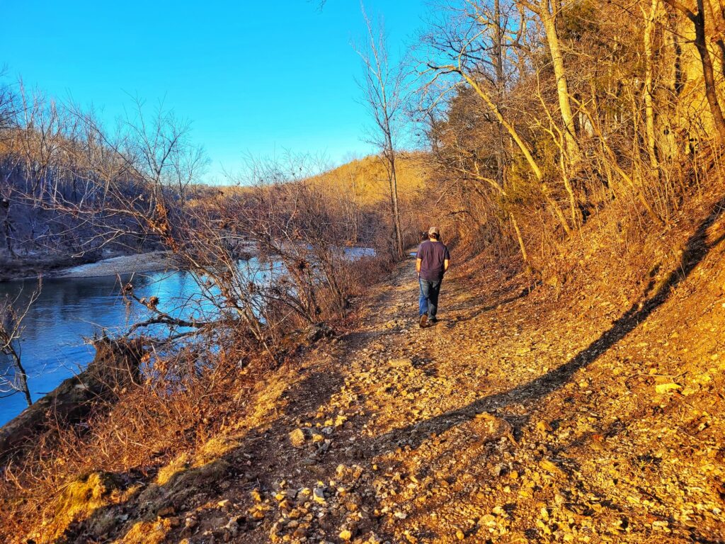
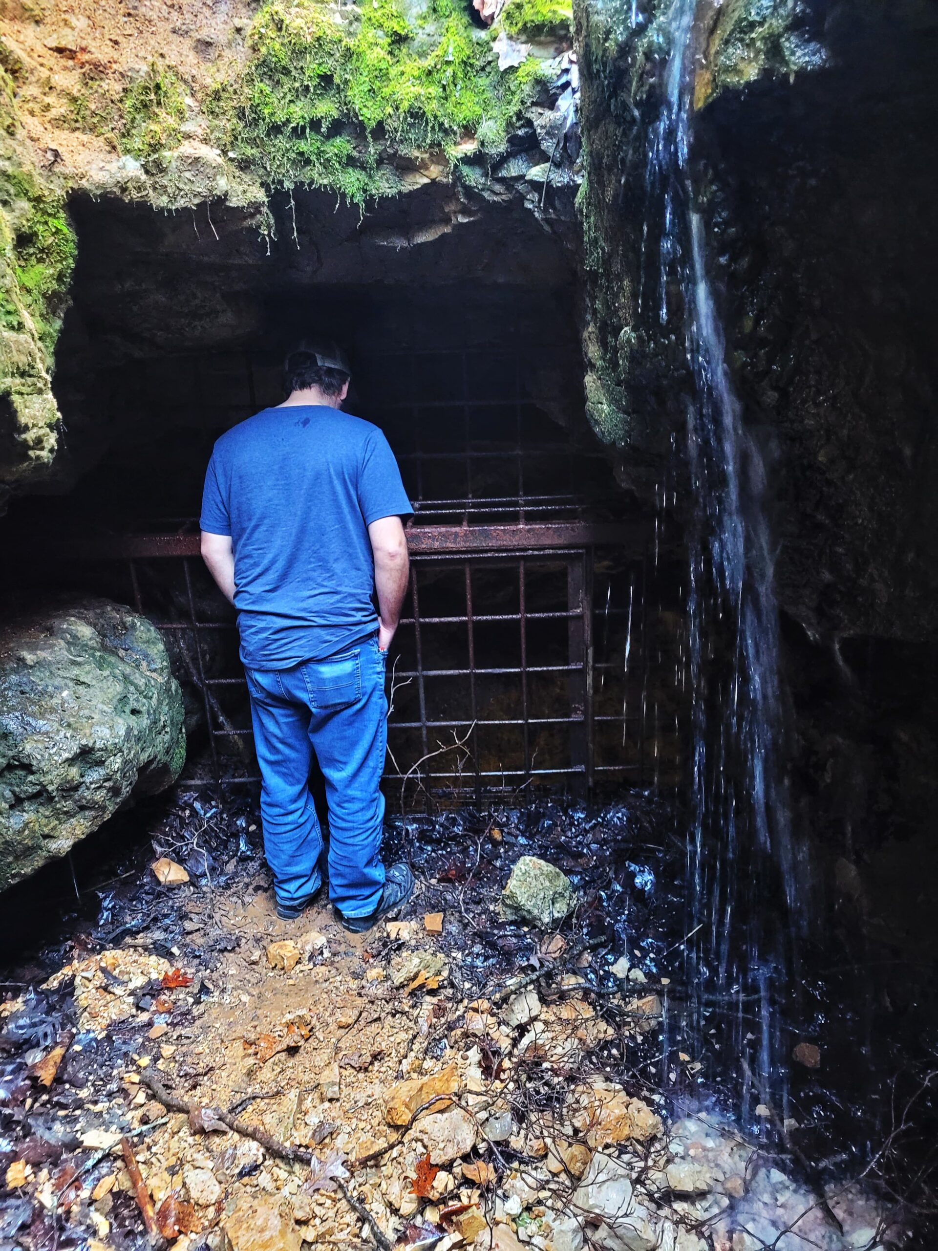
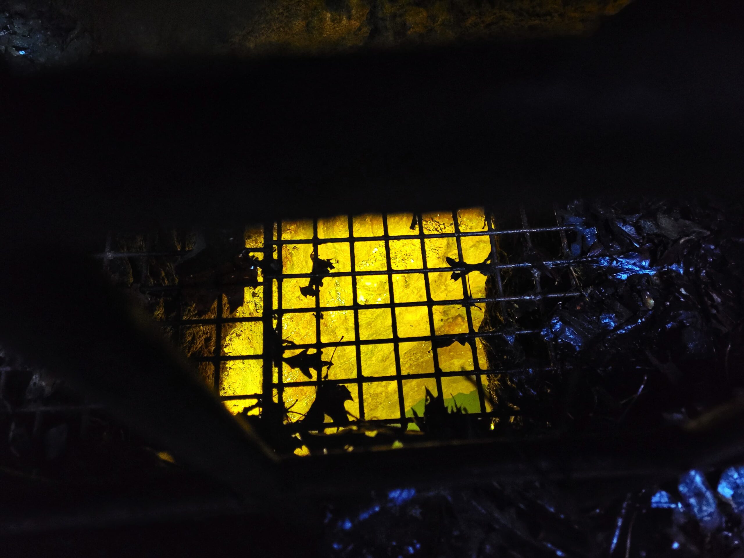
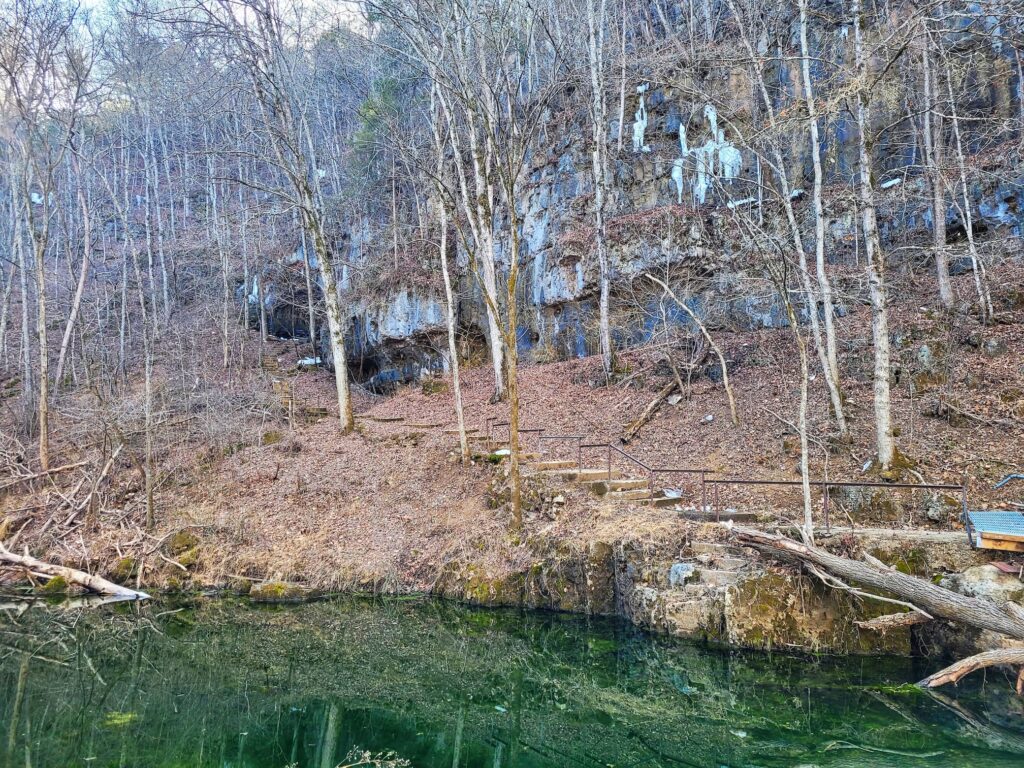
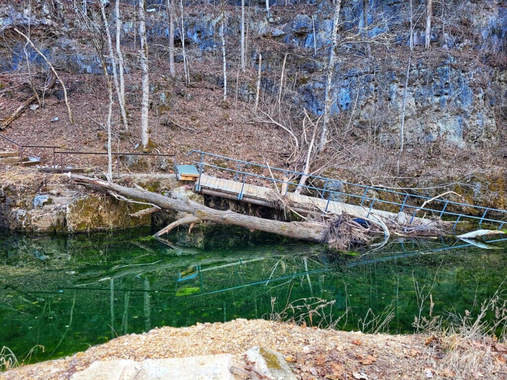
Devil’s Well is one of the wildest hidden gems in the Ozark National Scenic Riverways. It’s basically a massive underground lake sitting inside a collapsed cave system, making it one of the biggest sinkholes in the area. The water inside is over 100 feet deep and eventually resurfaces at Cave Spring before flowing into the Current River. The well was actually discovered in the 1860s when a landowner’s mule fell straight through the collapsed ceiling- definitely not the way you want to find something like this!
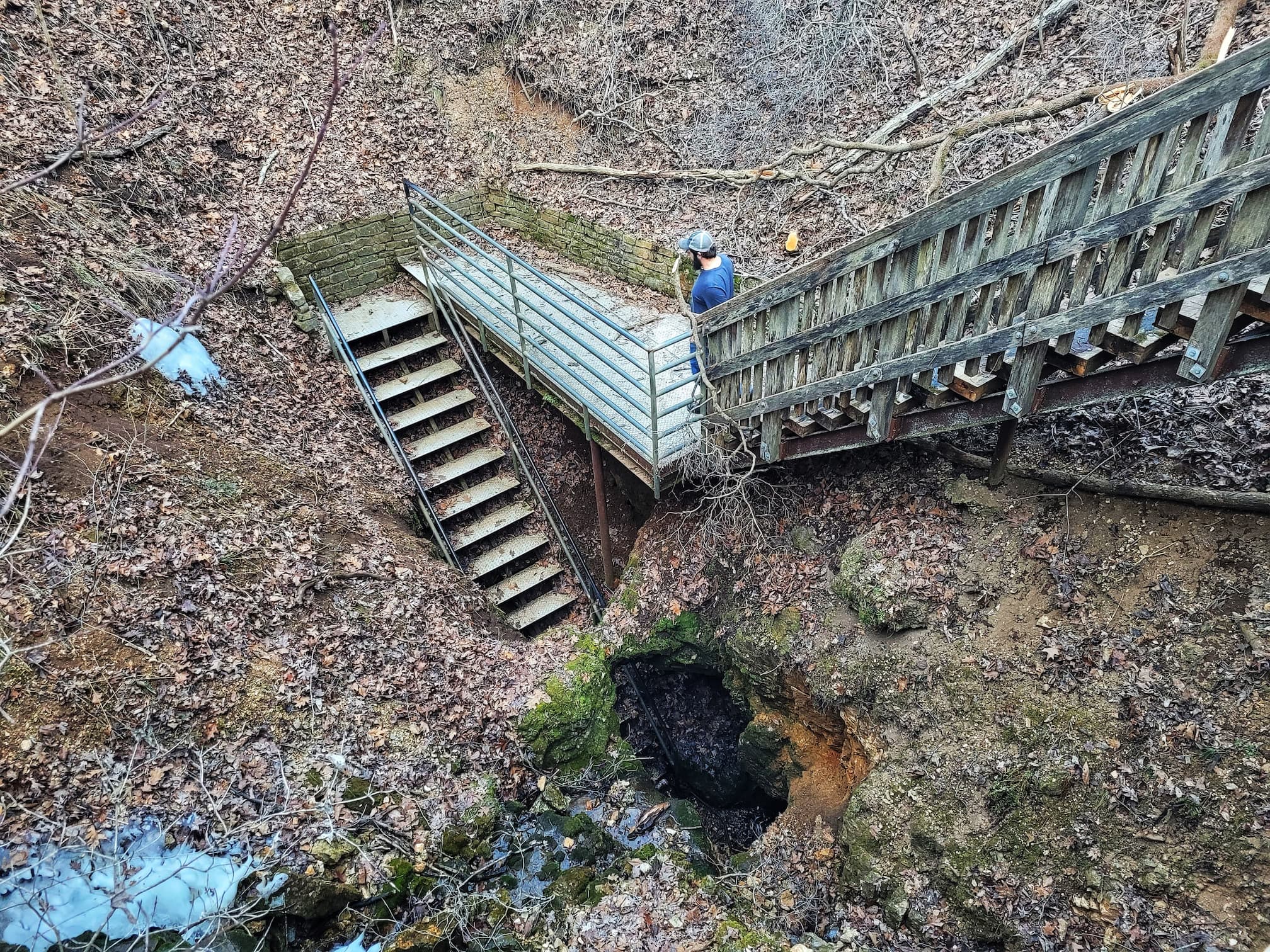
Getting to Devil’s Well is a bit of an adventure, with a long gravel mountain road leading to the parking area. But once you’re there, the well is right next to the lot, so there’s not much of a hike to reach it. There are a couple of trails nearby, and I read that one of them is really worth checking out, but we ran out of time. I had looked up Devil’s Well ahead of time, but pictures don’t do it justice- it’s way cooler in person! Josh didn’t know anything about it beforehand, so he got the fun experience of pulling up and being completely surprised. There’s a walkway and stairs leading down to a gated viewing area, where you can peer down at the water below. It’s kind of surreal to think about this huge, hidden lake just sitting underground!
(Also it totally made me want to rewatch Jennifer’s Body since it reminded me of the Devil’s Kettle)
2. Rocky Falls
Rocky Falls is one of the most beautiful and easily accessible waterfalls in the Ozark National Scenic Riverways, and it’s the perfect spot for a swim on a hot Missouri day. Water tumbles about 40 feet down a steep cascade, carving its way through ancient rhyolite rock before pooling into a clear, cool swimming hole. Unlike most of the Ozarks, which are made up of much younger sedimentary rock, the rhyolite at Rocky Falls is around 1.5 billion years old—basically some of the oldest rock you’ll ever see in Missouri.
Rocky Falls is also a great example of a “shut-in,” a term used in the Ozarks for places where a river or stream is squeezed into a narrow, rocky section, creating waterfalls and rapids. Thanks to the hard rhyolite, the water here is forced to take a dramatic plunge instead of meandering through softer rock like it does in most of the region. The end result is essentially a natural waterpark!
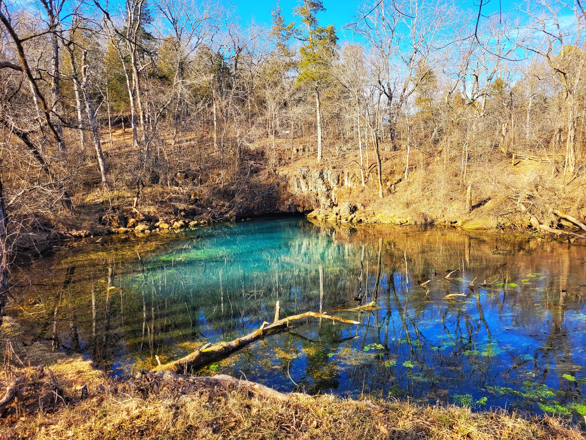
3. Welch Spring and Welch Spring Hospital Ruins
Welch Landing Google Maps directions
Welch Spring and the ruins of the Welch Spring Hospital are one of the most interesting hidden spots in the Ozark National Scenic Riverways. This first-magnitude spring pumps out an incredible 122 million gallons of crystal-clear, 55-degree water every day, flowing from a cave at the base of a limestone bluff and feeding into the scenic Current River. The spring creates the perfect habitat for fish and other aquatic life, and it’s also home to some fascinating history.
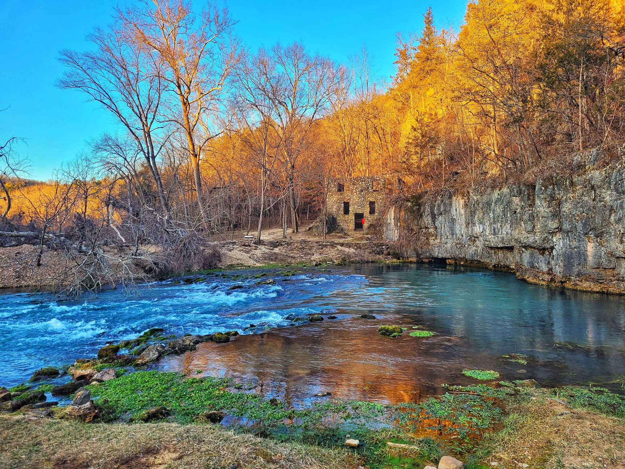
Back in 1913, a local doctor named C.H. Diehl bought Welch Spring with a big dream.He believed that the cool, clean air coming from the cave and spring had healing properties, especially for respiratory issues like asthma and tuberculosis. So, he built a hospital and health retreat right over the spring’s outflow, hoping it would attract patients looking for a natural cure. Unfortunately, its remote location and lack of easy access meant the hospital was never really successful, and after Dr. Diehl passed away in the 1940s, the site was abandoned. Today, the ruins still stand, making for an eerie and fascinating sight in the middle of the wilderness.
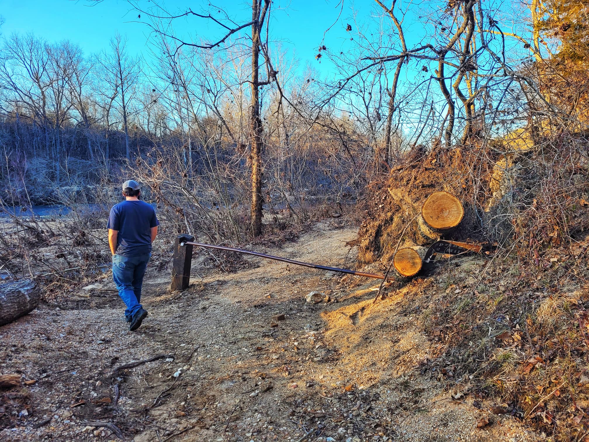
Finding Welch Spring was a bit trickier than expected. The National Park Service directions didn’t quite match up with what Josh saw on Google Maps, so we ended up taking a gravel road to Welch Landing and hiking in from there. This route gave us a great view of the hospital ruins from across the spring, which made sense since I had read that you need a boat to actually reach the ruins. But we could also see a picnic table and an interpretive sign by the ruins, meaning there’s clearly another way to get there. Just down the road from Welch Landing, we passed an NPS gate, which I think was the actual trailhead the NPS app mentioned. We didn’t have time to backtrack and check it out, but if you’re heading that way, it might be worth trying that route!
4. Big Spring
Big Spring Entrance Station Google Map directions
Big Spring is one of the most awe-inspiring natural wonders in the Ozark National Scenic Riverways- and honestly, one of the most impressive springs in the entire country. It’s not just big in name; this spring pours out an average of 286 million gallons of crystal-clear water every single day. After heavy rainfall, that number can skyrocket to over 800 million gallons. To put that into perspective, Big Spring pumps out more water in one day than an average person would use in 30 years!
The spring emerges from a cave at the base of a towering limestone bluff, its water an unreal shade of blue thanks to dissolved minerals. But what makes Big Spring even more fascinating is where all that water comes from. The Ozarks are known for their complex karst landscape, full of caves, sinkholes, and underground rivers. Dye-tracing studies have shown that some of the water bubbling up at Big Spring has traveled over 50 miles underground before making its grand entrance. That means rainwater from the surrounding hills seeps into the earth, winds its way through hidden passageways, and finally resurfaces here in this breathtakingly powerful display.
Big Spring isn’t just a geological wonder- it’s also an incredibly peaceful and scenic spot to visit. Located just outside Van Buren, Missouri, it’s easily accessible by car, with picnic areas and short trails nearby. Whether you’re stopping by for a quick visit or spending time exploring the surrounding area, standing in front of one of the largest single-outlet springs in the world is an experience you won’t forget.
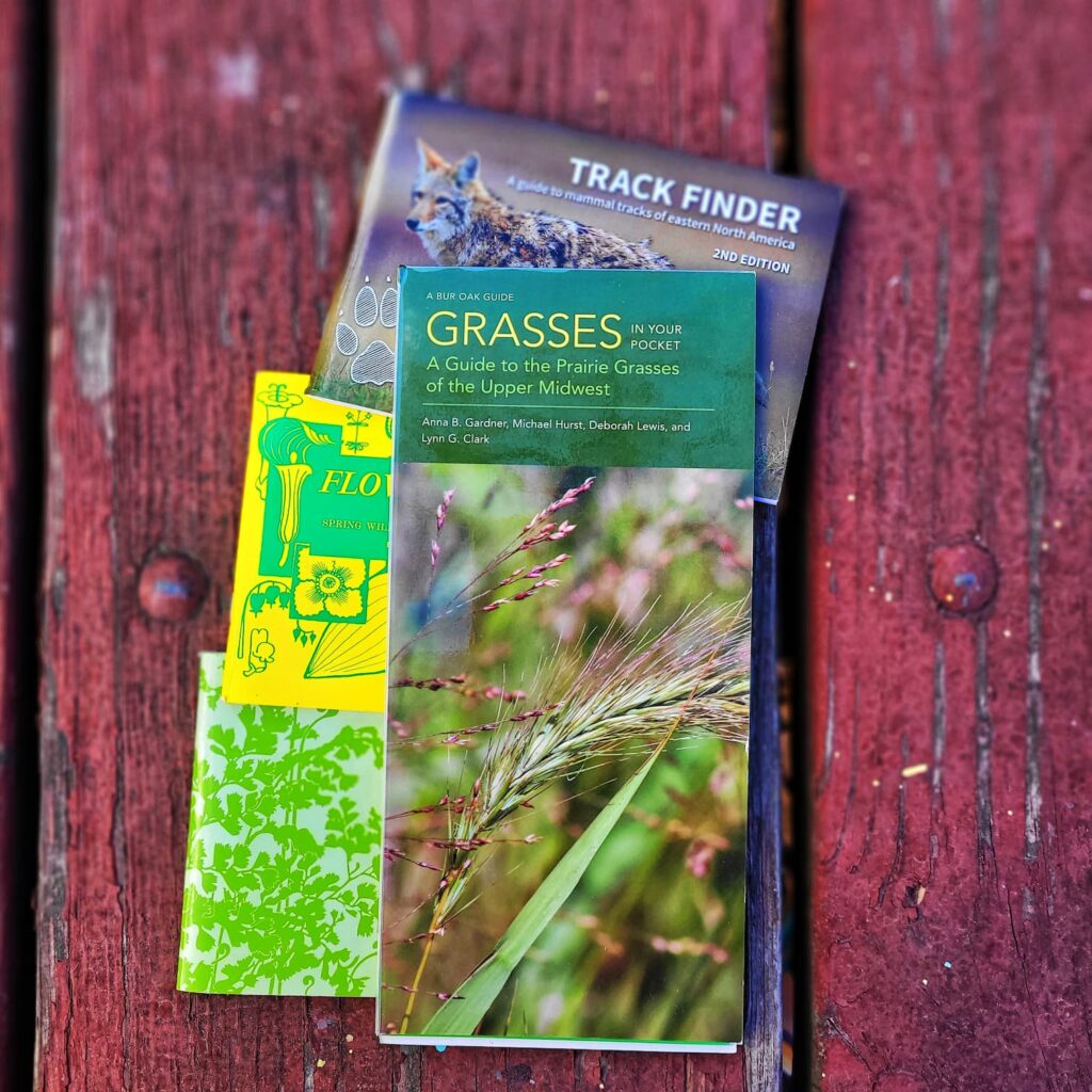
Ozark National Scenic Riverways Adventure Essentials


- Fujifilm Instax to capture memories in a fun retro way
- Pocket nature guides to help ID the plants and animals you find
- A good pocket knife always comes in handy
- Sea to Summit Pocket Towels are a great way to keep cool and clean
- Pack a picnic or just keep drinks cool with a sturdy cooler
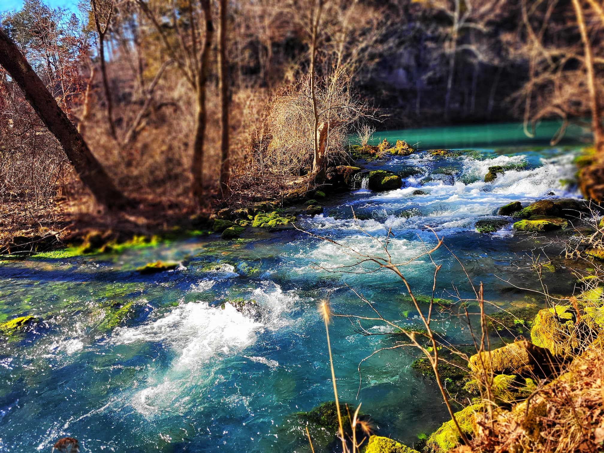
5. Alley Spring and Alley Mill
Alley Spring and Alley Mill might just be one of the most picture-perfect spots in the Ozark National Scenic Riverways. With its bright red wooden mill sitting beside an unbelievably blue spring, it’s no wonder this place is one of the most photographed locations in the Ozarks. The spring itself is a stunner, producing an average of 81 million gallons of water per day, which flows into the Jacks Fork River. That deep turquoise color is all thanks to dissolved minerals reflecting the sunlight, making the water look almost unreal. Like many other springs in the region, Alley Spring emerges from a vast underground karst system, where water travels through limestone caverns before surfacing.
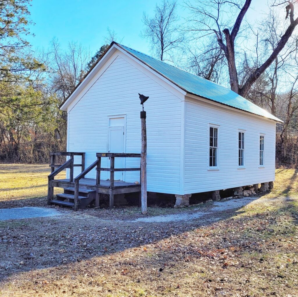
The history here is just as interesting as the scenery. Built in 1894, Alley Mill was a three-story grist mill that served the local farming community, grinding corn and wheat into flour. Back in the day, the mill wasn’t just a place to get grain processed—it was a social hub where farmers and their families gathered. Inside, you can explore original milling equipment, exhibits on Ozark culture, and even chat with a ranger at the front desk when it’s open. There’s also a one-room schoolhouse nearby, which we had to check out since we’ve been involved in a schoolhouse preservation project before.
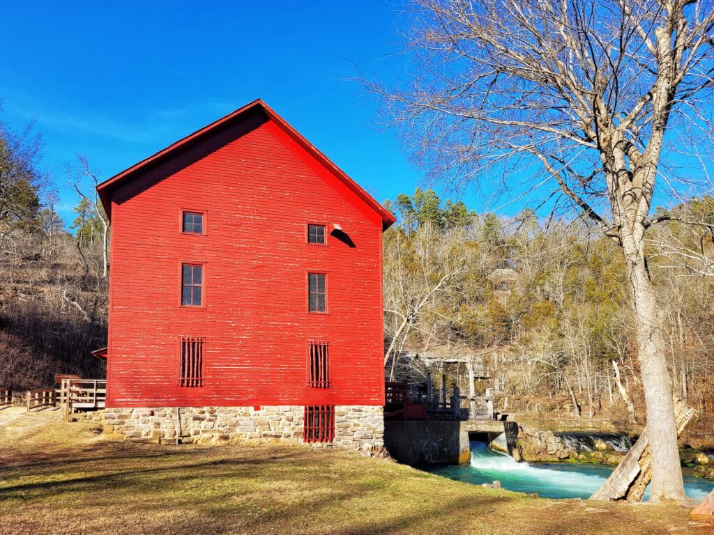
When we visited in February, the mill was closed for the off-season (it shuts down from November 1 to May 26), but it was still absolutely worth stopping by. Walking around the spring, taking in the vivid colors, and seeing the mill up close made for a great visit. And seriously, that is some blue ass water!
6. Blue Spring
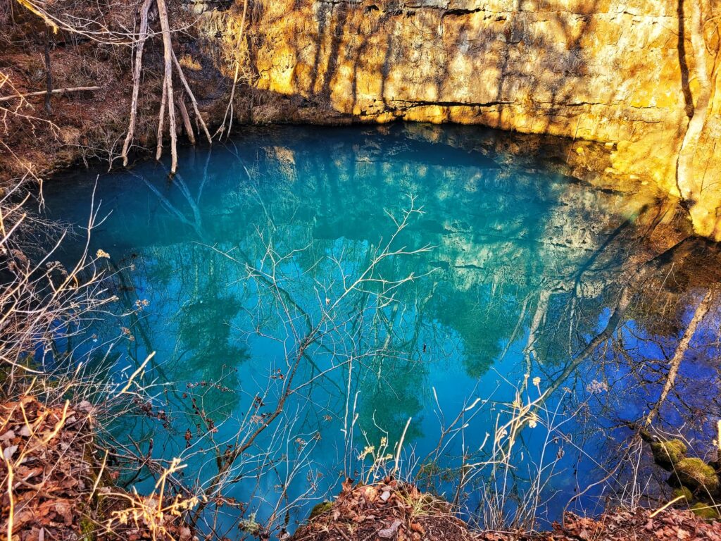
Blue Spring is easily one of the most jaw-dropping sights in the Ozark National Scenic Riverways. It’s famous for its unbelievable blue color and impressive depth (at least 310 feet deep), which is deep enough to completely submerge the Statue of Liberty! The spring discharges around 90 million gallons of water per day into the Current River, making it both a scenic and significant natural feature in the region. Its intense blue hue comes from dissolved minerals and the way light interacts with the water, creating a color so vivid it almost looks unreal.
This spot has been considered special for centuries. Native American tribes once called it the “Spring of the Summer Sky,” and standing on the shore, it’s easy to see why. The water emerges from a deep underground cave system, and while divers have explored parts of it, the full extent of the cave remains a mystery. Whether you’re here to admire the view, take photos, or just soak in the peaceful setting, Blue Spring is one of those places that truly feels magical.
7. Round Spring and Round Spring Cave
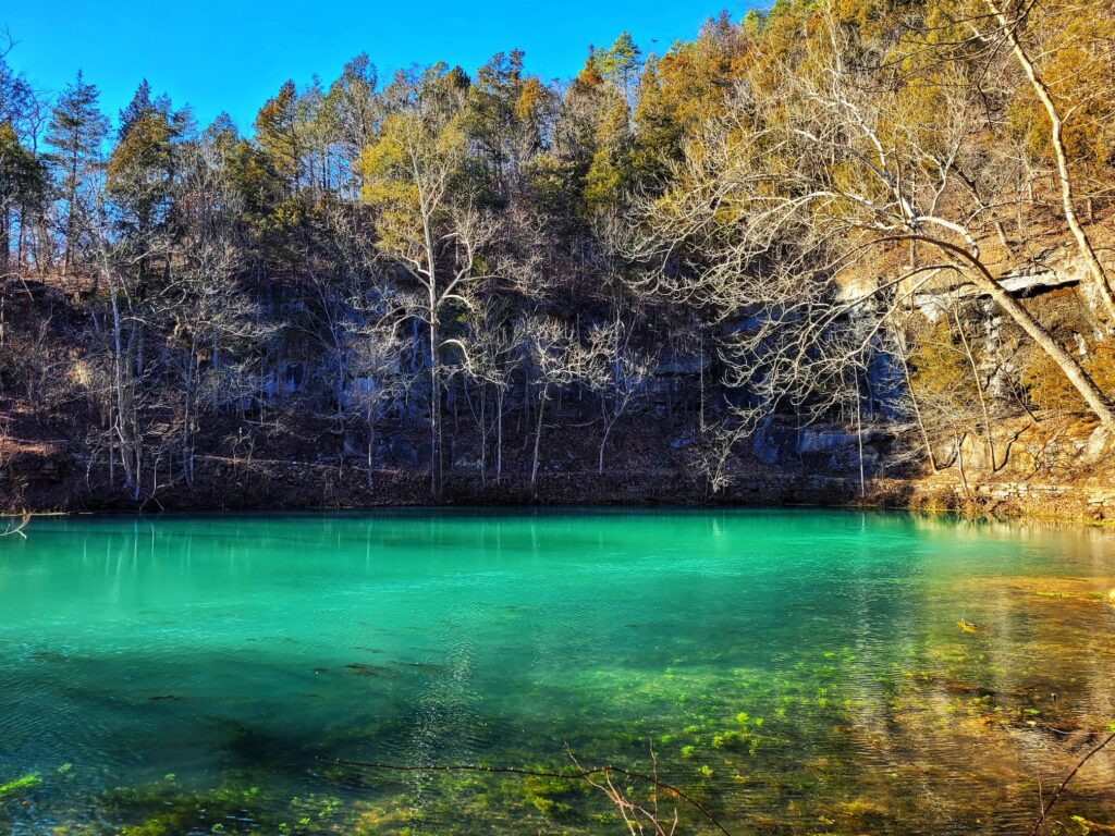
Round Spring and Round Spring Cave are two of the coolest natural features in the Ozark National Scenic Riverways. The spring gets its name from its nearly perfectly round basin, which is about 150 feet in diameter, and it pumps out around 26 million gallons of water per day into the Current River. Like many of the other springs in the region, its water comes from a complex underground karst system, but its exact source is still a mystery. The deep blue water and lush surroundings make it a great spot to visit, and it’s also known as a hangout for the Shannon County wild horses (though we didn’t get lucky enough to spot any when we were there).
Round Spring Cave, located nearby, offers an entirely different kind of adventure. It’s home to endangered gray bats and other unique cave-dwelling creatures, so to protect its delicate ecosystem, it’s only accessible through National Park Service–led tours in the summer. We were pretty bummed that the cave was closed for the season when we visited since we love caving, but it was still worth the stop just to see the spring. If you’re visiting during the warmer months, though, it sounds like the cave tour would be a great experience!
8. Klepzig Mill
Klepzig Mill is a hidden gem within the Ozark National Scenic Riverways, offering a mix of history, rugged beauty, and a touch of the wild, untamed Ozarks. Built around 1900, this small, weathered gristmill once served local farmers by grinding corn and wheat, playing a vital role in the area’s rural economy. Named after George Klepzig, who ran the mill in the early 20th century, it eventually fell out of use and was left to the elements. Though no longer operational, much of the structure still stands, giving visitors a rare glimpse into the region’s past.
What makes Klepzig Mill especially unique is its setting, tucked along Rocky Creek, surrounded by churning shut-ins and rocky outcroppings. Unlike more polished historic sites, this place feels raw and untouched, with its foundation and remnants blending into the rugged landscape. It’s not as easily accessible as some other spots in the park, but that only adds to its charm. The Klepzig Mill Trail provides a scenic hike through a mix of forest and rocky terrain, making the journey to the mill just as rewarding as the destination itself. If you love finding off-the-beaten-path historical sites with a side of wild Ozark beauty, this is definitely a stop worth making.
As Amazon and AllTrails affiliates, we earn on qualifying purchases.