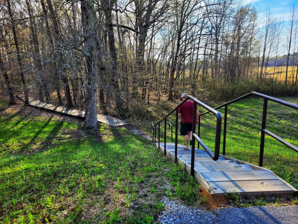
The Natchez Trace Parkway is one of the most scenic drives in the South, and the stretch between Tupelo, Mississippi, and Cherokee, Alabama, is packed with history, nature, and some unexpected hidden gems. Over the course of three days, we explored this 59-mile section while camping at Tishomingo State Park, making stops at historic sites, scenic overlooks, hiking trails, and even a few places just off the Parkway. Whether you’re planning a road trip or just looking for a scenic afternoon drive, this guide covers everything you need to know- where to stop, where to get gas, and what to expect along the way!
About the Natchez Trace Parkway
The Natchez Trace Parkway is a 444-mile scenic highway that stretches from Natchez, Mississippi (Mile Marker 0), to just south of Nashville, Tennessee (Mile Marker 444). It follows the historic Natchez Trace, a well-worn path used for centuries by Indigenous people, European explorers, traders, and early settlers. Today, it’s a beautiful drive packed with history, nature, and outdoor adventure.
You can start at either end or just pick a section to explore- there’s no wrong way to experience the parkway! Along the way, you’ll find stunning scenery, historic sites, and nearly 100 trails for hiking and biking. The National Park Service (NPS) manages the parkway, so it’s well-maintained and full of helpful signage to guide your journey.
One of the best things about the Natchez Trace Parkway is that there’s no commercial traffic! That means no billboards, no semi-trucks, and no distractions- just miles of peaceful, scenic road. The speed limit is 55 mph, making it the perfect slow-paced drive for road trippers, RVers, and cyclists alike.
Tips for Visiting the Natchez Trace Parkway
- Plan for 3–5 days if you want to drive the whole route, but you can easily break it into smaller sections if you’re short on time
- No gas, food, or lodging directly on the parkway, but there are plenty of exits leading to nearby towns where you’ll find all the essentials. The NPS even has a handy list of places to eat and stay: NPS Eating & Sleeping Guide
- Restrooms are spaced out every 50 miles or so- so plan accordingly!
- Cell service is spotty in places, save the Natchez Trace Parkway map on the NPS app before you go
- Use the mile marker system to navigate- it’s super easy to follow, and all the best stops are marked!
- There are three free, first-come, first-served campgrounds at MM 385.9, MM 193.1, and MM 54. They’re primitive (no electricity, showers, or dump stations), but they’re peaceful and a great way to immerse yourself in nature
- Cyclists, take note! The parkway is an official bicycle route, and bikes are allowed to use the full lane. If you’re driving, you’ll need to change lanes to pass cyclists safely
- If you’re in an RV, check bridge clearances! The max vehicle length allowed is 55 feet (including anything you’re towing)
The parkway is open 24/7, year-round, and it’s completely free to visit- no passes or entry fees required! If you want more info along the way, stop by one of the three visitor centers at MM 266 (Tupelo, MS), MM 15.5 (Mount Locust, MS), or MM 385.9 (Hohenwald, TN).
Whether you’re driving the whole route or just exploring a small section, the Natchez Trace Parkway is a perfect mix of history, scenery, and adventure. Take your time, enjoy the ride, and don’t forget to stop for a few hikes along the way!
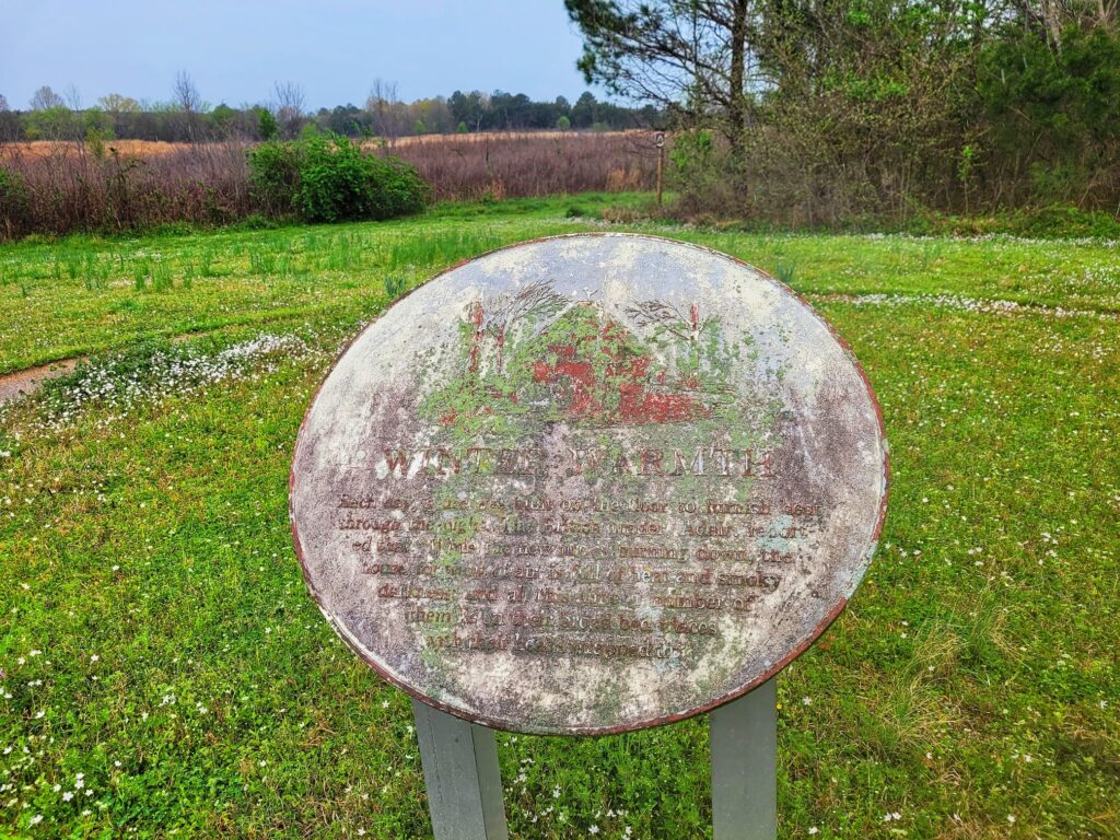
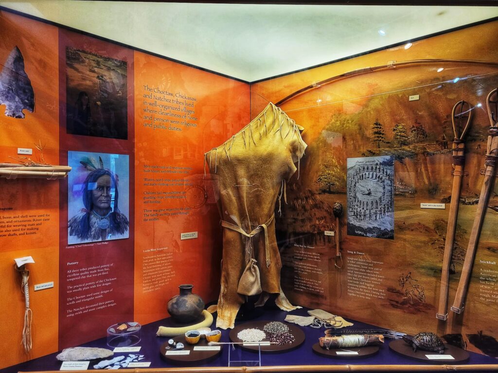
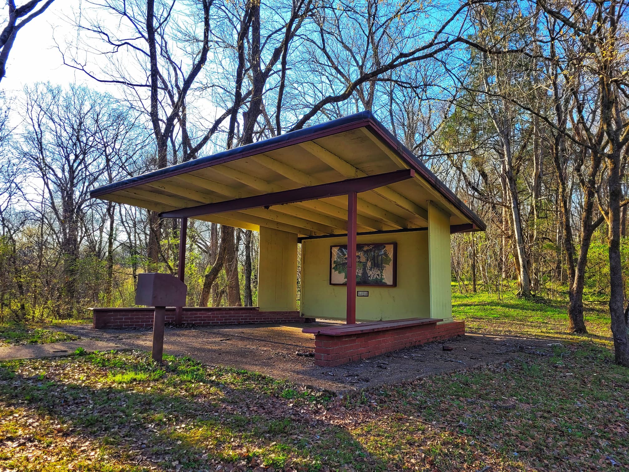
Mile Marker 261.8: Chickasaw Village Site
This site marks the location of a large Chickasaw village, once a thriving community along the Natchez Trace. A short trail leads to a pavilion with interpretive signs and an audio station, offering insight into the Chickasaw people and their way of life. The concrete outlines of former buildings help visualize how the village was arranged, though the signs are definitely showing their age and some are barely readable.
The Chickasaw have lived in this region since the 1500s, adapting their lifestyle to local conditions. The Black Belt Prairie’s rich soil supported their agriculture, with corn, beans, and squash as staple crops. They built their villages along ridge lines for safety, with round, mud-plastered winter homes for warmth and rectangular summer homes designed to catch cooling breezes. The Natchez Trace itself played a key role in their trade network, connecting their settlements with other groups.
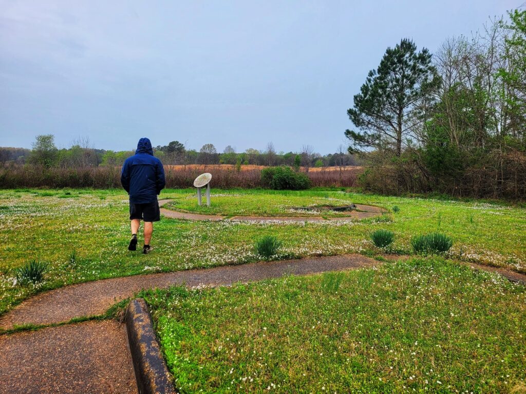
Today, the Chickasaw people still consider this region their traditional homeland. The Natchez Trace National Scenic Trail passes through this site, making it an easy stop to explore a bit of history on foot.
Mile Marker 262-263: Exit to McCullough Boulevard, Tupelo
⛽Nearest Gas stations:
- North Gloster Cheron, 848 N Gloster St, Tupelo, MS 38804, approximately 2 minutes off the Parkway
- Kroger Fuel Center, 960 W Main St, Tupelo, MS 38801, approximately 5 minutes off the Parkway
- Exxon, 1817 N Gloster St, Tupelo, MS 38802, approximately 4 minutes off the Parkway
Things to Do in Tupelo, Mississippi
The Natchez Trace Parkway runs right through Tupelo, Mississippi, which is a good-sized town with lots to do. There are plenty of food and shopping options here, as well as some fun activities!
If you’re looking for more National Park Service sites, visit Tupelo National Battlefield. This is a small NPS unit that’s about the size of a suburban yard. There is a monument, two cannons, another marker, a few gravestones, and interpretive signs here.
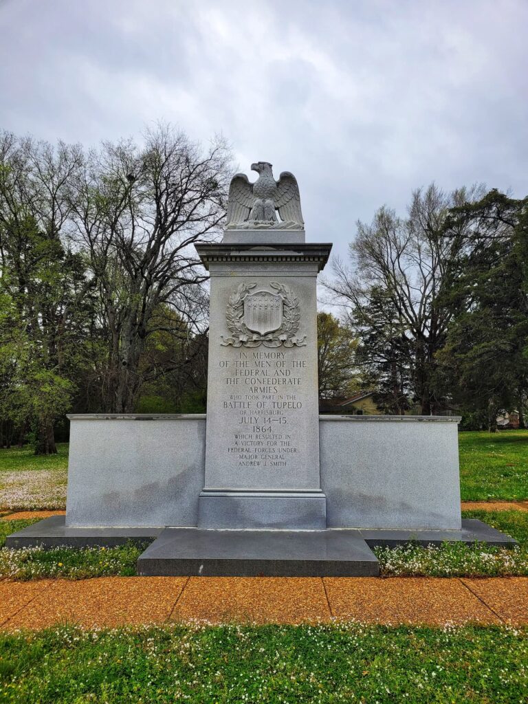
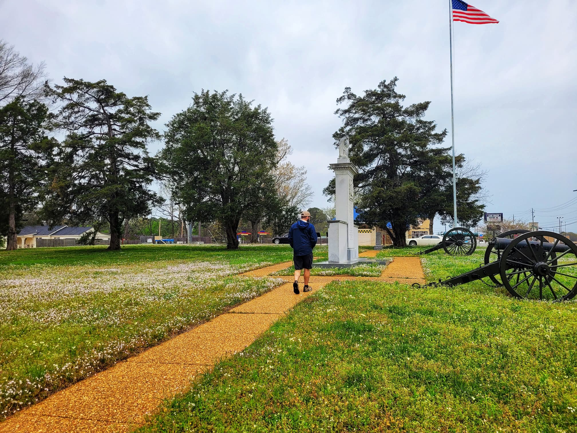
Tupelo National Battlefield commemorates the Battle of Tupelo, which took place on July 14-15, 1864, during the Civil War. This battle was part of Union efforts to keep Confederate forces under General Nathan Bedford Forrest from disrupting Union supply lines in northern Mississippi and western Tennessee. It was a Union victory, ensuring that the vital Memphis & Charleston Railroad remained under Union control and was one of the last major battles fought in Mississippi.
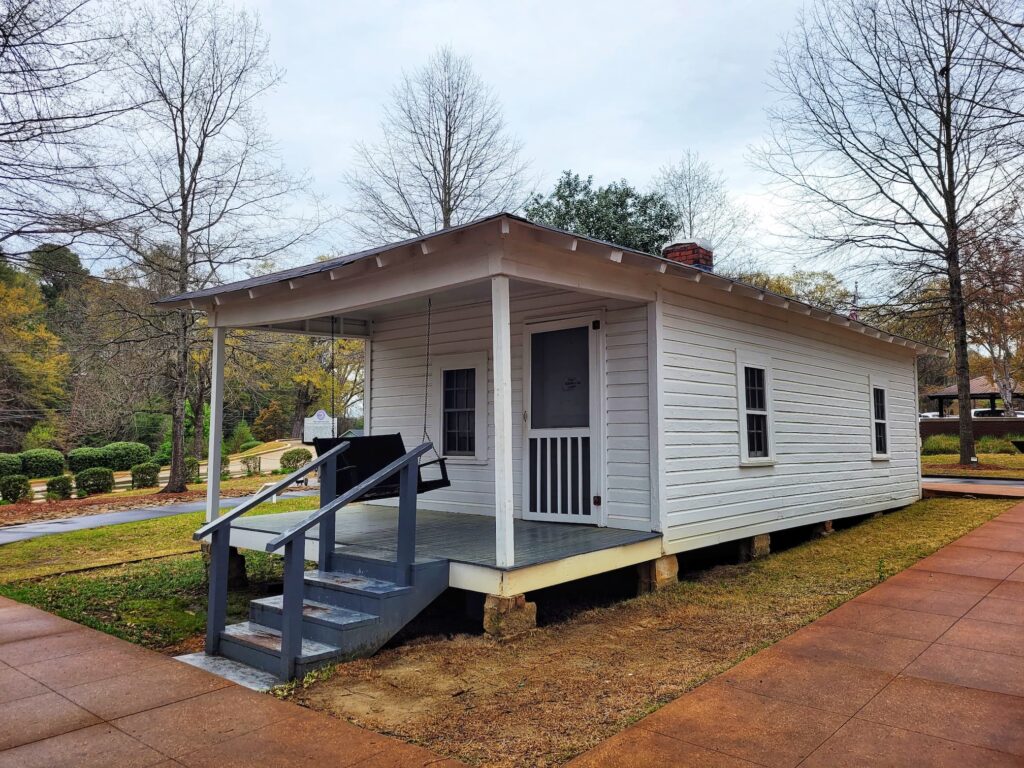
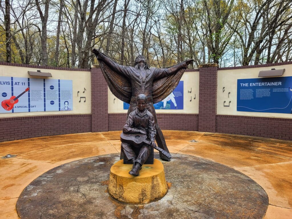
If you’re looking for more things to do in Tupelo, the town is most famous for being the birthplace of Elvis. Start your Elvis Driving Tour at the Elvis Presley Birthplace & Museum to see the home Elvis was born in and the church where he first fell in love with gospel music. You can also visit Tupelo Hardware Company, the store where Elvis’ mom bought him his first guitar, which is still an operating hardware store. For the full tour, there are plaques around town at Elvis’ schools, favorite swimming hole, and concert sites.
Mile Marker 263-264: Exit to Tupelo, Fulton, Tombigbee State Park, Elvis Presley Lake
⛽Nearest Gas station:
Exxon, 1817 N Gloster St, Tupelo, MS 38802, approximately 5 minutes off the Parkway
Fulton, Mississippi
The town of Fulton is about 25 minutes off the Natchez Trace Parkway from this exit. There are food and gas options here. The most interesting thing to do is visit PlayGarden Park, to see the whimsical statues creator by sculptur Tom Otterness.
Tombigbee State Park
Tombigbee State Park is just over 15 minutes off of the Natchez Trace Parkway. This beautiful state park offers outdoor recreation, camping, and a quiet retreat into nature, just a few miles from the city. The park has hiking trails, fishing and boating access on Lake Lee, picnic spots, and a disc golf course. If you’re looking for somewhere to stay the night, they also have cabins and both RV and tent campsites.
Elvis Presley Lake
10 minutes off the Parkway, Elvis Presley Lake is a 322 acre lake with fishing, boating, hiking, and picnic spots.
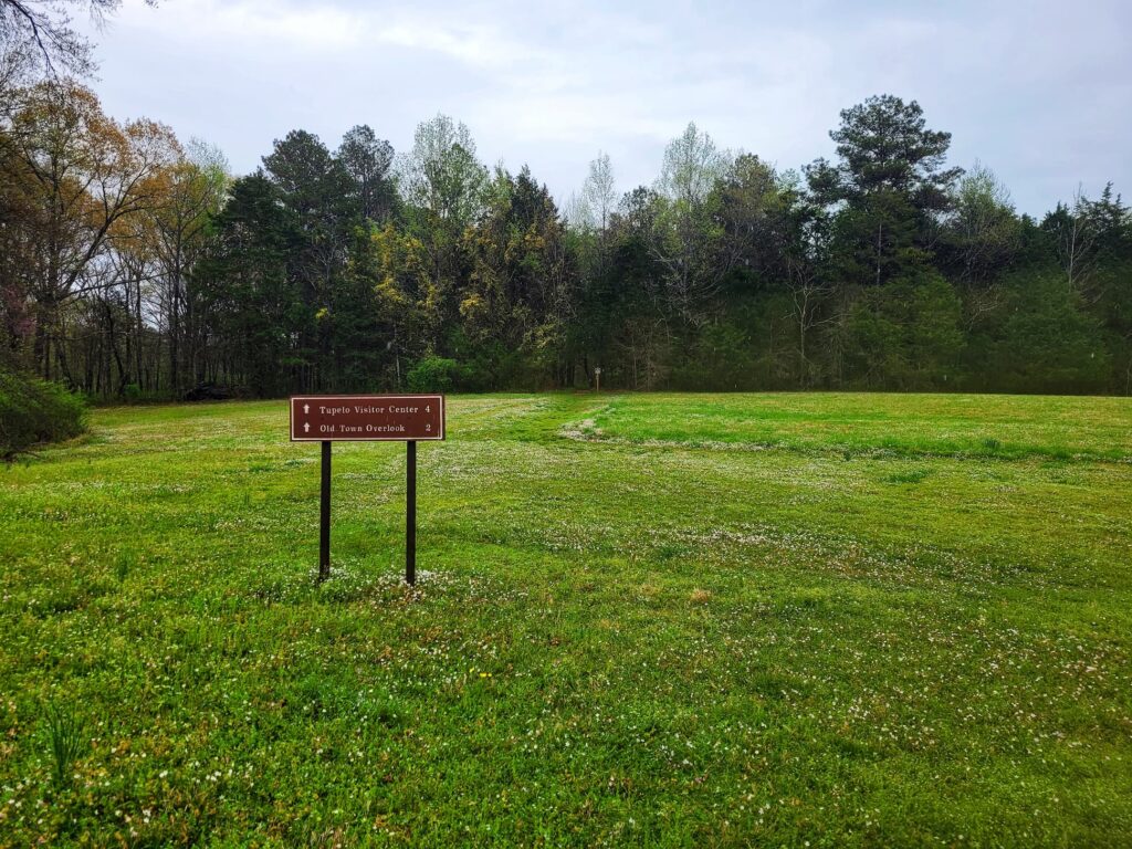
Mile Marker 263.9: Old Town Overlook
We ended up skipping this stop because of the rain, but it offers a short trail through the woods, access to the Natchez Trace National Scenic Trail, and a small pond where fishing is allowed. There’s also a picnic table for a quick break.
The name “Old Town” comes from the English, who used it to refer to a large, established Chickasaw village that once stood here. While we didn’t get to explore this one, it looks like a nice, quiet stop for a walk or a bit of fishing on a better-weather day.
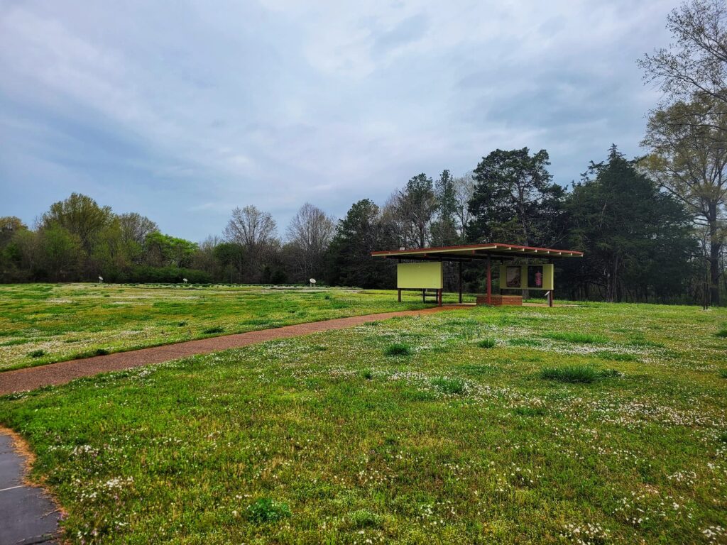
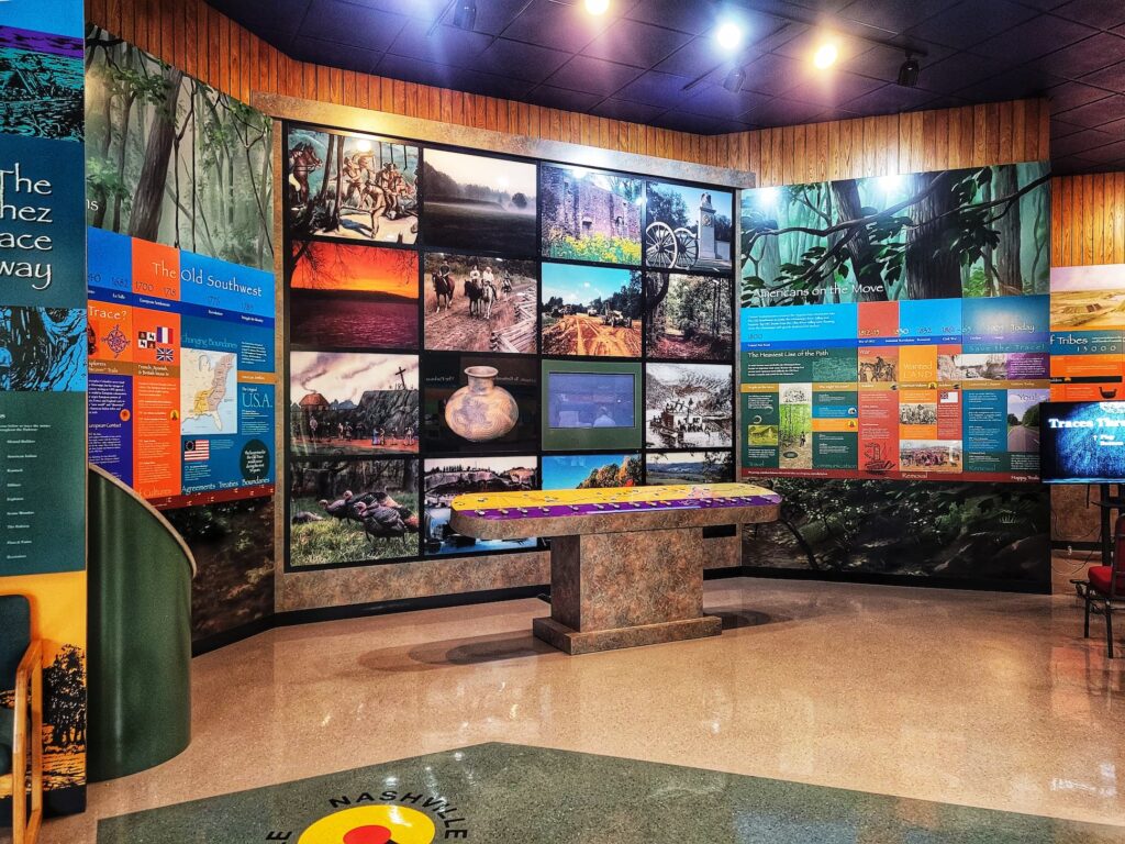
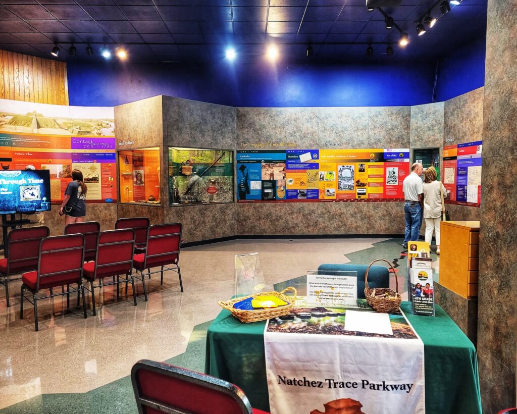
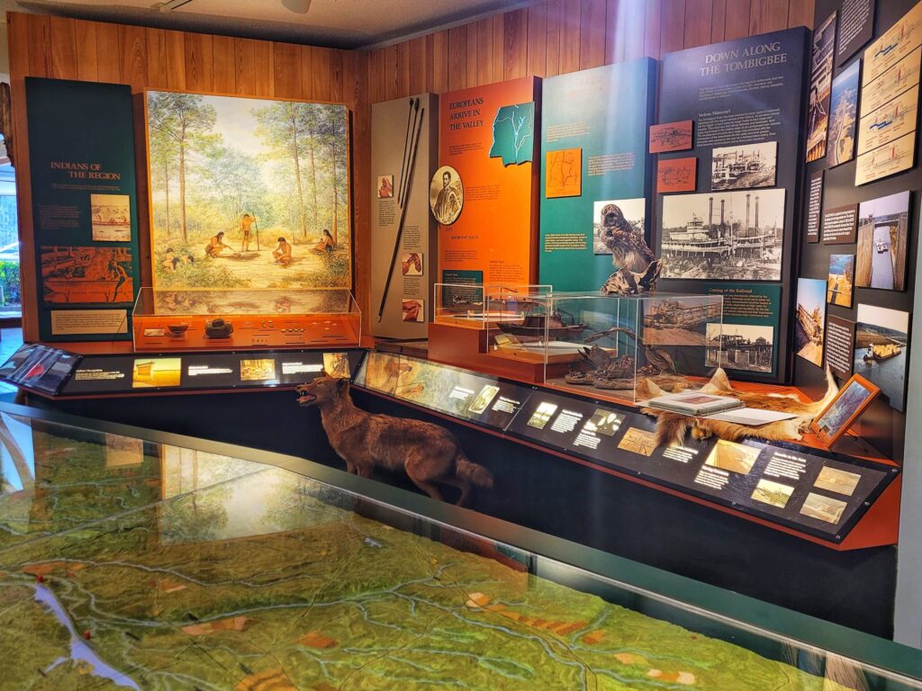
Mile Marker 266: Natchez Trace Parkway Visitor Center, Beech Springs Nature Trail, Exit to Hwy 145
A great first stop for anyone traveling the Parkway, the visitor center has exhibits covering the history of the Natchez Trace and the development of the Parkway. There’s also a park film, ranger programs, and a gift shop. We made sure to grab our passport stamps while we were here.
The center is open daily from 9 AM to 4:30 PM, except on major holidays. Outside, there’s a picnic area if you need a break before heading to the next stop. Plus, clean bathrooms- always a bonus!
Natchez Trace Parkway Passport Stamps and Unigrids
If you’re like me and a National Park passport stamp fanatic, the Natchez Trace Parkway Visitor Center is a must-do! When we visited, they had the following stamps available:
- Natchez Trace Parkway, Tupelo Stamp
- Trail of Tears National Historic Trail, Natchez Trace Pkwy Stamp
- Tupelo National Battlefield
- Natchez Trace National Scenic Trail
- Brices Cross Roads National Battlefield Site
- Nathez Trace Parkway, Meriwether Lewis Monument Stamp
The Natchez Trace Parkway Visitor Center is also a dream for unigrid collectors! When we visited, I saw:
- Natchez Trace Parkway
- Natchez Trace- Meriwether Lewis
- Natchez Trace- The Gordon House
- Natchez Trace Parkway- Historic Stands Along the Old Trace
- Natchez Trace- Common Wildflowers of the Natchez Trace Parkway
- Natchez Trace Parkway- Chisha Foka Multi-Use Trail
- Natchez Trace- Chickasaw Fire
- Natchez Trace- Mount Locust Inn and Plantation
- Natchez Trace- Emerald Mound
- Natchez Trace National Scenic Trail
- Medgar and Myrlie Evers Home
- Wildland Fire in National Parks
- Brices Cross Roads and Tupelo
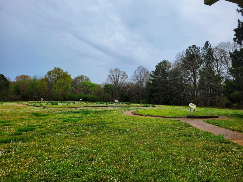
Beech Springs Nature Trail
Located right next to the Visitor Center is the half mile long Beech Springs Nature Trail. This is a paved loop trail with lots of native plants to see. Leashed dogs are allowed on the trail, so it’s the perfect spot for the whole family to stretch their legs!
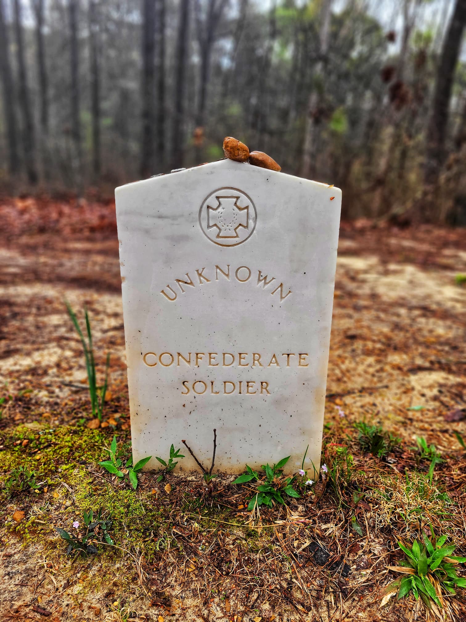
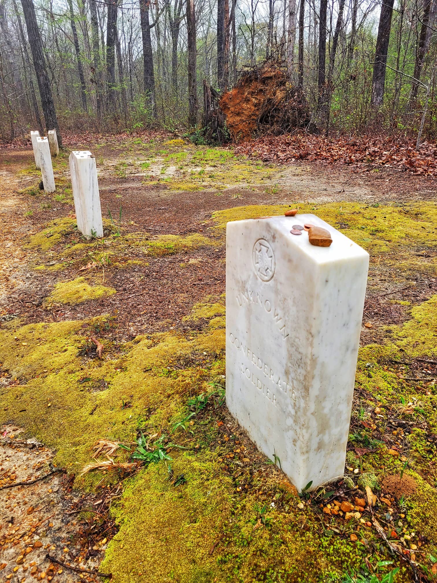
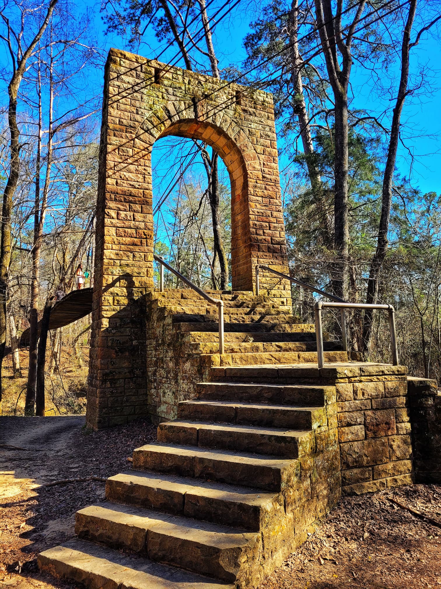
Mile Marker 269.4: Old Trace and Confederate Gravesites
A short but steep 700-foot paved walkway leads up to a section of the original Natchez Trace and a small cluster of 13 graves. No one knows exactly who these soldiers were, but tradition says they were Confederates who died along the Old Trace. By the time of the Civil War, much of the Trace had been abandoned, but some sections were still used by marching soldiers.
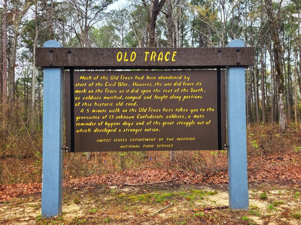
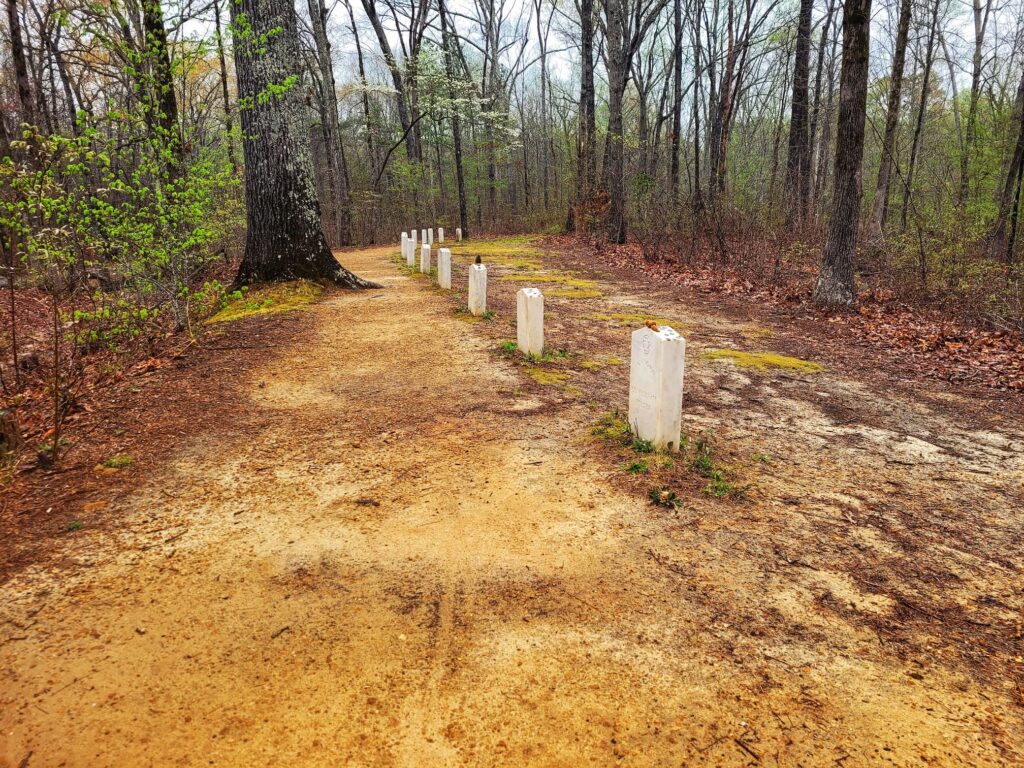
The original grave markers are long gone. If they ever had names, they’ve been lost to time. In 1940, Senator Theodore Bilbo arranged for marble headstones, but they were stolen. The current markers were placed by the National Park Service. It’s a solemn stop with an eerie sense of history, tucked away in the woods just off the Parkway.
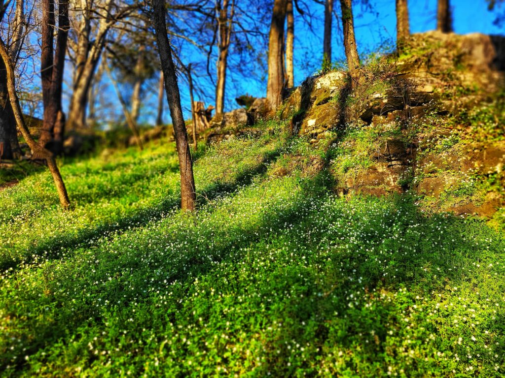
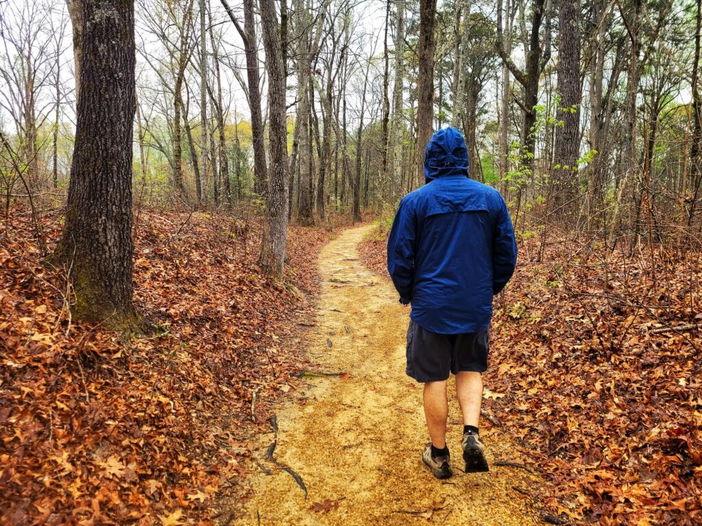
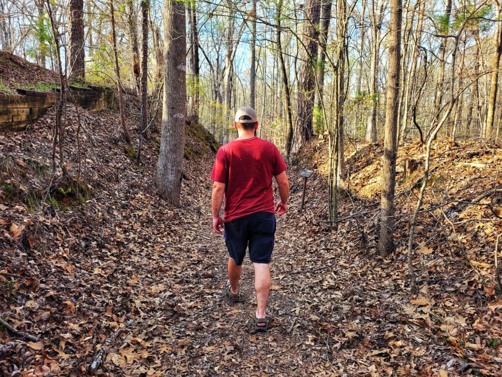
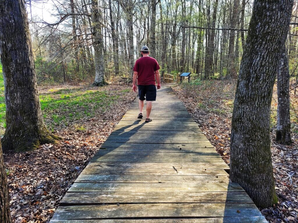
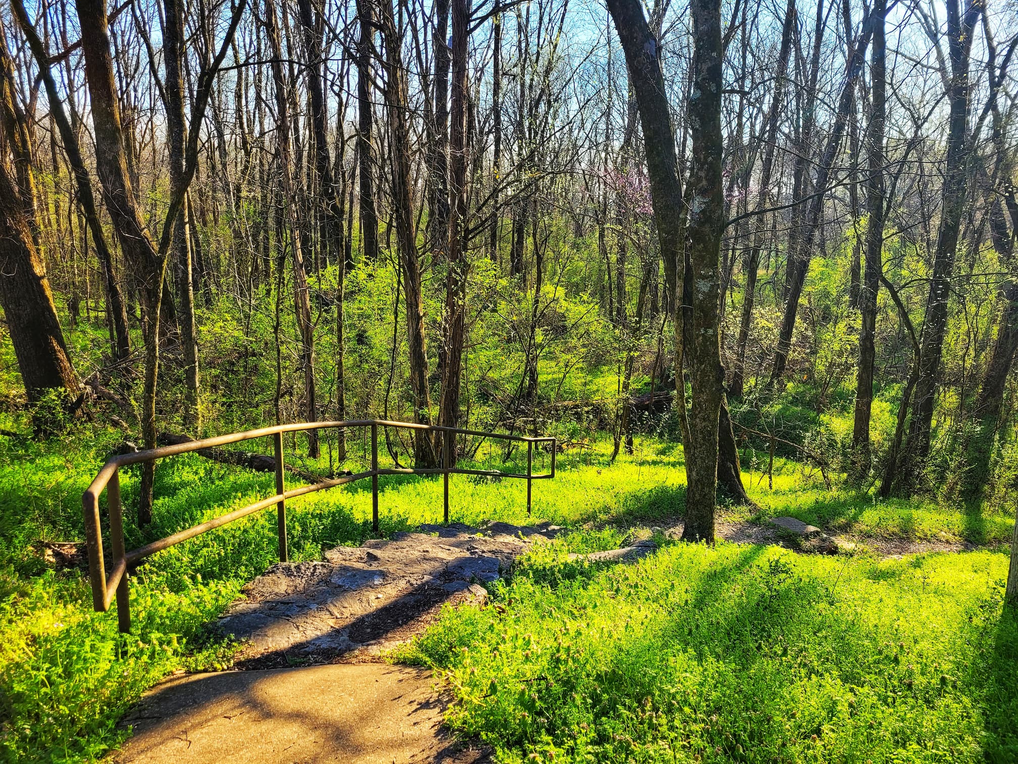
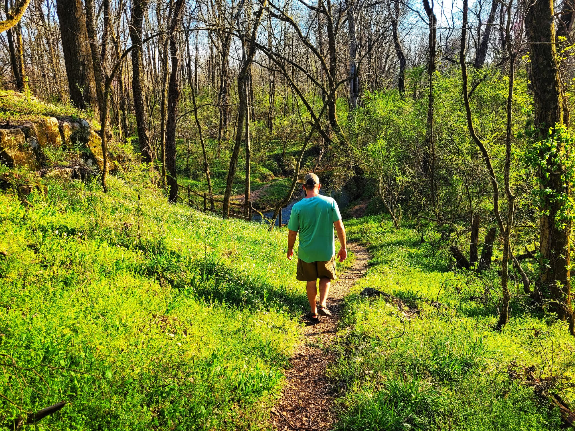
Mile Marker 275: Dogwood Valley
We visited this section of the Natchez Trace Parkway over three days. For our last stop on Day 2, we took a peaceful walk through Dogwood Valley, a 1,600-foot loop trail winding through a small valley filled with dogwood trees. The blooms peak from early to late April, so we were too early to see them in full display, but the forested setting was still a great way to end the day.
What made this stop really exciting was discovering that part of the trail follows a sunken section of the original Natchez Trace! I hadn’t realized we’d be visiting any old trace sites, so stumbling upon it was an unexpected highlight. This worn-down path was shaped by years of foot, horse, and wagon traffic, combined with over 200 years of rain eroding the trail deeper into the ground.
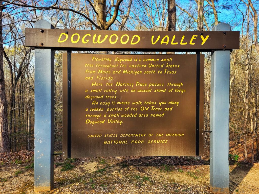
Another section of the loop follows an old logging road, where wagons once hauled harvested trees. The compacted ground has made it difficult for vegetation to grow back, leaving a distinct contrast with the surrounding forest.
The Parkway is also a great spot for botanizing, especially for spring ephemerals. While I didn’t find any new flowers for my ephemeral list, I did spot bloodroot (Sanguinaria canadensis) leaves (a classic spring ephemeral) and lots of crane-fly orchid (Tipularia discolor) leaves.
After finishing the hike, we made the 30-minute drive back to Tishomingo State Park, officially ending our Thursday after-work adventure. Even though we were too early for dogwood blooms, the unexpected section of the old Trace made this stop well worth it!
Mile Marker 278.4: Twentymile Bottom Overlook
This stop is a quick one, just long enough to take in the view of the rich agricultural bottomlands stretching below. Twentymile Bottom is typical of the low-lying areas along streams that the Natchez Trace winds through, and standing here, it was easy to imagine how challenging travel must have been centuries ago.
Back in 1812, Reverend Johnson recorded his difficult journey through this area. He stopped at Old Factor’s Stand, a trading post near here, and wrote about having to swim his horse 5 times, bridge a creek, ford even more creeks, and wade through the swamp repeatedly.
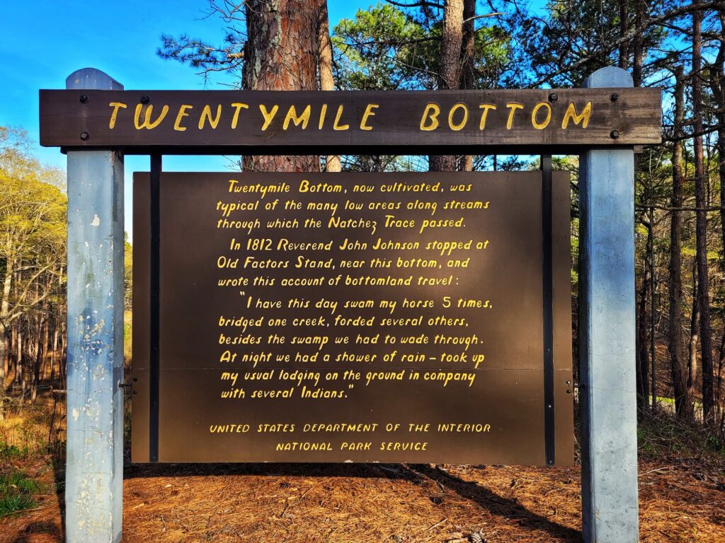
Traveling the Parkway in the comfort of a truck made us appreciate just how brutal this route must have been in the early 1800s!
This overlook doesn’t have a circular drive, so large RVs should be cautious when pulling in. We just took in the scenic view before moving on to our next stop.
Mile Marker 282: Exit to Marietta, Mantachie, Baldwyn
⛽Nearest Gas stations:
- Ozark Country Store, 10759 MS-371, Marietta, MS 38856, approximately 4 minutes off the Parkway
- Marietta Mini Mart, 365 MS-371, Marietta, MS 38856, approximately 6 minutes off the Parkway
Nearby Towns
This exit is about a 5 minute drive to Marietta, MS. It’s also about 15 minutes to both Mantachie and Baldwyn. If you’re looking for somewhere to eat, Mantachie has two restaurants on the Mississippi Hills National Heritage Area Foodie Trail- Delmar’s and Peppertown Restaurant. If you’re looking for more National Park Service-run sites, you can visit Brices Cross Roads National Battlefield Site in Baldwyn. Another interesting stop in Baldwyn is W.M. Browning Cretaceous Fossil Park, where you can dig for sharks teeth and fossils in the creek!
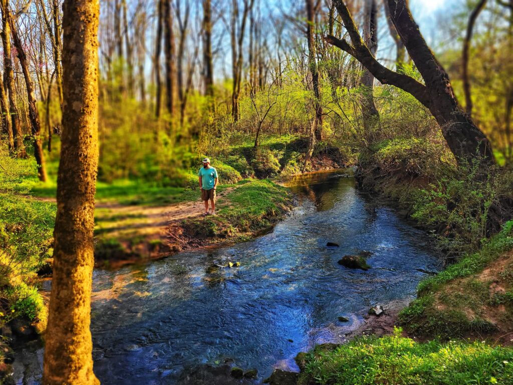
Mile Marker 283.3: Donivan Slough
Our fourth stop on Thursday was Donivan Slough, a peaceful nature stop that offered a quick walk into a hardwood forest and swampy wetland. Slough (pronounced slew) refers to a natural, swampy depression, and this one sits adjacent to an agricultural field, helping to drain off excess water while remaining wet year-round.
The 1600-foot trail into the slough made for an easy walk, though we had to descend a set of stairs from the parking lot to reach it. Leashed dogs are allowed, and there are some plant ID signs along the way, making it a nice little spot for a relaxed nature break.
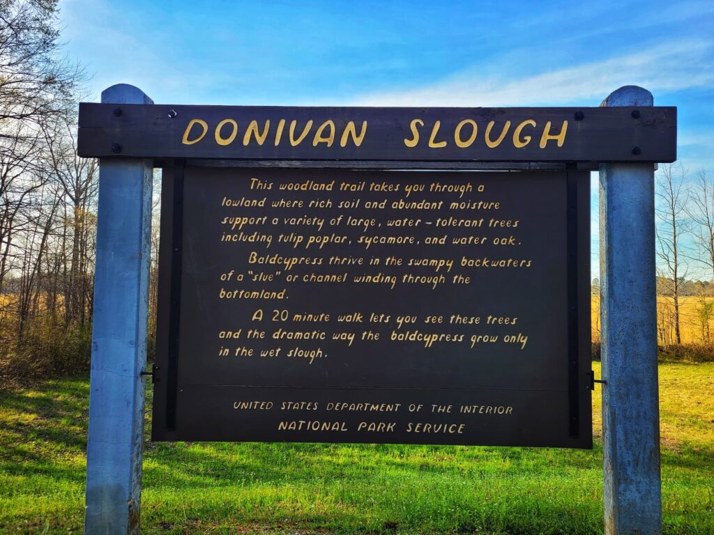
Why Sloughs Are Special
Sloughs act like huge sponges, meaning the plants here don’t have to use as much energy to get water and nutrients. As a result, they can grow more leaves and produce more fruit, making this a highly productive ecosystem.
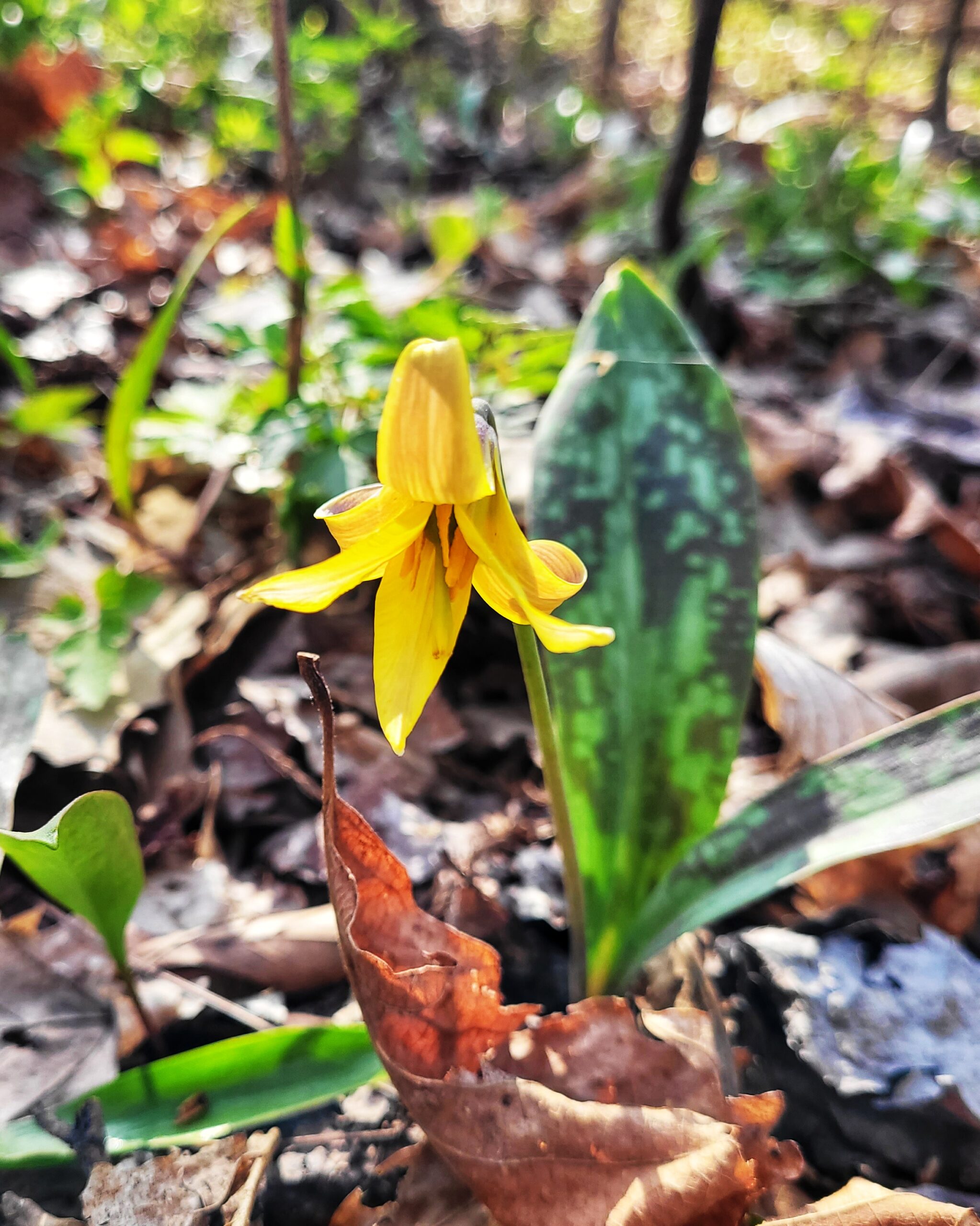
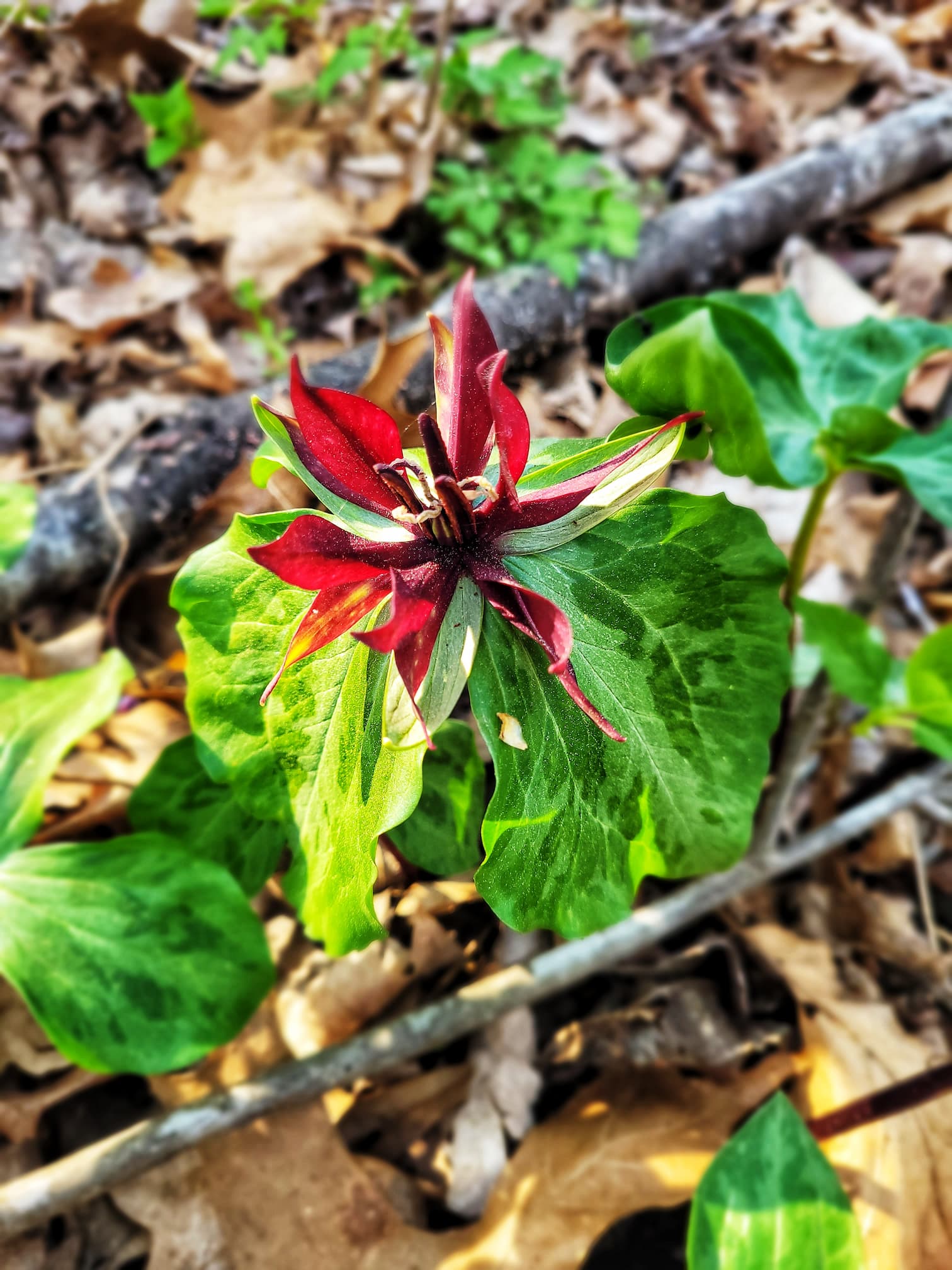
Botanizing Bonus: Spring Ephemerals
This stop also gave me two exciting additions to my spring ephemeral list:
- Yellow trout lily (Erythronium americanum)- and these were huge ones! I’ve never seen trout lily leaves so big, it really shows the power of the slough
- Twisted trillium (Trillium stamineum)- this was a totally new species to me, which was super exciting! I’ve seen lots of trilliums, but didn’t even know this one existed- and it’s really cool looking
Even though this was a quick stop, it was a great place to stretch our legs and take in a different kind of natural habitat along the Parkway.
Mile Marker 286.3: Browns Bottom
We skilled the Browns Bottom stop ourselves, but were able to get a good view from the road. There are a couple picnic tables alongside a small lake, and plenty of parking. Fishing regularions on the Parkway apply to all “finfish” in this park. Amphibians, mollusks, and crustaceans (including crayfish) are not considered fish by the NPS and fall under separate wildlife regulations.
If you’re looking to fish along the Natchez Trace Parkway, you can use a Mississippi, Alabama, or Tennessee fishing license on any Parkway waters. Other regulations, such as limits and types of baits, follow state fishing regulations based on which state you’re in.
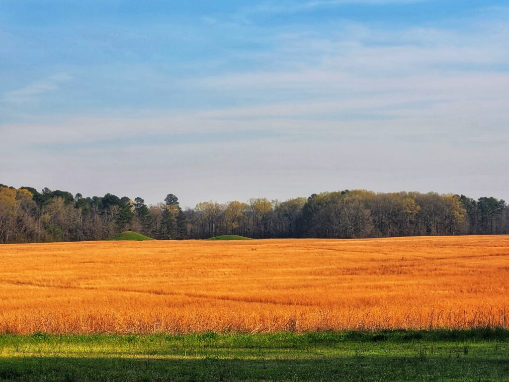
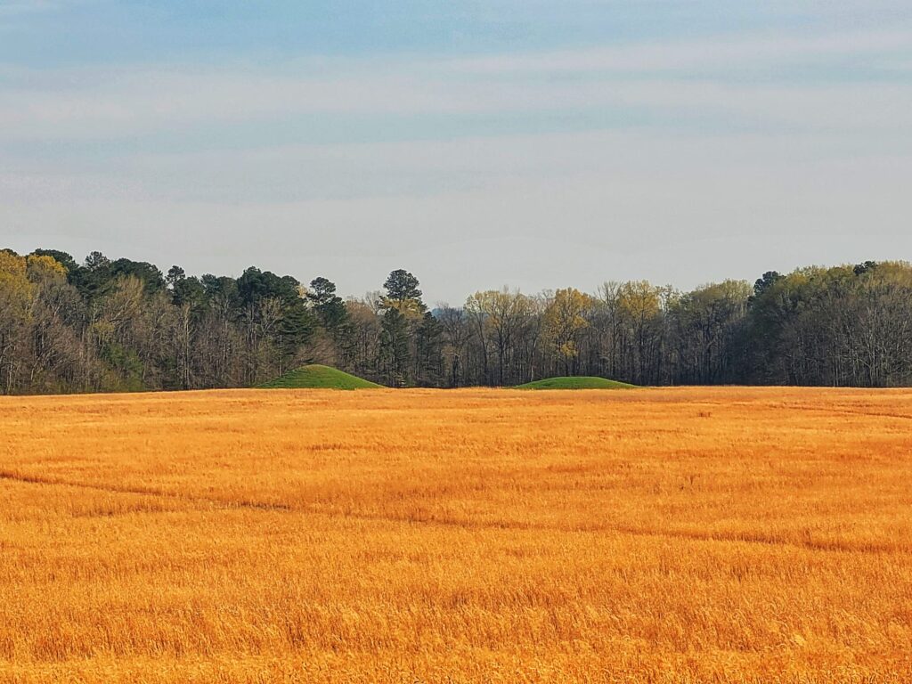
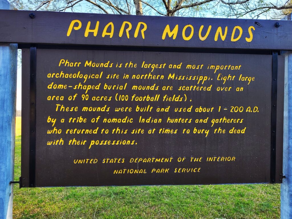
Mile Marker 286.7: Pharr Mounds
Our most exciting Thursday stop was Pharr Mounds, a fascinating archaeological site that gave us a glimpse into the ancient past. We’ve visited quite a few mound sites before across different states, but this one stood out because of its distinctly shaped dome mounds and the sheer number of them spread across the landscape.
A Middle Woodland-Era Village & Trading Hub
Dating back 1,800–2,000 years, Pharr Mounds was once a thriving village built by Indigenous people during the Middle Woodland period. The site consists of eight dome-shaped mounds spread over 90 acres, making it one of the largest mound sites in the region.
The Chickasaw Nation considers Pharr Mounds a sacred site, and its history reflects the widespread trade networks of the time. Artifacts found here, some originating as far away as the Great Lakes region, reveal how deeply connected these ancient communities were through the Hopewell Exchange System.

Burial Mounds & Archaeological Discoveries
- The mounds, constructed between 100–200 BC, were burial sites, and when NPS archaeologists excavated four of them in 1966, they uncovered:
- Fire pits and low clay platforms at the base of the mounds
- Human remains
- Ceremonial artifacts crafted from non-local materials, showcasing the site’s role in trade
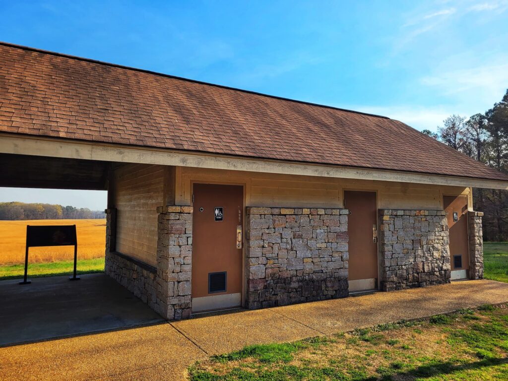
Pharr Mounds is also a great stop if you’re doing a longer Parkway drive because in addition to the pavilion with interpretive signs, there’s also bathrooms!
Seeing how well-preserved and clearly defined these mounds were made this stop particularly memorable. From here, we continued south, eager to see what the Parkway had in store next.
Mile Marker 288: Exit to Siloam Road
⛽Nearest Gas station:
Marietta Mini Mart, 365 MS-371, Marietta, MS 38856, approximately 8 minutes off the Parkway
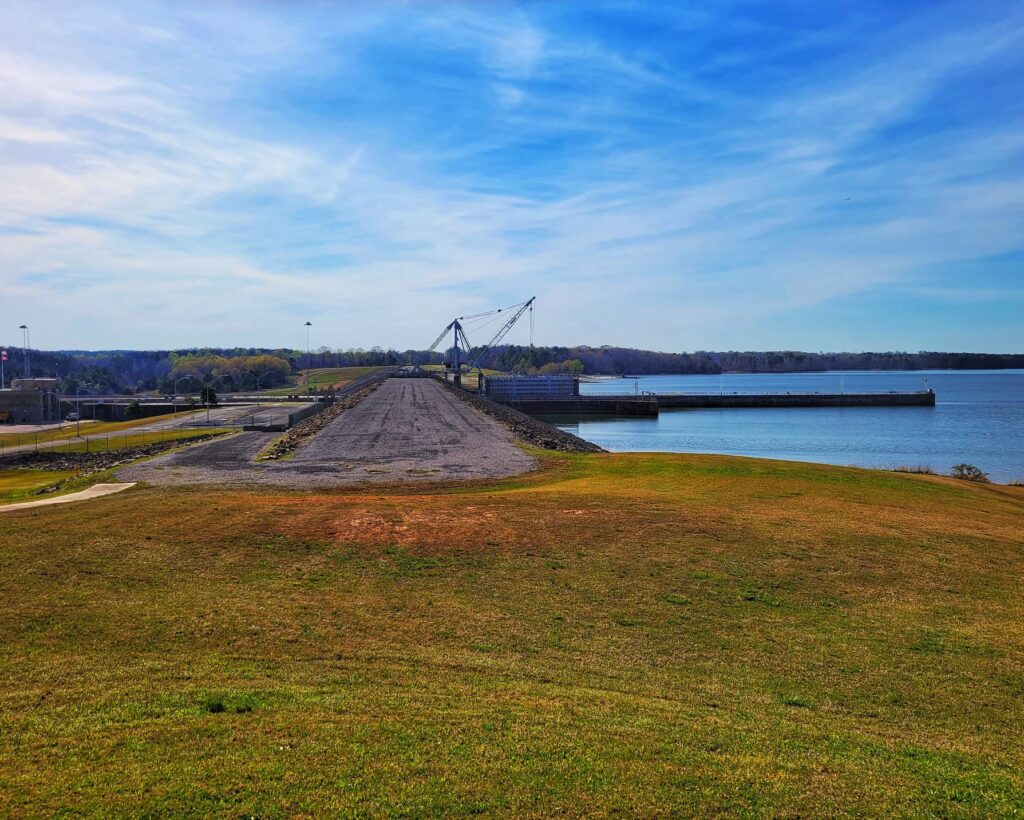
Mile Marker 293.2: Tenn-Tomm Waterway and Jamie L. Whitten Bridge
Our second stop on Thursday brought us to the Tennessee-Tombigbee Waterway (Tenn-Tomm) and the Jamie L. Whitten Bridge, where we took in the views and explored the history of this massive engineering project.
A Waterway Centuries in the Making
The Tenn-Tomm Waterway stretches 234 miles, linking the Tennessee River to the Tombigbee River. The idea for this connection dates back to the mid-1700s, but it wasn’t until 1810 that residents of Knoxville, Tennessee, formally approached Congress about making it happen.
The U.S. Army Corps of Engineers conducted its first survey in 1827, but with the expansion of railroads, the project was put on hold for over a century because of a focus on railroad expansion isntead. Finally, in 1972, construction began, and by 1985, the waterway was complete. It remains the largest land-moving project in U.S. history.
One of the most impressive features here is the Bay Springs Lock and Dam, which has an 84-foot lift.
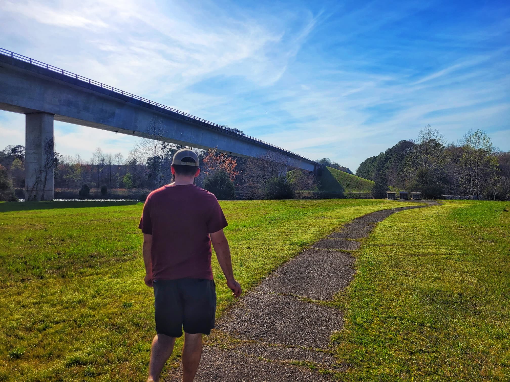
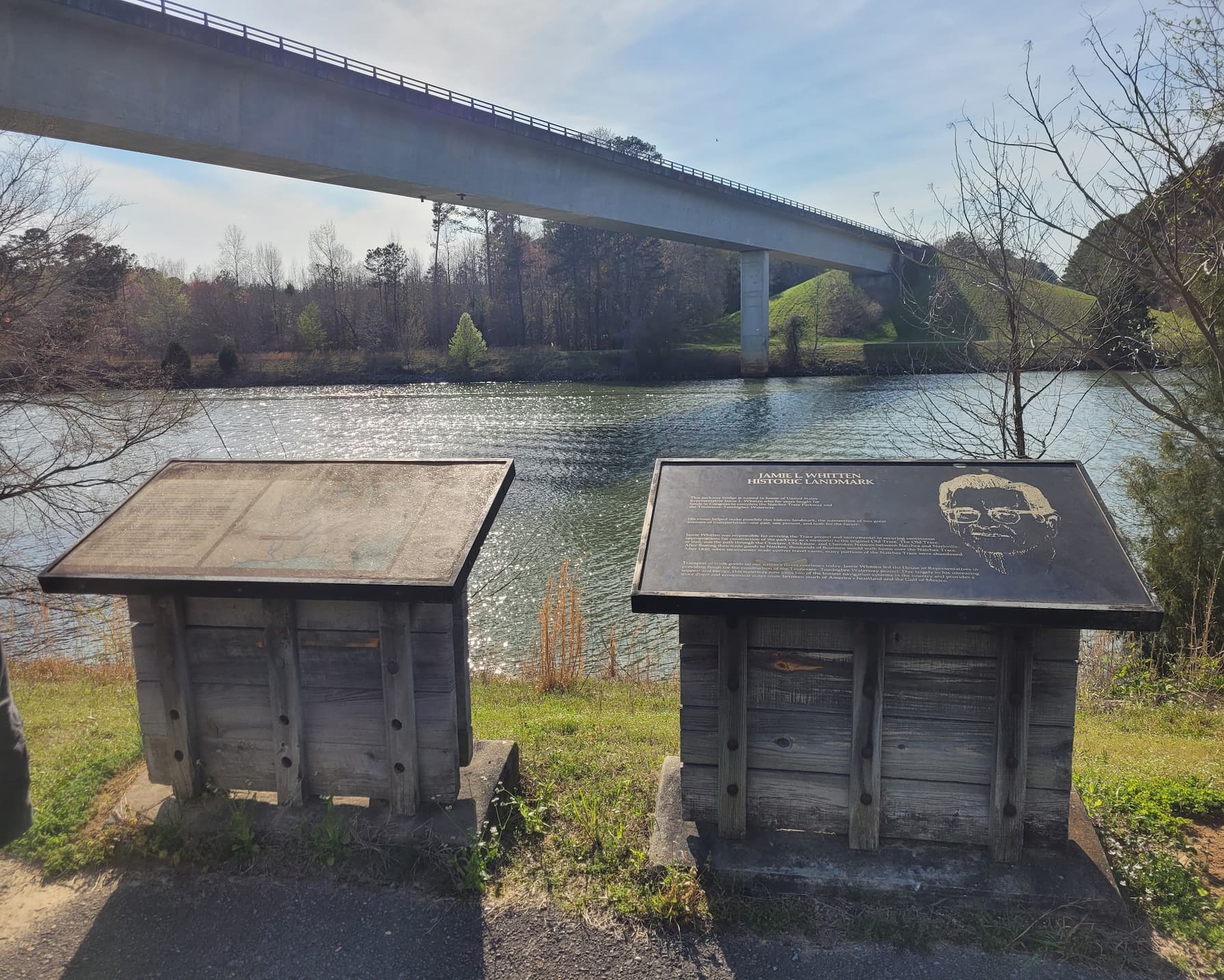
Jamie L. Whitten Bridge & Parkway Connection
The Parkway bridge at this stop is named after U.S. Representative Jamie L. Whitten, who played a key role in securing funding for both the Tenn-Tomm Waterway and the Natchez Trace Parkway. His efforts helped ensure that both projects were completed, making this a fitting tribute to his work.
It was a short but interesting stop, and after taking in the sights, we continued down the Parkway, ready for the next leg of our journey.
Milemarker 293-294: John Whitten Lock & Dam, Visitor Center, and Butler Dogtrot Cabin
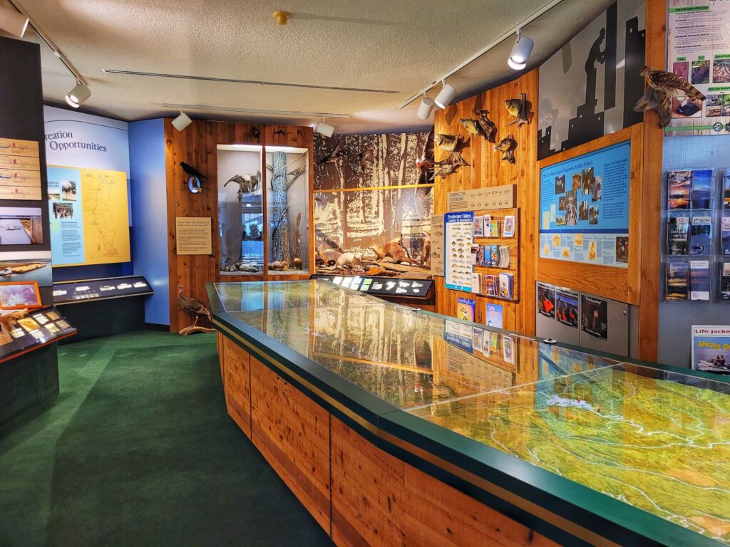
Our Thursday after-work adventure started just off the Parkway at the John Whitten Lock & Dam, managed by the U.S. Army Corps of Engineers. While it’s not technically on the Parkway, it’s close enough that it felt like part of the journey- and well worth the quick detour!
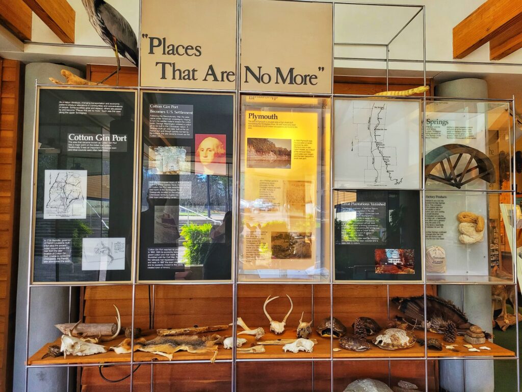
We made it to the visitor center just before it closed at 4:00 PM, and we’re glad we did. A helpful staff member gave us insight into the area and Bay Springs Lake, and we checked out the wildlife displays and exhibits on the dam’s history.
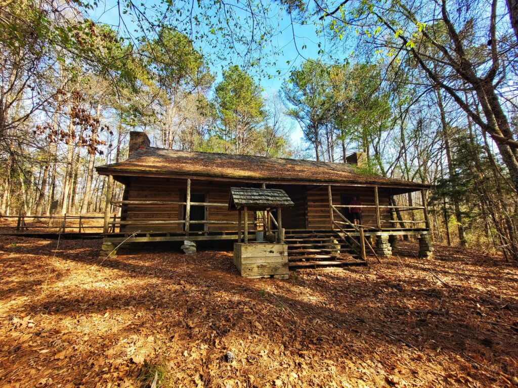
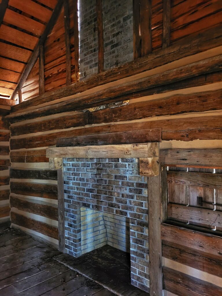
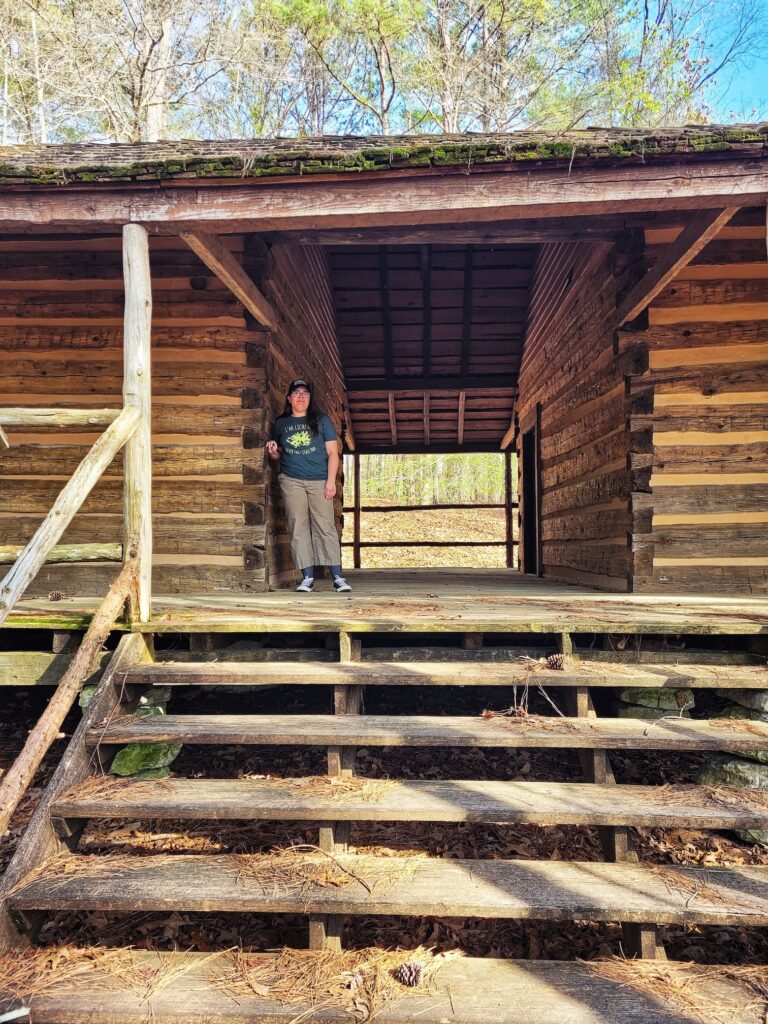
Butler Dogtrot Cabin
Besides my well-documented love of locks, one of the main reasons I wanted to stop here was to see the Butler Dogtrot Cabin, tucked along a short nature trail near the visitor center.
This classic dogtrot-style cabin, built in 1860 by James Thomas and Margaret Ann Searcy Butler, features two main rooms separated by a covered breezeway. One side was for cooking, the other for sleeping, and somehow, the Butlers raised five children in this small space, with only a few side rooms for extra space.
In 1979, the Corps of Engineers moved the cabin here to save it from being flooded by Bay Springs Lake. The craftsmanship was impressive, with hand-hewn timbers, half-dovetail corner joints, and pegged joinery. Even today, it’s actively maintained, and we could see newer wood used for repairs, which really surprised us since we visit so many neglected historic buildings.
After the cabin, we checked out the dam overlook, which offered a great view of Bay Springs Lake, a scenic spot that boasts multiple boat ramps, campgrounds, a marina, and day-use areas with picnicking & activities.
It’s a great place for boating and fishing, and while we weren’t staying long, it definitely looked like a worthwhile stop for anyone wanting to spend more time on the water.
With that, we wrapped up our first stop of the evening and got back on the Parkway, ready for the next adventure!
Mile Marker 293-294: Exit to John Rankin Hwy
⛽Nearest Gas stations:
- Crows Store, 1500 MS-4, New Site, MS 38859, approximately 4 minutes off the Parkway
- Crossroad Express Gas Station, 12360 John Rankin Hwy, Fulton, MS 38843, approximately 8 minutes off the Parkway
Mile Marker 295: Jordan Creek Picnic Area
This was another picnic area that we skipped, since we didn’t need it. It was a small area with a view tables and a nice view of the creek.
Mile Marker 297: Exit to Bay Springs Lake, Belmont, Booneville
⛽Nearest Gas station:
Crows Store, 1500 MS-4, New Site, MS 38859, approximately 8 minutes off the Parkway
Nearby Towns
This exit is about a 15 minute drive to the town of Belmont, Mississippi and 30 minutes to the town of Booneville.
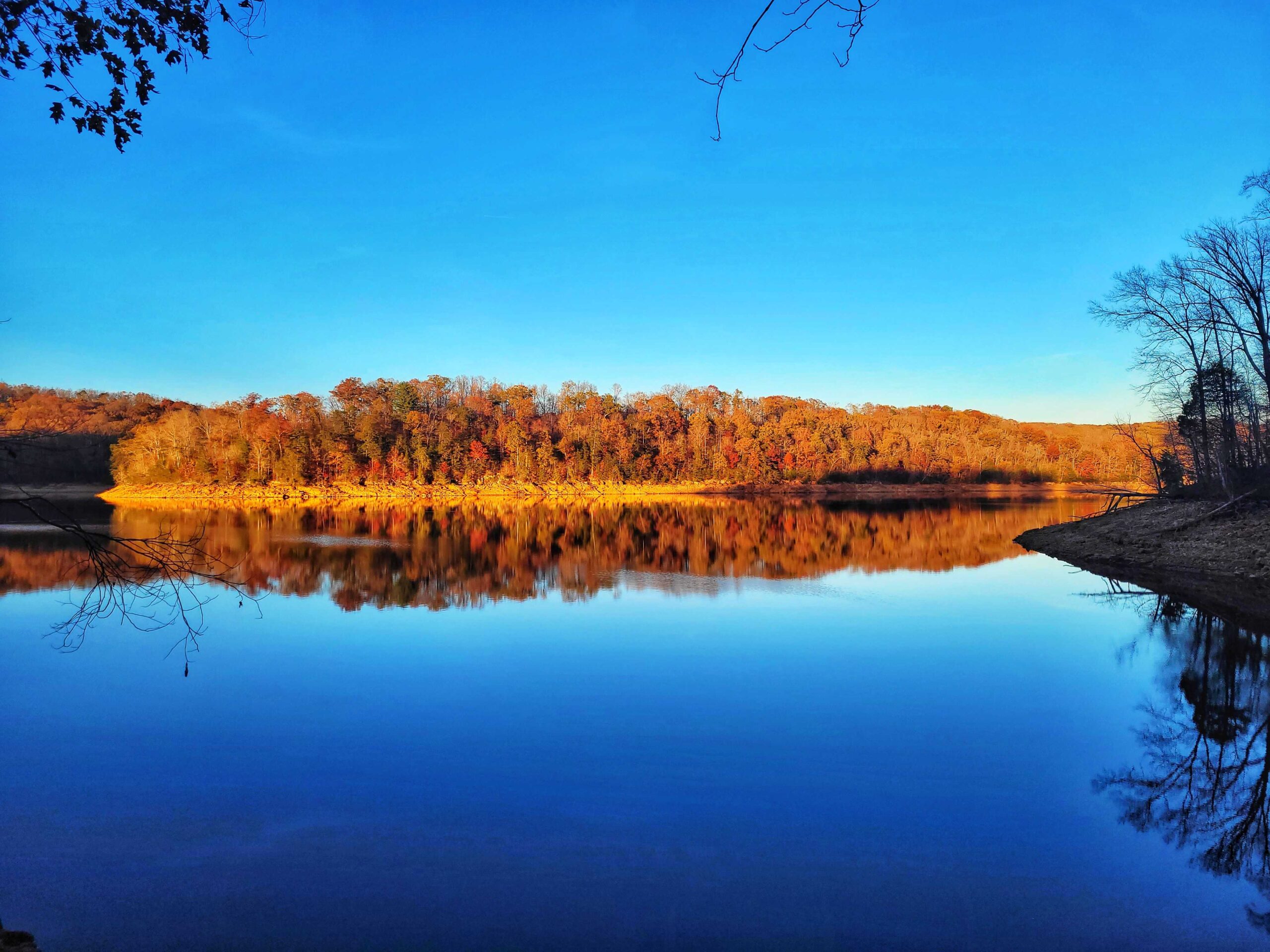
Bay Springs Lake
Bay Springs Lake is a 6,700 acre US Army Corps of Engineers lake that was created by damming the Tombigbee River. The John Whitten Lock and Dam Visitor Center we talked about earlier is on Bay Springs Lake, but there are activities all around the massive lake.
Mile Marker 302-304: Exit to Belmont
This exit is about a 10 minute drive to the town of Belmont, Mississippi.
⛽Nearest Gas station:
Country Store of Dennis, 739 MS-25, Dennis, MS 38838, approximately 9 minutes off the Parkway
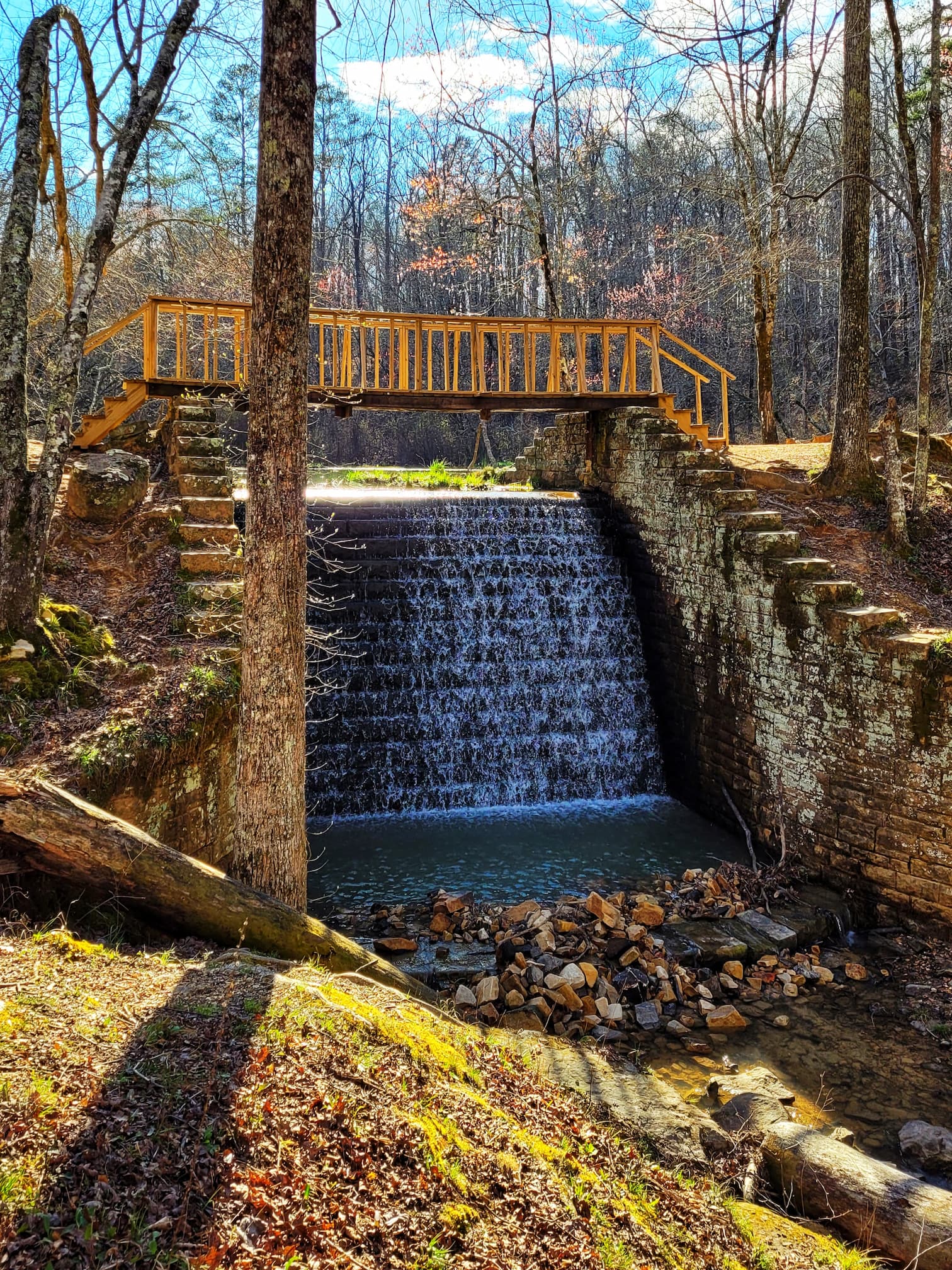
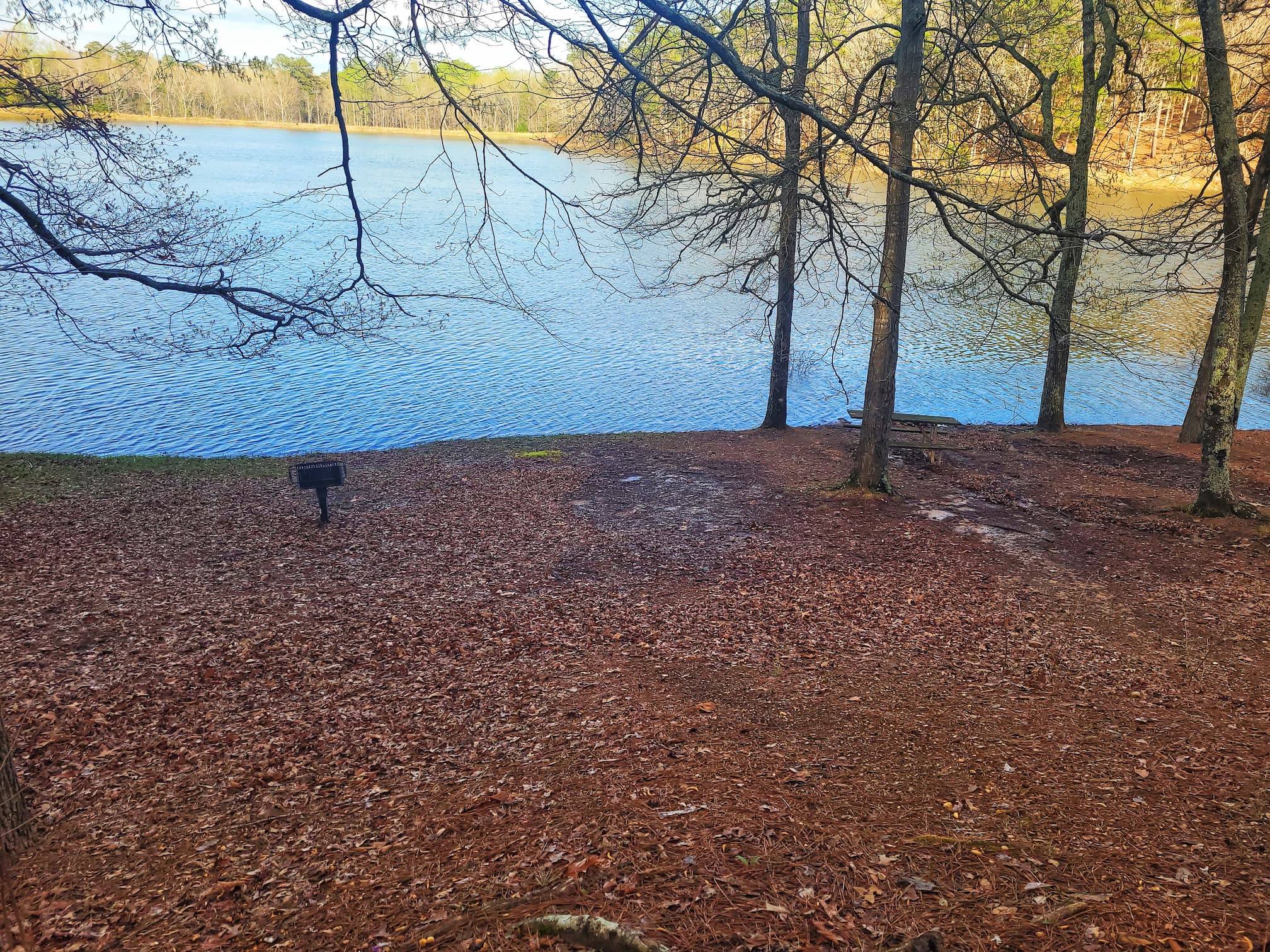
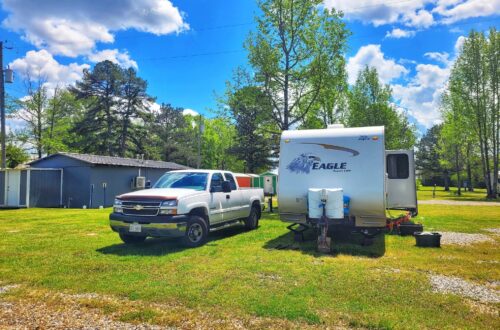
Mile Marker 304: Tishomingo State Park
For our Mississippi stay, we’re camping at Tishomingo State Park, a hidden gem tucked into the foothills of the Appalachian Mountains. It’s a place where ancient history, rugged landscapes, and outdoor adventure all come together.
The park is named after Chief Tishomingo of the Chickasaw Nation, and its history goes back even further; archaeological excavations show that Paleo-Indians lived in this area as early as 7000 B.C. That deep history, combined with the park’s unique rock formations (which aren’t found anywhere else in Mississippi!), makes it a fascinating stop along the Natchez Trace Parkway.
Things to Do at Tishomingo State Park
The parkway runs directly through the park, so it’s an easy place to stop and explore. There’s a $2 daily entry fee if you’re just visiting, but if you’re camping, it’s included in your stay.
Once inside, you’ll find tons of outdoor activities to fill your day:
- Hiking: Plenty of trails wind through the rocky terrain, some leading to waterfalls and scenic overlooks
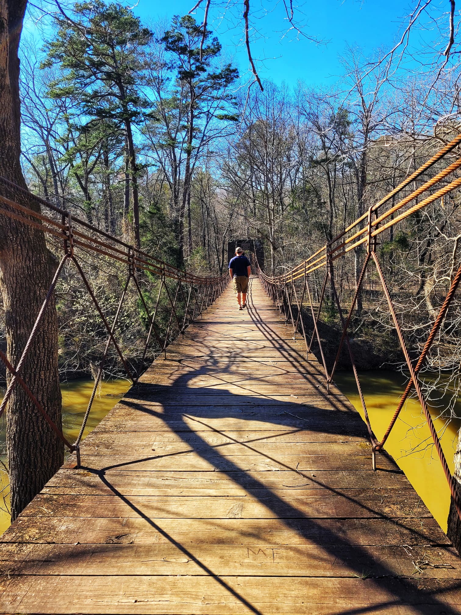
- Historic CCC Sites: Built in the 1930s by the Civilian Conservation Corps (CCC), many original stone buildings still stand, including the famous 1938 swinging bridge
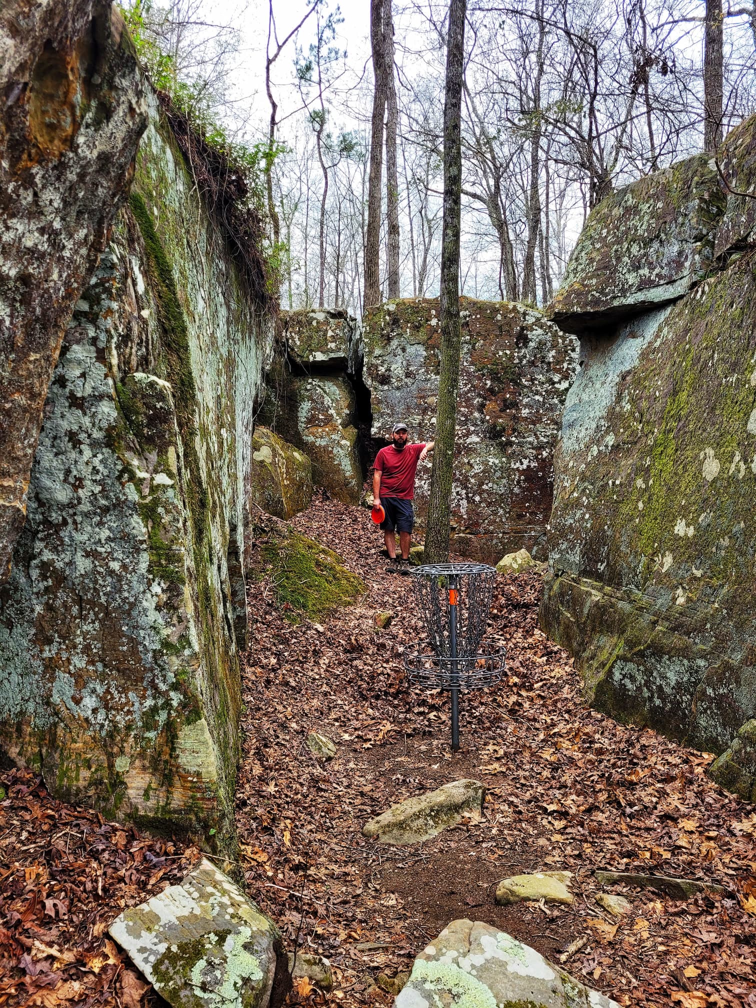
- Disc Golf: The park has three different disc golf courses, so bring your discs!
- Fishing & Boating: You can cast a line in Haynes Lake or Bear Creek, and there’s a boat launch if you want to get out on the water
- Rock Climbing: One of the few places in Mississippi where you can climb natural rock formations
- Picnicking & Playgrounds: Great for a lunch break if you’re just passing through
Camping at Tishomingo
Whether you’re in an RV, tent, or looking for a cozy cabin, there’s a spot for you here.
- RV sites include options with full hookups
- Tent camping is available in scenic wooded areas
- Cabins & cottages offer a more comfortable stay while still being surrounded by nature
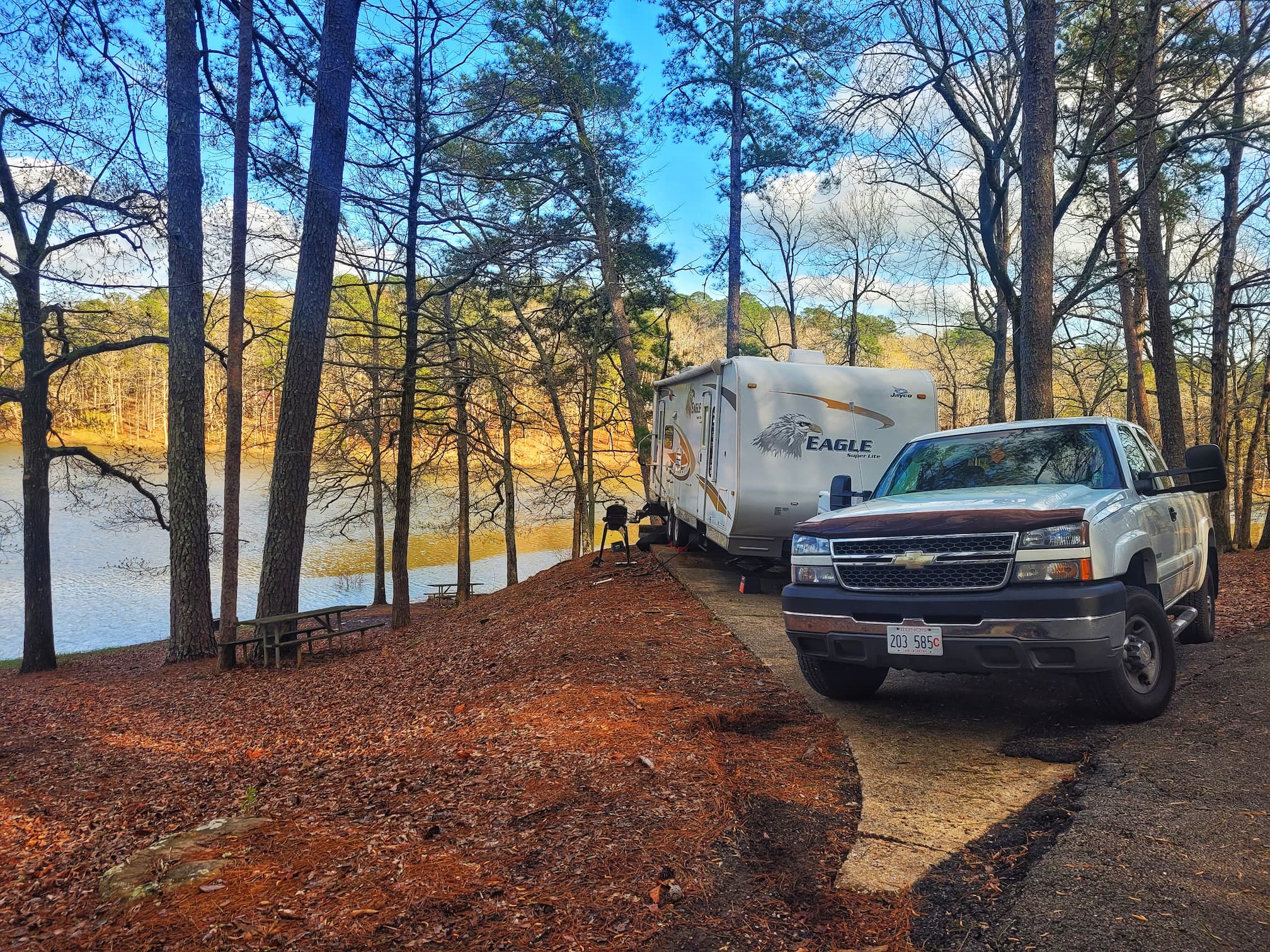
Tishomingo State Park is a perfect place to camp along the Natchez Trace Parkway, with its mix of history, scenery, and outdoor activities. Whether you’re staying overnight or just stretching your legs for a few hours, it’s well worth the stop!
⛽Nearest Gas stations:
- Tish’s Fast Stop, 1307 Main St, Tishomingo, MS 38873, approximately 5 minutes off the Parkway
- Martyville Gas station, 1379 MS-25, Tishomingo, MS 38873, approximately 5 minutes off the Parkway
Mile Marker 307-308: Exit to Booneville
This exit is about 35 minutes to the town of Booneville.
⛽Nearest Gas stations:
- Tish’s Fast Stop, 1307 Main St, Tishomingo, MS 38873, approximately 7 minutes off the Parkway
- Martyville Gas station, 1379 MS-25, Tishomingo, MS 38873, approximately 8 minutes off the Parkway
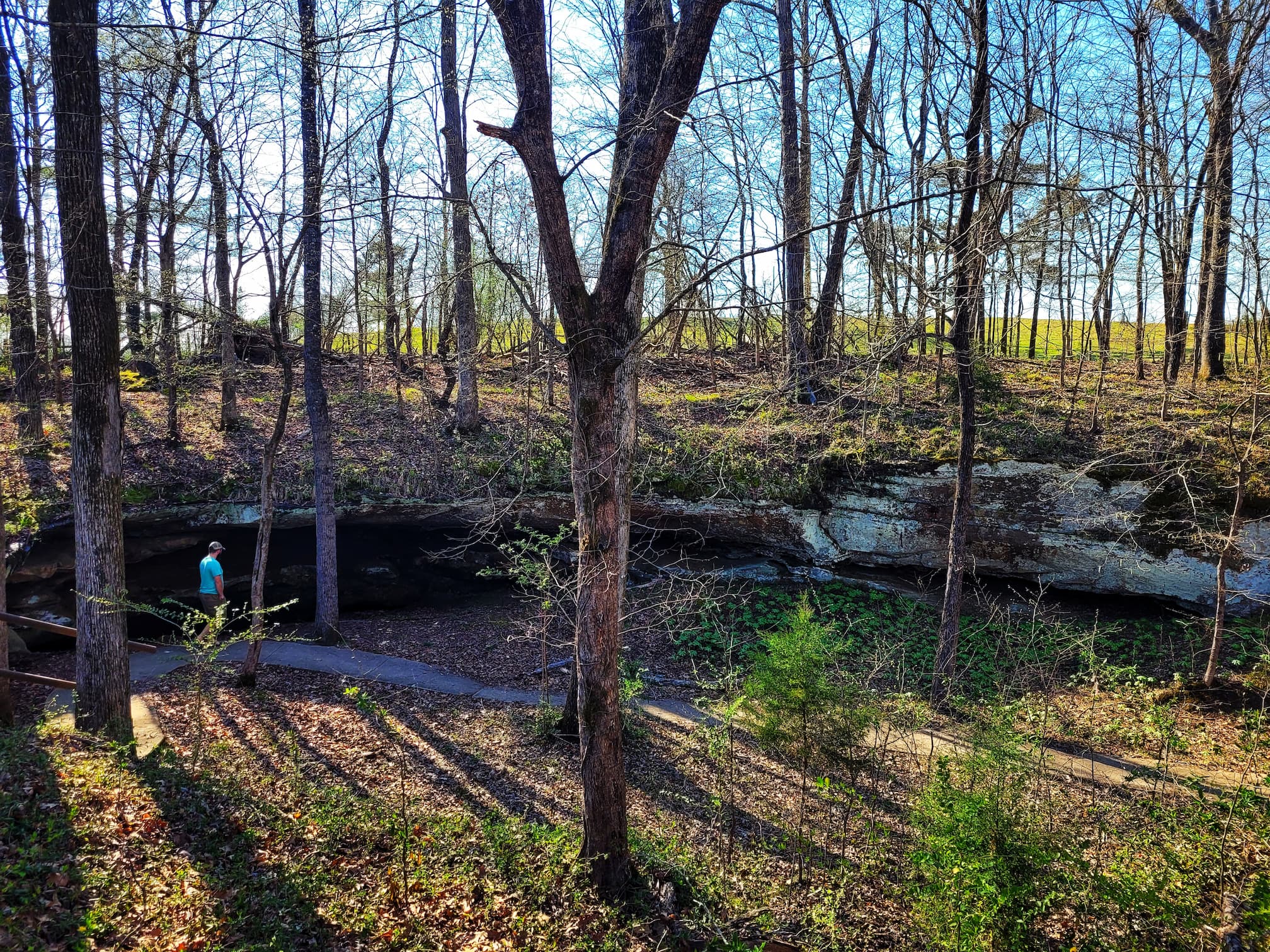
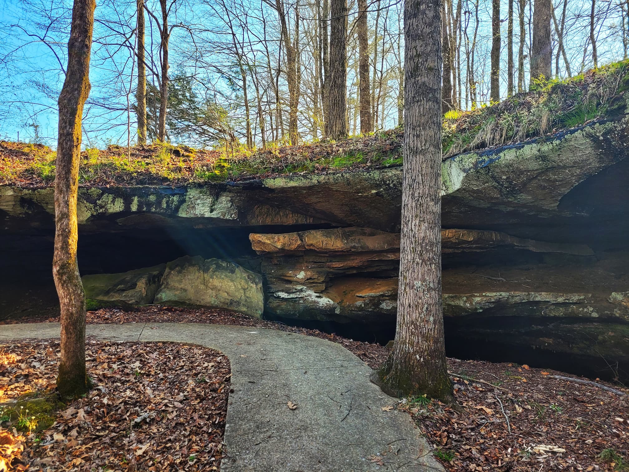
Mile Marker 308.4: Cave Spring
After finishing work on Wednesday, we set out on our first Natchez Trace Parkway adventure, starting from our campsite at Tishomingo State Park. Our first stop? Cave Spring, a short but fascinating stop just a few miles up the road at mile marker 308.4.
Exploring Cave Spring
A quick, paved trail leads to the mouth of the cave, making it an easy and accessible stop. While you can’t go inside the cave, there’s plenty to take in from the outside. Cave Spring was formed by underground water dissolving a long, narrow corridor in the rock. Over time, the ceiling became unstable and eventually collapsed, creating the formation we see today. The process is still ongoing. Right next to the cave, you’ll notice a sinkhole forming as water continues to erode the limestone beneath the surface.
Long before European settlers arrived, Indigenous peoples likely used this cave as a source of water and stone. Today, the water is unsafe to drink, and the cave itself is considered dangerous, but standing at the entrance, you can still get a feel for its history and natural beauty.
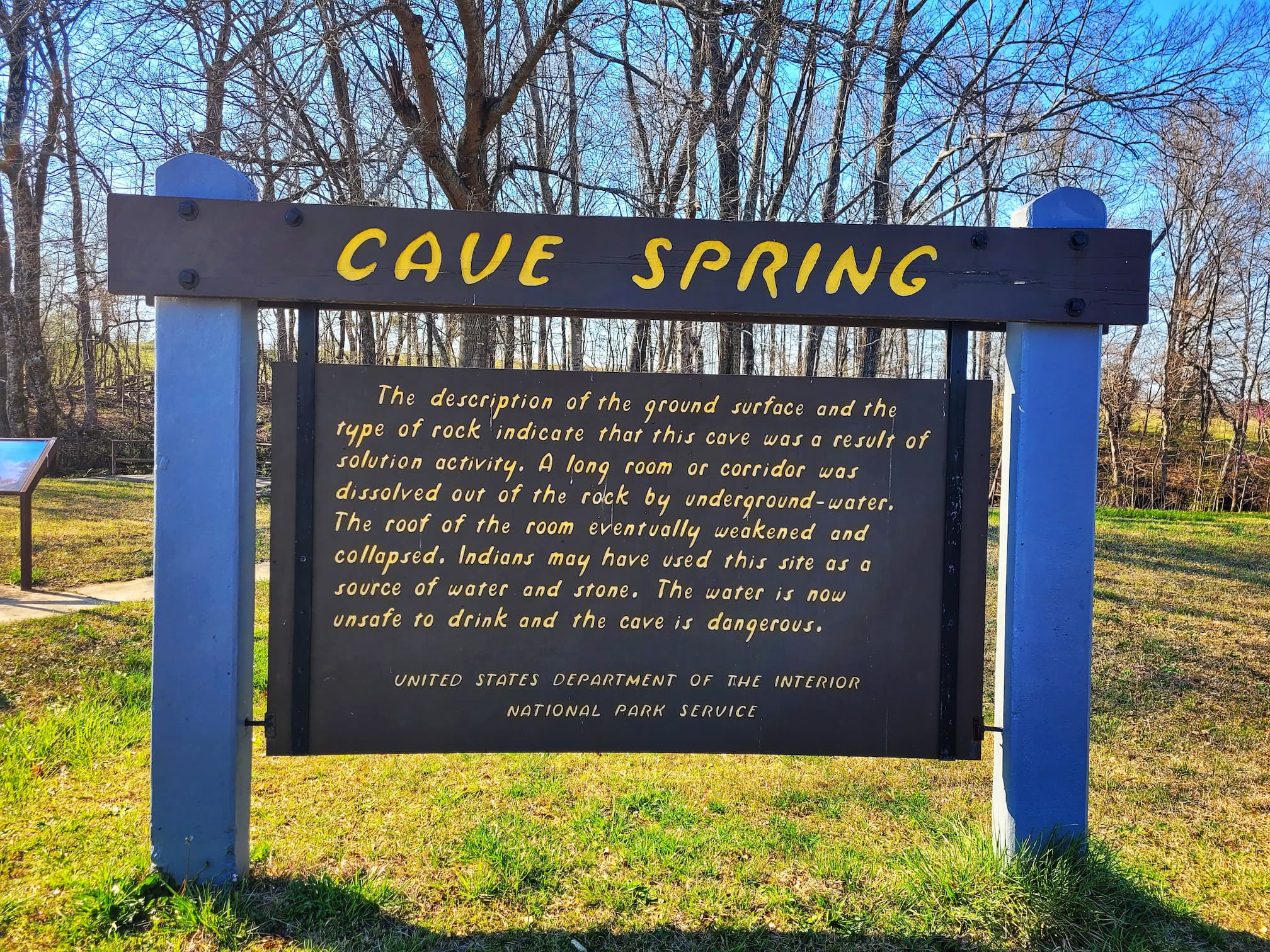
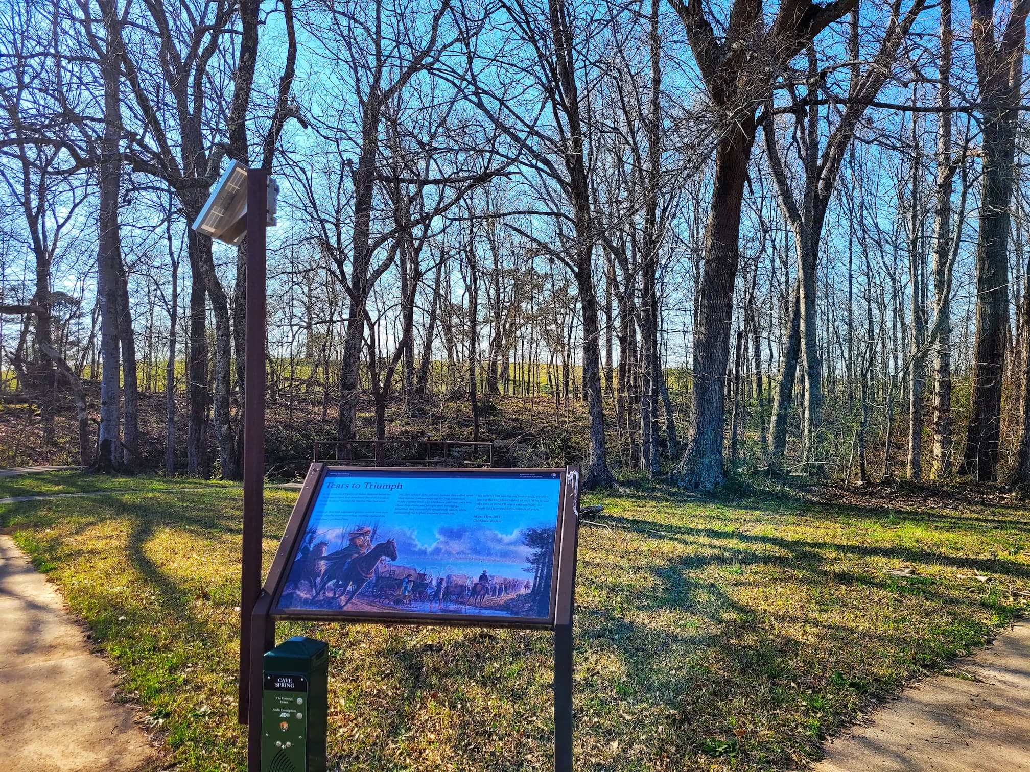
A Site of Chickasaw History
One of the most impactful parts of visiting Cave Spring is learning about its connection to the Chickasaw Nation and the forced removal of Indigenous people in the 1830s. An interpretive sign and audio story at the site share how the Chickasaw people were forced from their homeland due to U.S. Indian Removal policies. One of the trails they took to Indian Territory (present-day Oklahoma) crossed the Natchez Trace just south of Cave Spring, making this area a somber reminder of the region’s difficult history.
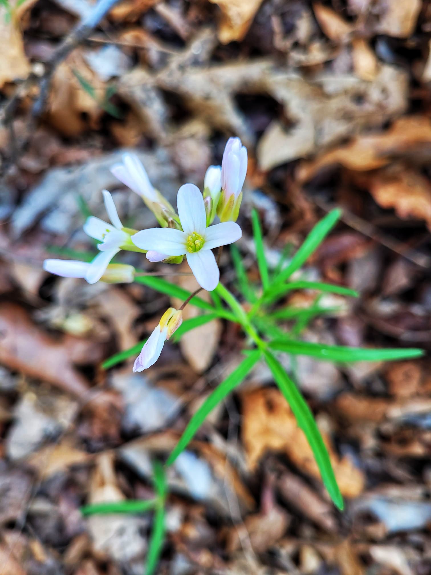
Spring Ephemeral Flowers
Of course, I couldn’t stop myself from doing a little botanizing while we were there! Spring ephemerals, those delicate wildflowers that bloom early in the season before the trees leaf out, were popping up along the trail. I spotted:
- Virginia Spring Beauty (Claytonia virginica)
- Virginia Saxifrage (Micranthes virginiensis)
- Cut-leaved Toothwort (Cardamine concatenata)
- Mayapple (Podophyllum peltatum)
- Common Blue Violet (Viola sororia)
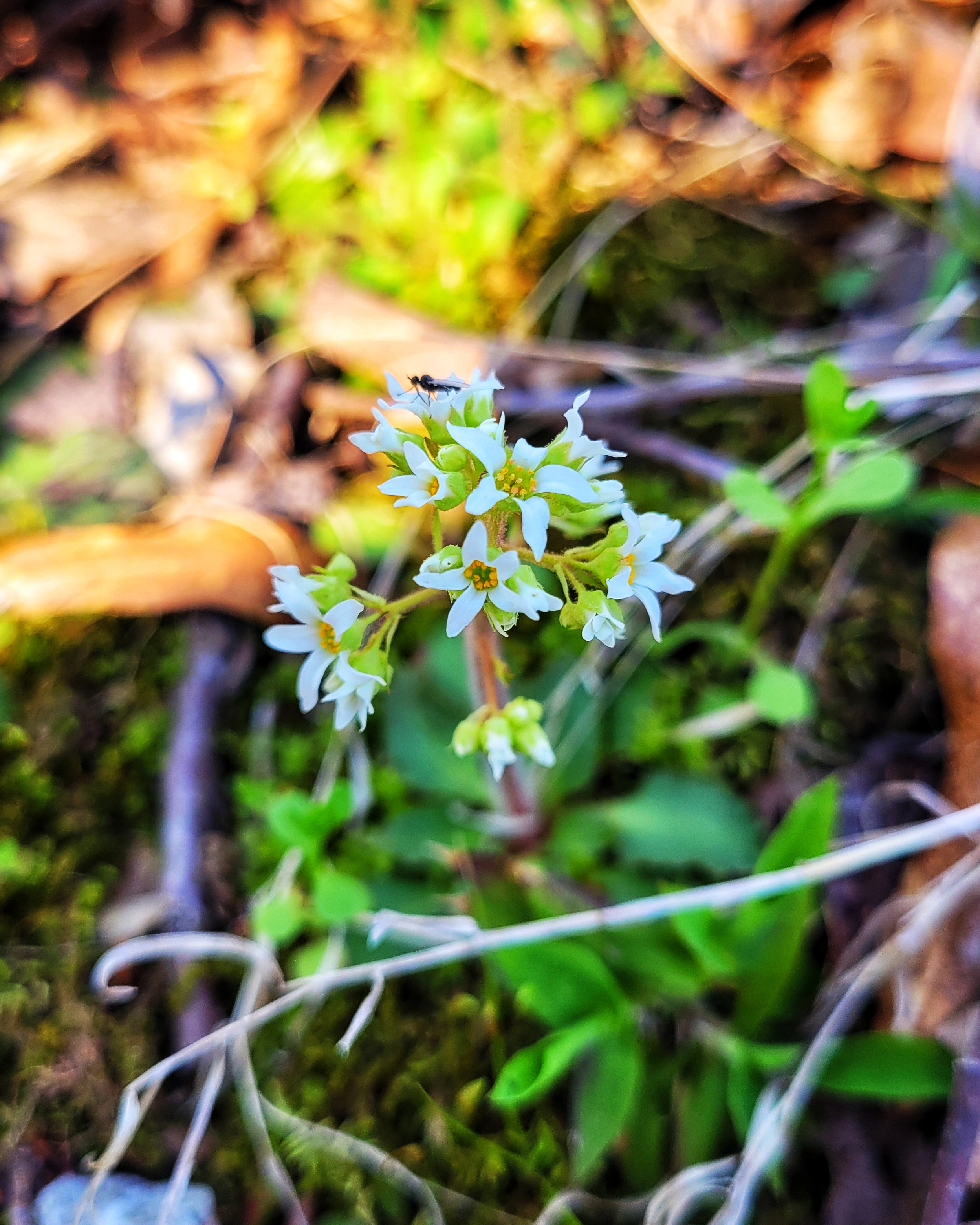
It was the perfect way to start our Parkway adventure- a mix of geology, history, and wildflowers all in one stop.
Mile Marker 308.8: Bear Creek Mound
After exploring Cave Spring, we continued just a little farther down the Natchez Trace Parkway to our second stop of the afternoon: Bear Creek Mound. Sitting right near the Alabama-Mississippi state line, this site offers a glimpse into the deep history of the people who lived here long before the Parkway existed.
A Window into the Mississippian Period
About 900 years ago, Indigenous people of the Mississippian culture began constructing this flat-topped mound, likely as the base for a ceremonial building. But the history of this site stretches back much further. For thousands of years before mound-building began, this area was used by semi-sedentary groups who hunted, fished, and passed through seasonally.
Bear Creek itself was a major draw for people, acting as an early highway for dugout canoes and a reliable fishing spot. Even as far back as 8000 BC, hunters used this location as a place to process game before moving on. While agriculture in this area remained limited until around 1000 AD, the land provided rich physical and spiritual resources, making it a natural gathering place for generations of Indigenous people.
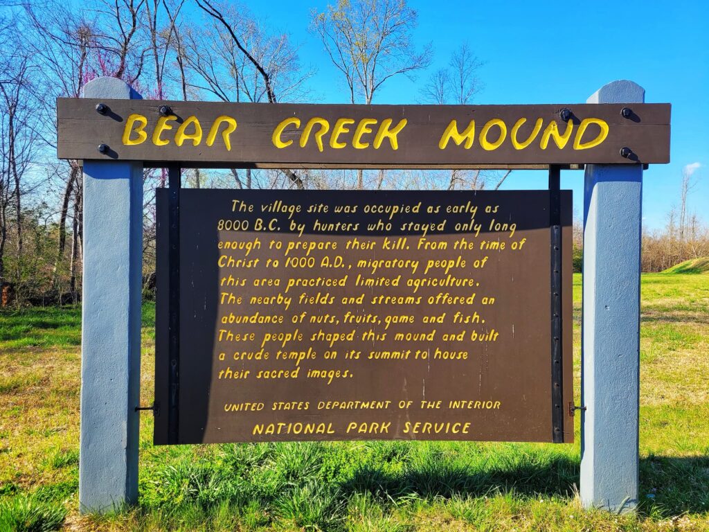
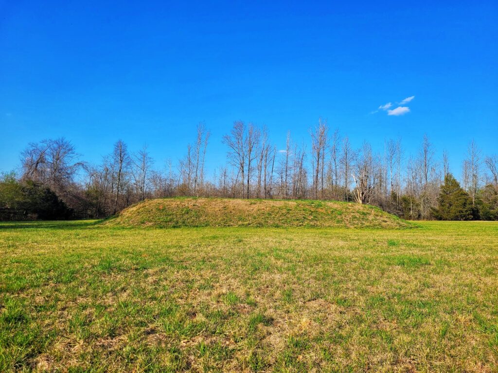
Visiting Bear Creek Mound
This is a quick and easy stop, with a mowed field and interpretive signs explaining the site’s significance. While there are six mound sites along the Parkway, this was the first one we visited and standing at the base of the mound, it’s humbling to think about the thousands of years of history beneath your feet.
If you’re driving the Parkway, this stop pairs well with Cave Spring just a half-mile away. It’s a great way to experience both the natural and cultural history of the region in one short stretch of road!
Mile Marker 309-310: Exit to Allsboro Road
This exit is just about a 15 minute drive to the town of Cherokee, Alabama. If you’re looking for more outdoor activities, check out Freedom Hills Wildlife Management Area, which is on the North Alabama Birding Trail. If you’re looking for something more weird to do, head over to Coon Dog Cemetery, a cemetery that’s exclusively used for burying beloved coon dogs.
⛽Nearest Gas stations:
- Exxon, 6220 US-72, Cherokee, AL 35616, approximately 13 minutes off the Parkway
- Cherokee Chevron, 8205 US-72, Cherokee, AL 35616, approximately 17 minutes off the Parkway
Mile Marker 313: Bear Creek Picnic
We didn’t stop at Bear Creek Picnic Area, but we got a good view from the road. This was the largest picnic area in this section of the Parkway and had tons of tables in a nice open area. It looked like a great place for a lunch break!
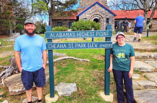
Mile Marker 317: Freedom Hills Overlook
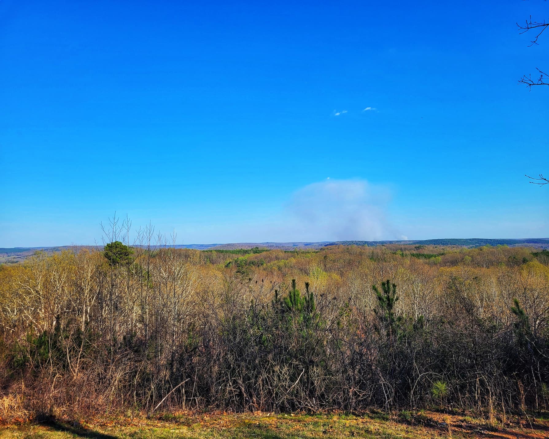
After passing Bear Creek Picnic Area at MM 313, we continued north to Freedom Hills Overlook, one of the highest points in Alabama along the Natchez Trace Parkway.
A Short but Steep Climb
The trail to the overlook is only 1,100 feet long, but don’t let the short distance fool you- it’s a steep hike! Thankfully, there are benches along the way if you need to catch your breath before reaching the top. And once you do, the views are worth it. From here, you get a wide-open look at the rolling hills of northern Alabama, a landscape that feels a world away from the flatlands farther south on the Parkway.
More Spring Wildflowers!
Of course, I was also keeping an eye out for spring ephemerals, adding a few new species to my growing list:
- Crowpoison (Nothoscordum bivalv)
- Plantain-leaved Pussytoes (Antennaria plantaginifolia)
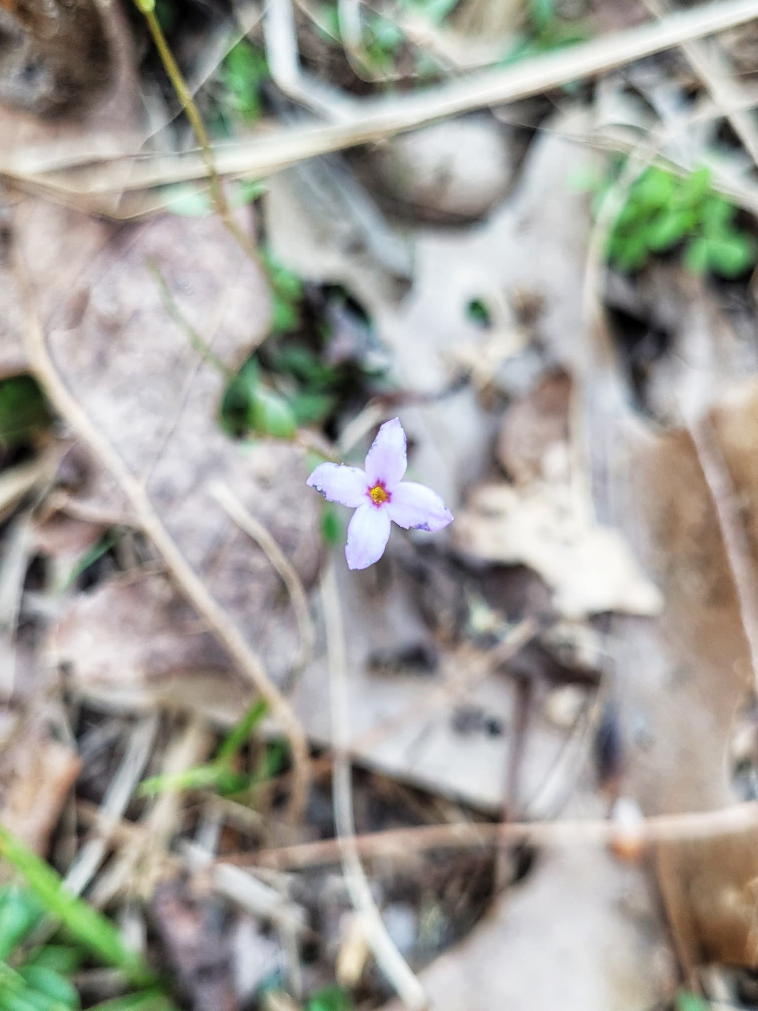
- Tiny Bluet (Houstonia pusilla)
(And yes, I was tracking everything on iNaturalist- only counting new species at each stop!)
After soaking in the views and snapping some photos, we continued our Parkway adventure, ready for the next stop ahead.
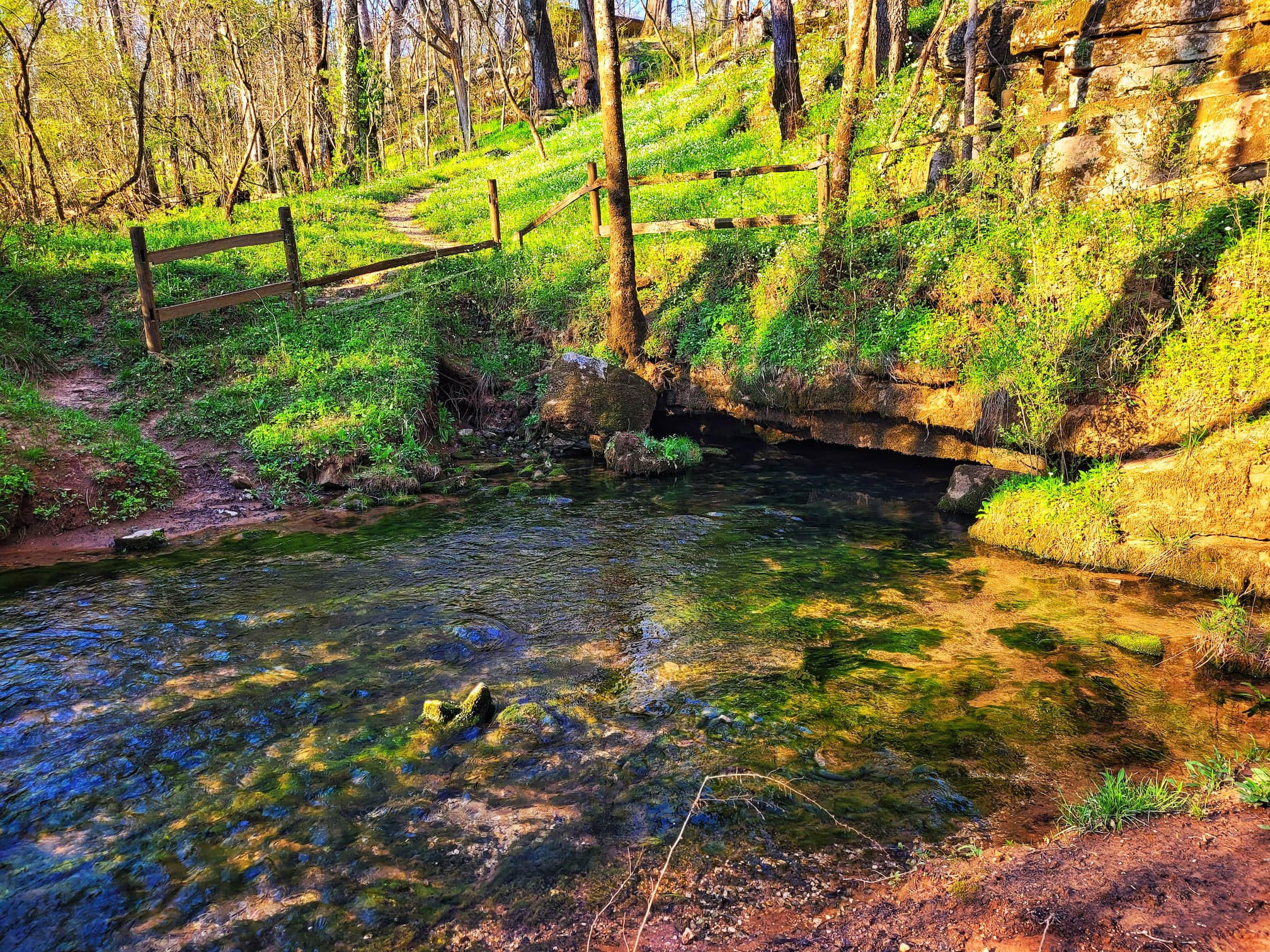
Mile Marker 320.3: Buzzard Roost Springs
We wrapped up our Wednesday adventure with a visit to Buzzard Roost Spring, a peaceful stop with a short trail leading to a natural spring flowing from a small cave. But beyond its quiet beauty, this site holds layers of history, particularly the story of Levi Colbert, a Chickasaw leader who played a major role in negotiations between his people and the U.S. government.
Levi Colbert and the Stands of the Natchez Trace
Colbert, also known as Itawamba Mink (“Bench Chief”), was of Chickasaw and Scottish descent. His bilingual skills and deep knowledge of both cultures made him a skilled negotiator for the Chickasaw people. He built an inn, or “stand,” here at Buzzard Roost- one of the many along the Trace that provided weary travelers with food, shelter, and news between the 1790s and 1840s.
The stands varied in size and services, but they were essential in an era before modern roads and travel infrastructure. They served a diverse mix of people, including traders, settlers, Native Americans, and African Americans, many of whom were enslaved and forced to travel the Trace as part of the mass relocation to the Deep South.
As steamboat travel grew in the 19th century, fewer people used the Trace, leading many stand owners to close up shop or move elsewhere. Today, nothing remains of Colbert’s stand, but an interpretive sign and an audio box at the pavilion share his story.
A Peaceful Spring and More Wildflowers
After learning about the site’s past, we took the short trail to Buzzard Roost Spring itself, where clear water emerges from the earth. It was a calm, shady spot, perfect for a quick break before heading back to camp.
And of course, I was still on my flower hunt! Here, I spotted:
- Swamp Buttercup (Ranunculus septentrionalis)
- False Rue Anemone (Enemion biternatum)
With that, we wrapped up our day of Parkway adventures for the day and headed back to our campsite at Tishomingo State Park!
Mile Marker 320.3: Exit to Cherokee
This exit takes you right into Cherokee, Alabama which has multiple food and gas options.
We are Bookshop.org Affiliates and earn on qualifying purchases.


One comment on “Driving the Natchez Trace Parkway: A Complete Guide to Mile Markers 261–320”
Comments are closed.