The Weldon Spring Site is a U.S. Department of Energy Office of Legacy Management–controlled nuclear waste disposal site with a public interpretive center. That combination alone makes it memorable. During our Route 66 Centennial road trip, we were staying at Dr. Edmund A. Babler Memorial State Park just outside of St. Louis, and one windy Tuesday in February we drove about 20 minutes to see it for ourselves. It turned out to be one of the most unexpectedly fascinating stops of the trip, and absolutely worth a short detour if you have time to step off Route 66 proper.
Today, the site centers around a 75-foot-tall, limestone-capped disposal cell that contains 1.48 million cubic yards of waste from World War II explosives production and Cold War uranium processing. Surrounding it are restored prairie lands, native plant gardens, multiuse trails, and a striking new interpretive center that walks visitors through the area’s layered history, from displaced farming communities to wartime manufacturing to decades of environmental cleanup and long-term stewardship. In this post, I’ll cover the site’s complex history, what it’s like to climb to the top of the disposal cell, the surprising amount of nature and recreation around it, and what to expect inside the interpretive center, so you can decide if this unique stop belongs on your own Route 66 itinerary.
Weldon Spring Site Visiting Basics
Address: 7295 MO-94, St Charles, MO 63304
Website: https://www.energy.gov/lm/weldon-spring-site-interpretive-center
Interpretive Center Hours: Monday-Friday 9am-5pm, Saturday/Sunday 10am-5pm
Grounds Hours: Sunrise-Sunset
Admission: Free!
A Little Bit of Site History at Weldon Spring
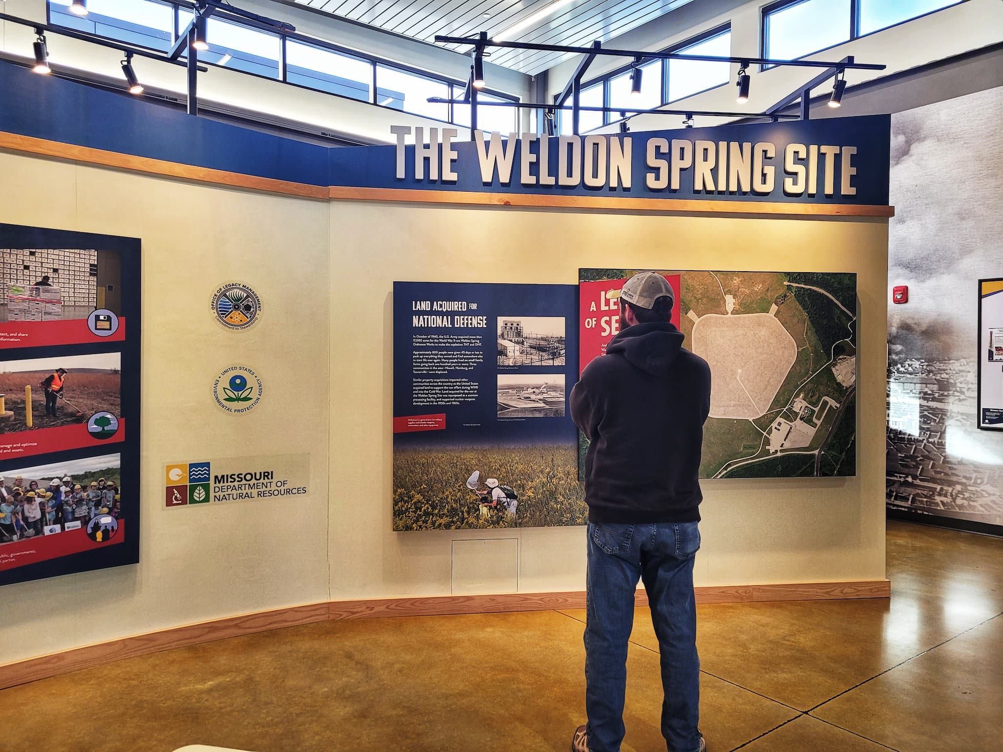
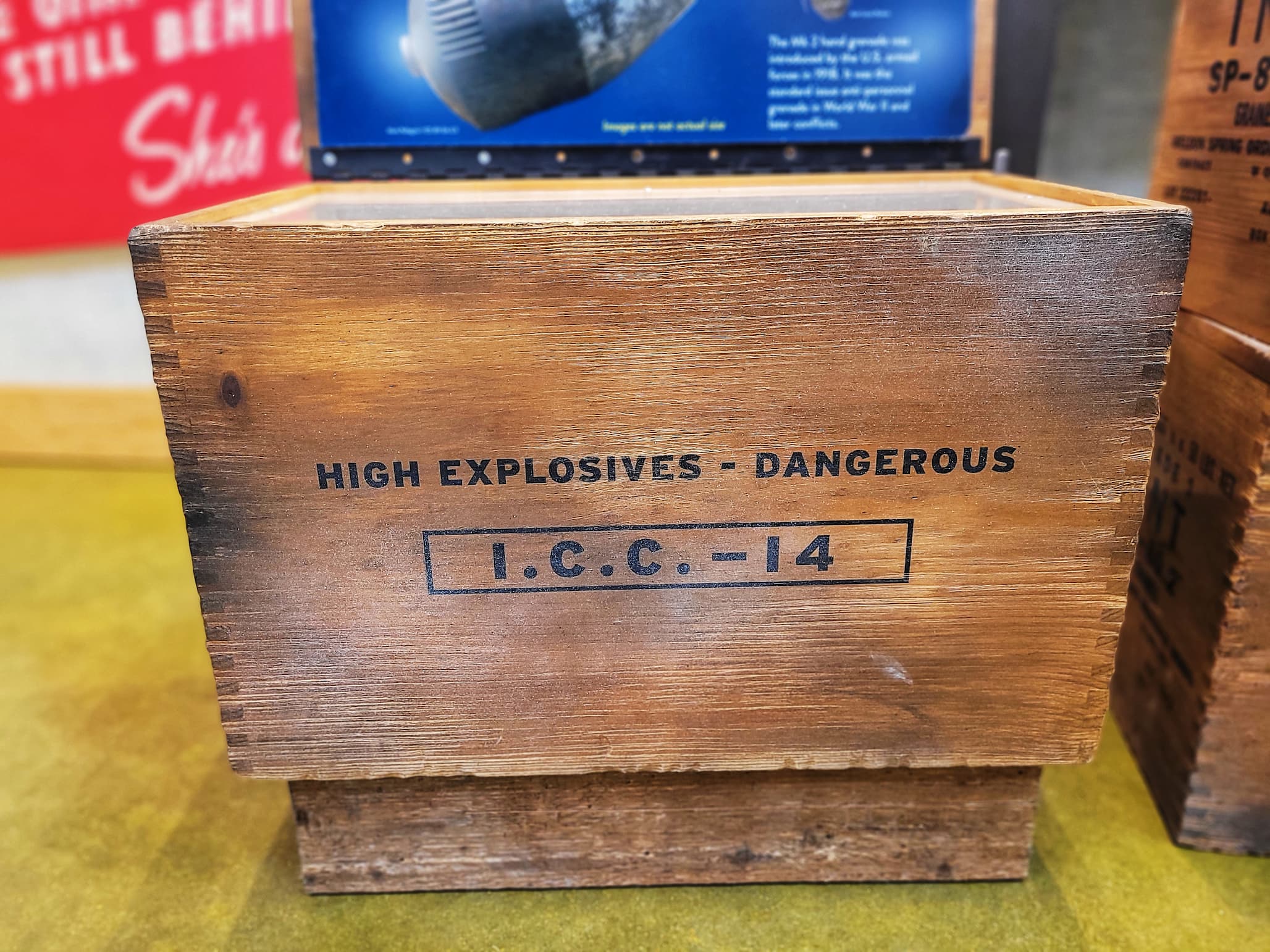
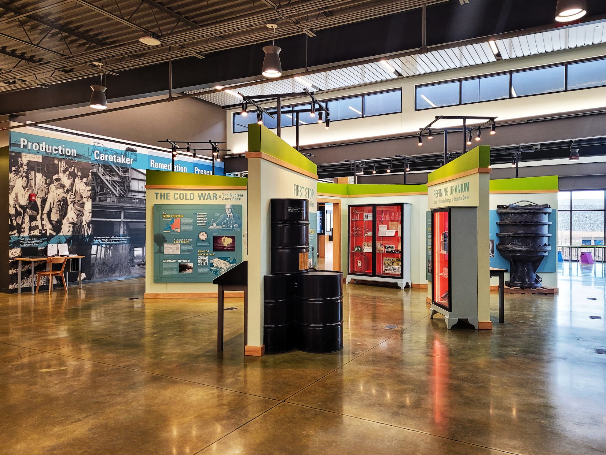
Long before the staircase and limestone cap, this land was farm country. In 1941, the U.S. government acquired roughly 17,000 acres of rural Missouri to create the Weldon Spring Ordnance Works. In the process, the towns of Hamburg, Howell, and Toonerville were displaced. About 600 people, many from multigenerational family farms, were given 45 days or less to pack up their lives and leave. From 1941 to 1945, the U.S. Army manufactured TNT and DNT here, ultimately producing 75 million pounds of explosives to support World War II. The scale of production left a legacy: contamination in soil, sediments, groundwater, and even nearby springs. Limestone mined from the adjacent quarry was used to build the plant itself, and the quarry later became a burn and disposal area for TNT-contaminated rubble, compounding the environmental impact.
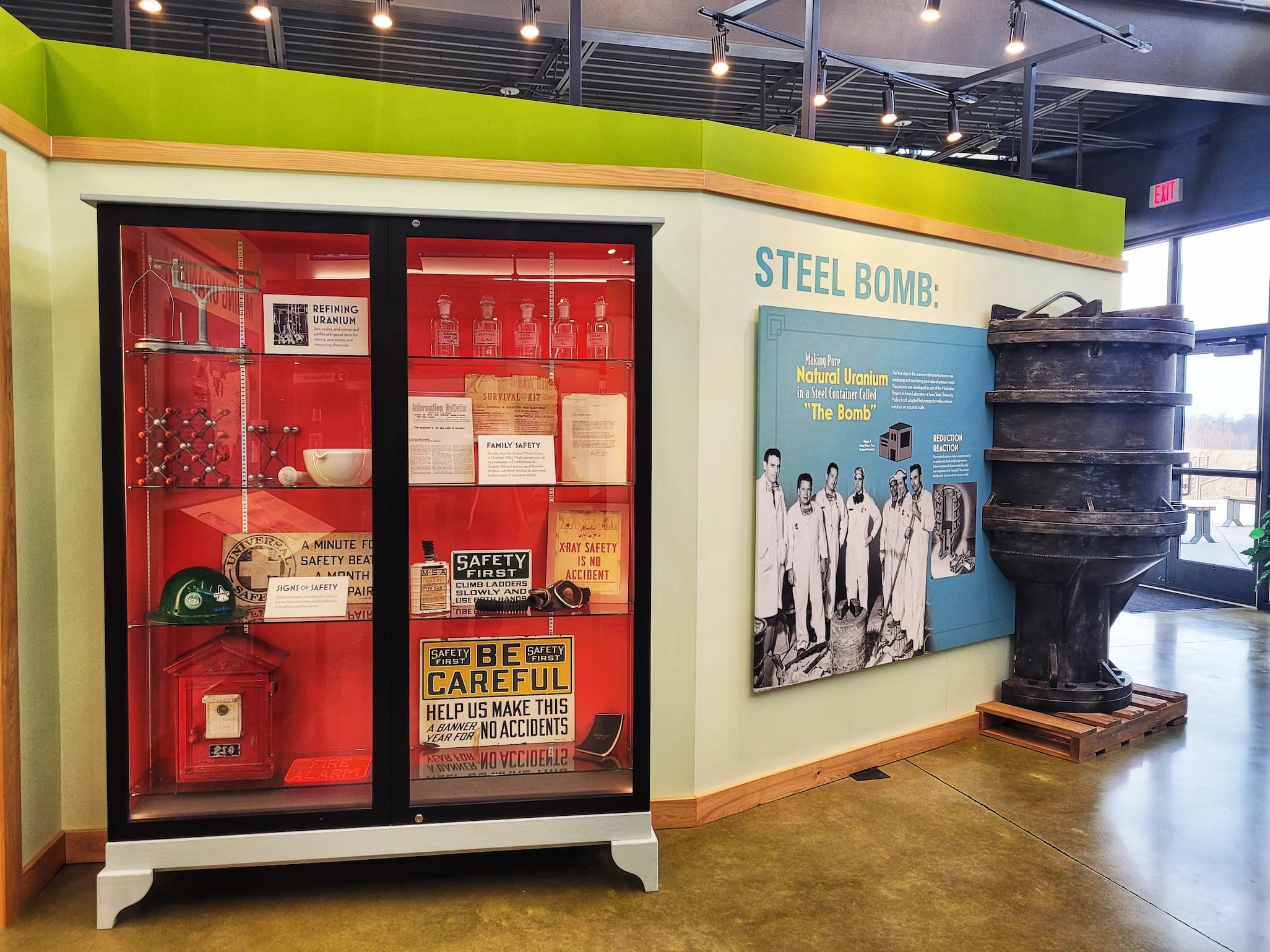
The site’s mission shifted during the Cold War. In 1956, after extensive explosive demolition by the Army, the property was transferred to the U.S. Atomic Energy Commission and converted into the Weldon Spring Uranium Feed Materials Plant. From 1957 to 1966, workers processed uranium ore concentrates into uranium trioxide, intermediate compounds, and uranium metal, along with small amounts of thorium. This work generated large volumes of waste known as raffinate, which was stored in pits on the property. Some of these radioactive and chemical contaminants mingled with the earlier World War II-era pollution. The quarry, transferred to the Atomic Energy Commission in 1960, was used between 1963 and 1969 for disposal of uranium and thorium residues.
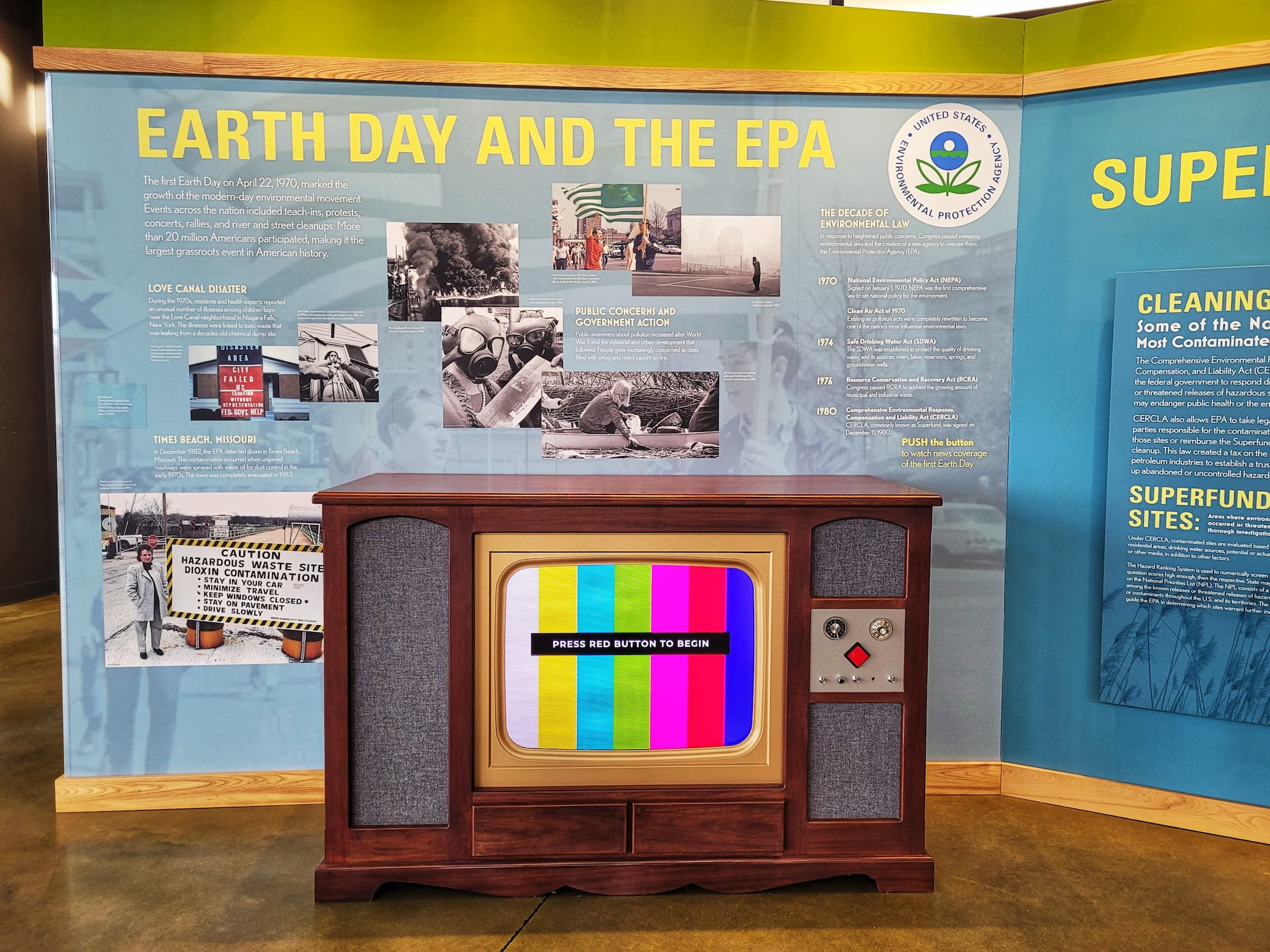
Uranium processing ceased in 1966, and the facility was returned to the Army, with the Atomic Energy Commission (which later became the Department of Energy) serving as caretakers responsible for security and maintenance. In the 1980s, as environmental awareness grew, the site came under increased scrutiny. The Army undertook building repairs and partial decontamination in 1984, then transferred the chemical plant fully to the Department of Energy in 1985. The quarry and chemical plant were added to the Environmental Protection Agency’s National Priorities List in 1987 and 1989, formally designating them as Superfund sites. Remediation culminated in 2001 with the completion of the on-site disposal cell that now contains the deconstructed buildings, contaminated soils, and residues. In 2020, the site received the EPA’s Federal Facility Excellence in Site Reuse Award, recognition of a landscape that has moved, over decades, from farmland to weapons production to environmental cleanup and public interpretation.
First Stop: The Weldon Spring Site Interpretive Center
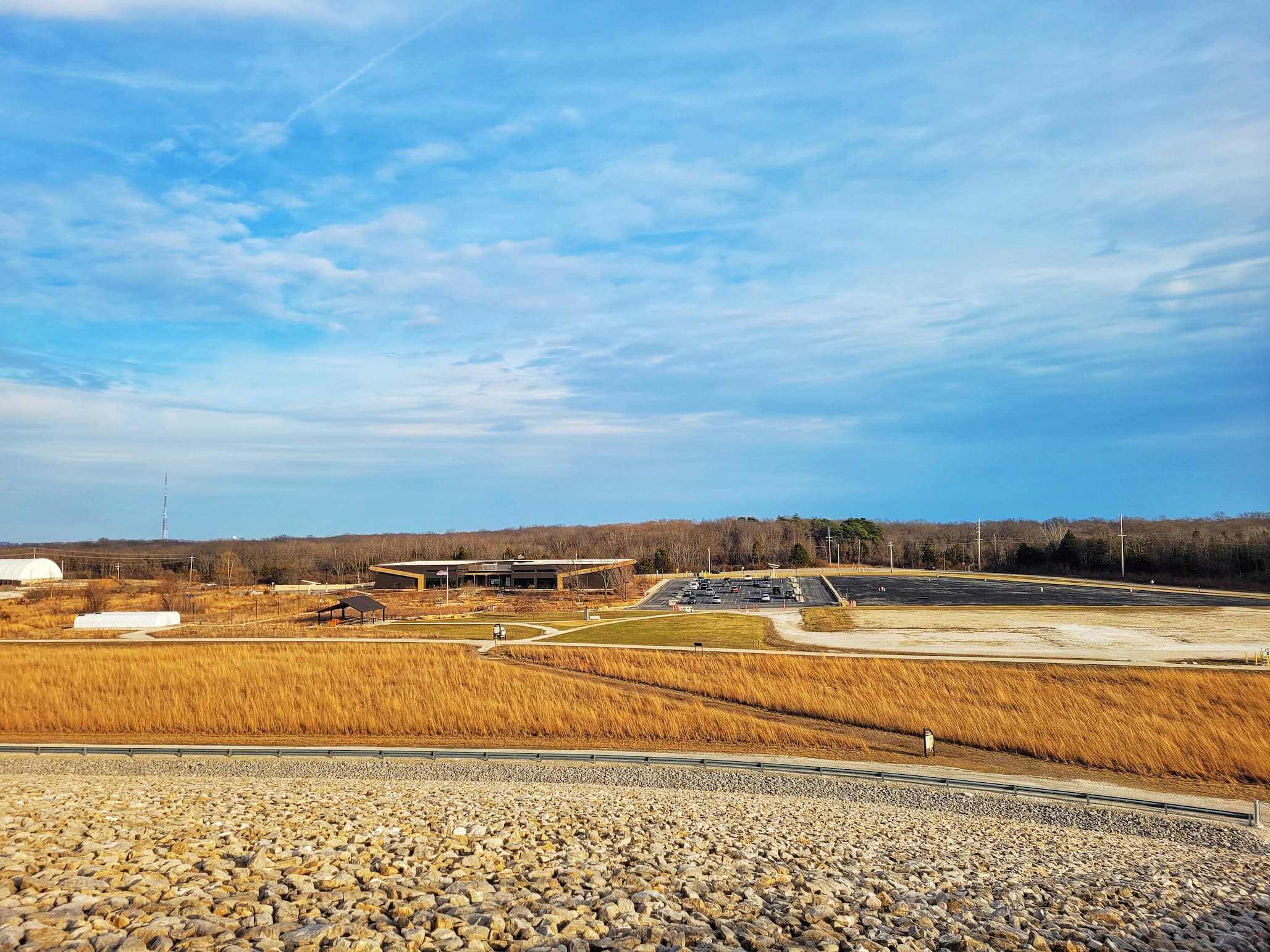
The Weldon Spring Interpretive Center pulls the entire story together, far more thoroughly (and beautifully) than you might expect. The current building, which opened in 2022 after years in a temporary space, is spacious and thoughtfully designed, with large windows overlooking the disposal cell and Howell Prairie. Even on a cold or rainy day, it’s worth stepping inside just for the view. The exhibits walk you through the full arc of the site: the rural communities that existed here before 1941, the massive World War II ordnance production effort, the Cold War uranium processing years, and the long, complicated cleanup and stewardship process that followed. There’s real depth here, artifacts from different eras, well-produced films, hands-on displays explaining the science behind explosives and uranium processing, and detailed breakdowns of the remediation effort that led to the construction of the disposal cell.
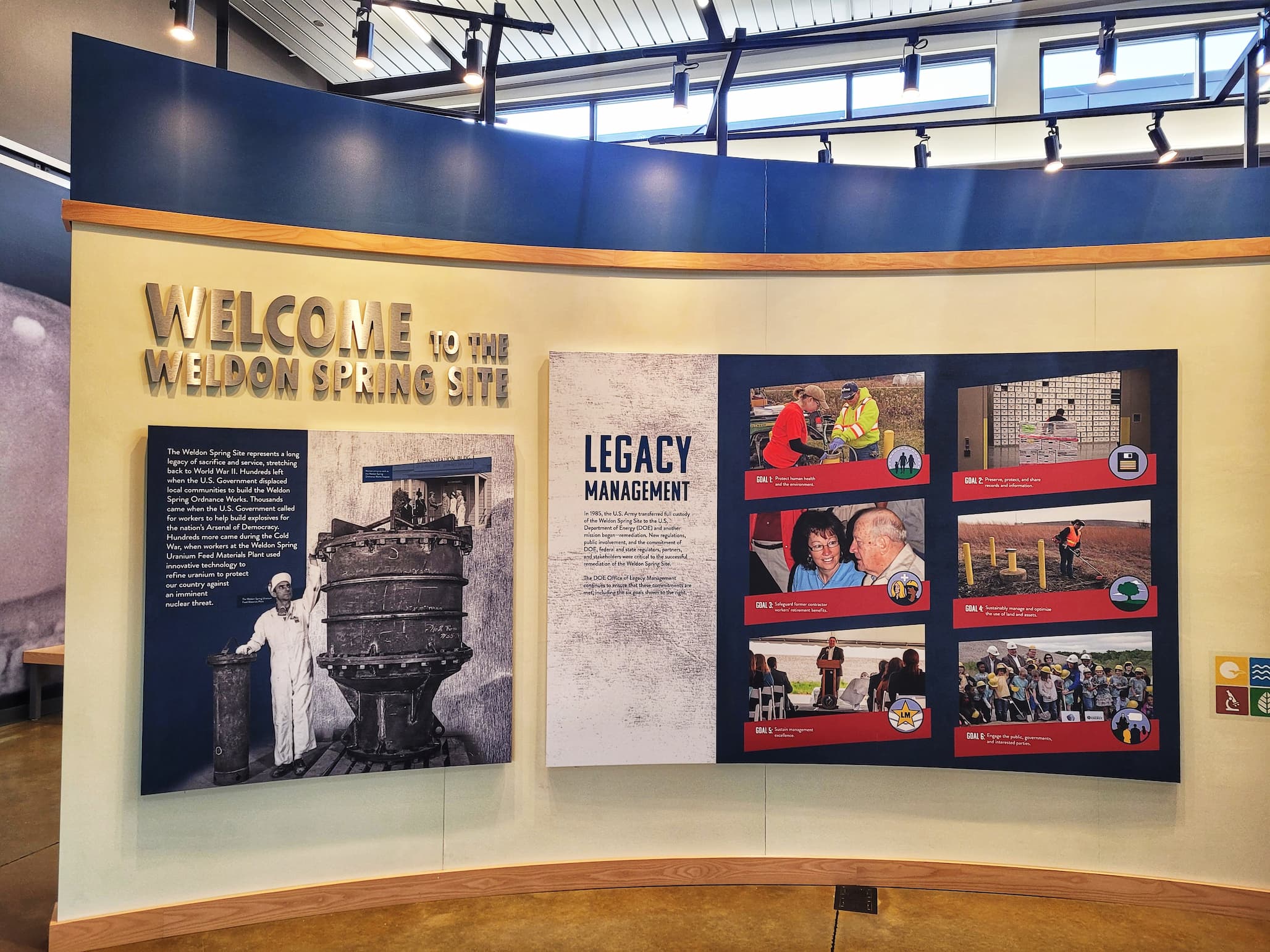
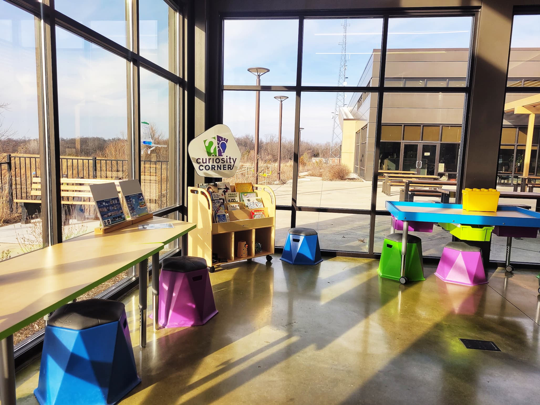
Beyond the exhibits, the center hosts educational programs, tours, and community meetings, reinforcing that this is not just a memorial to the past but an active public resource. There’s even a small but inviting kids’ corner designed to make some of the heavier topics more accessible to younger visitors. The overall effect is immersive without being overwhelming: a clear-eyed look at the site’s contributions to World War II and the Cold War, the environmental consequences that followed, and the decades-long effort to contain, monitor, and responsibly manage what remains.
Climbing to the Top of the Disposal Cell
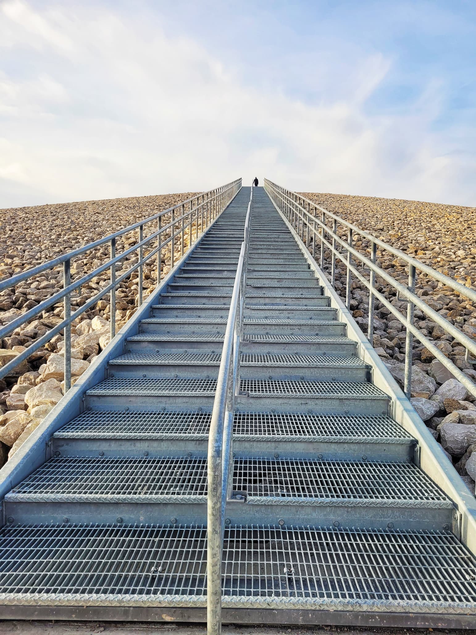
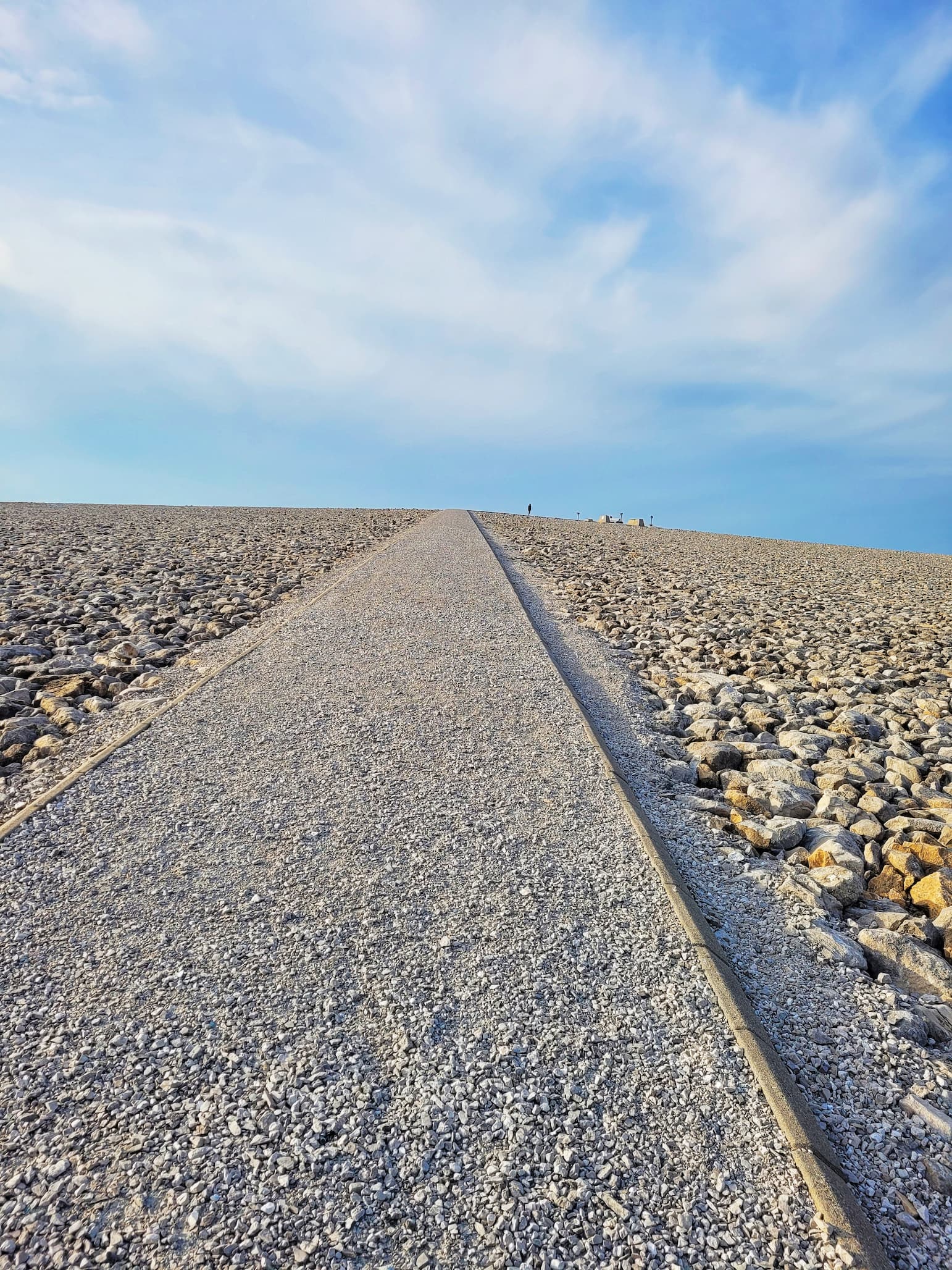
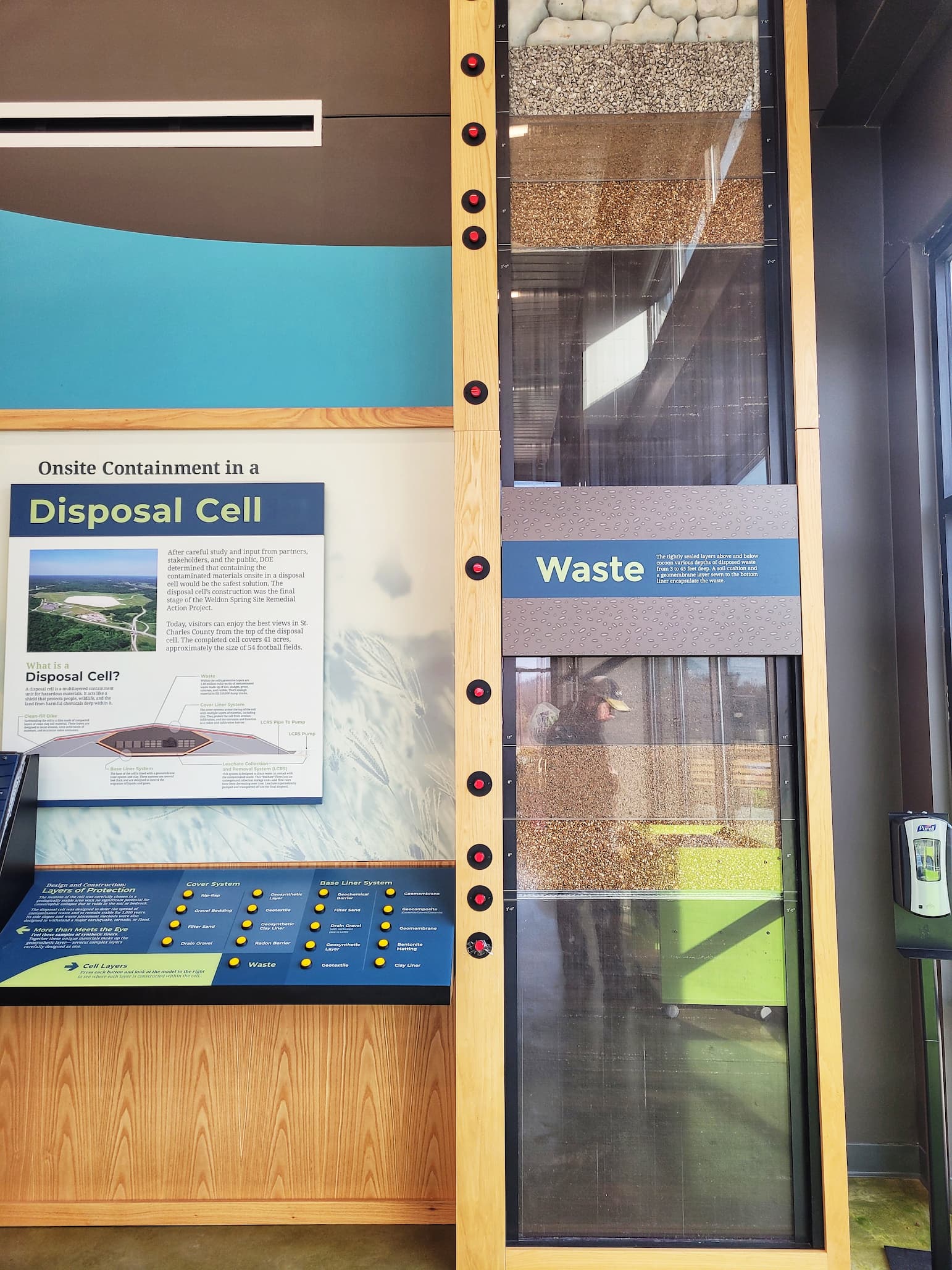
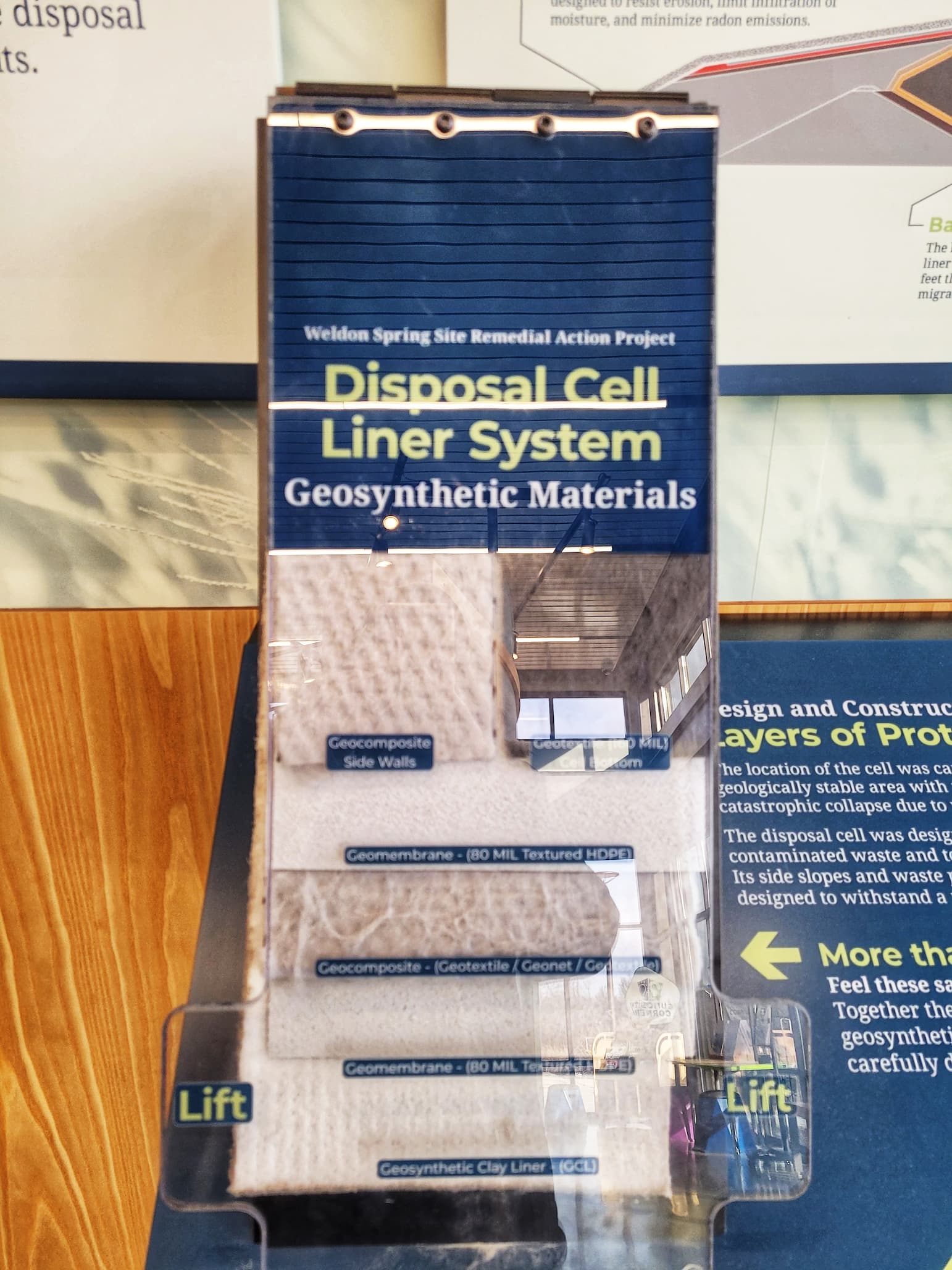
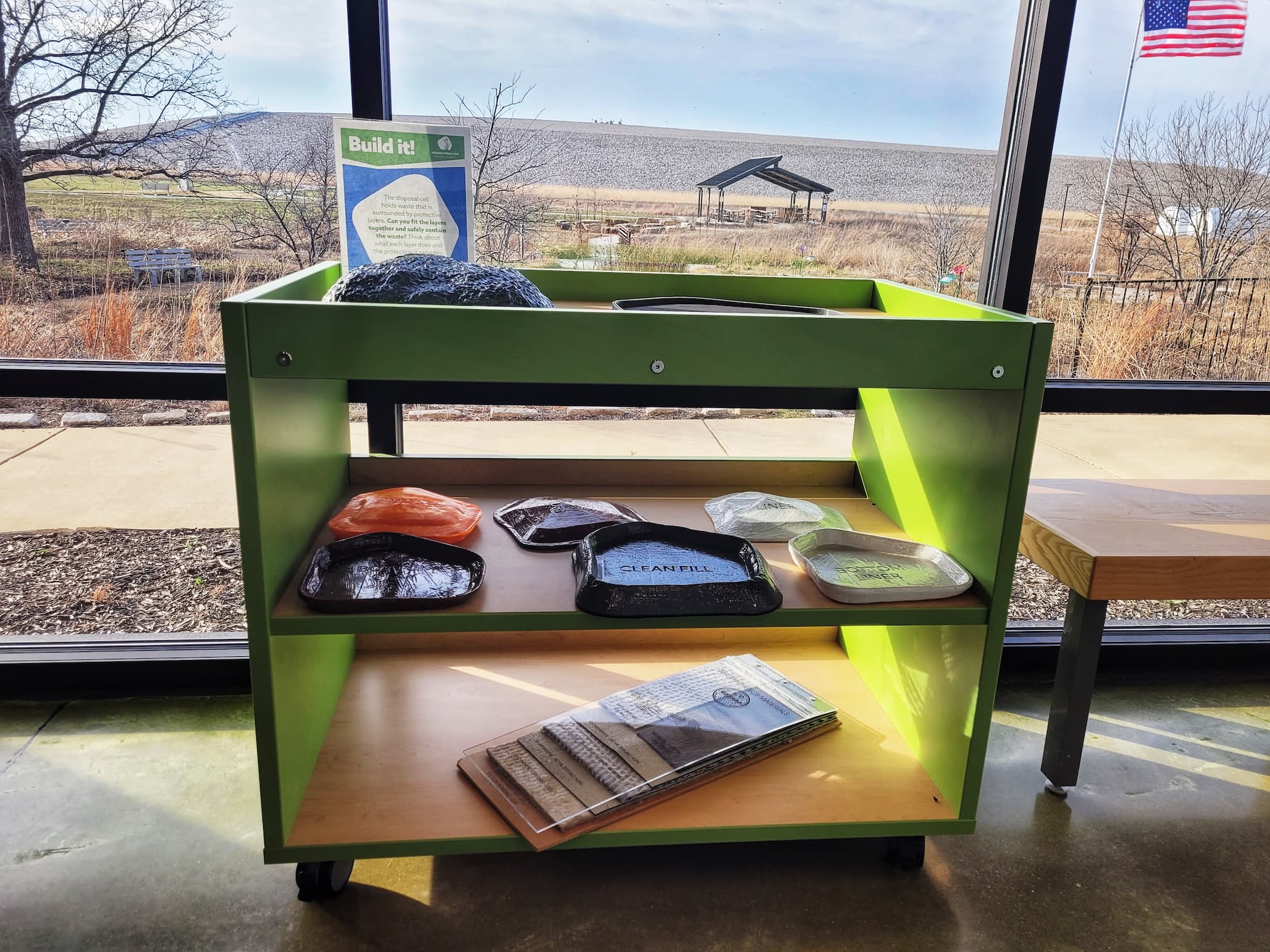
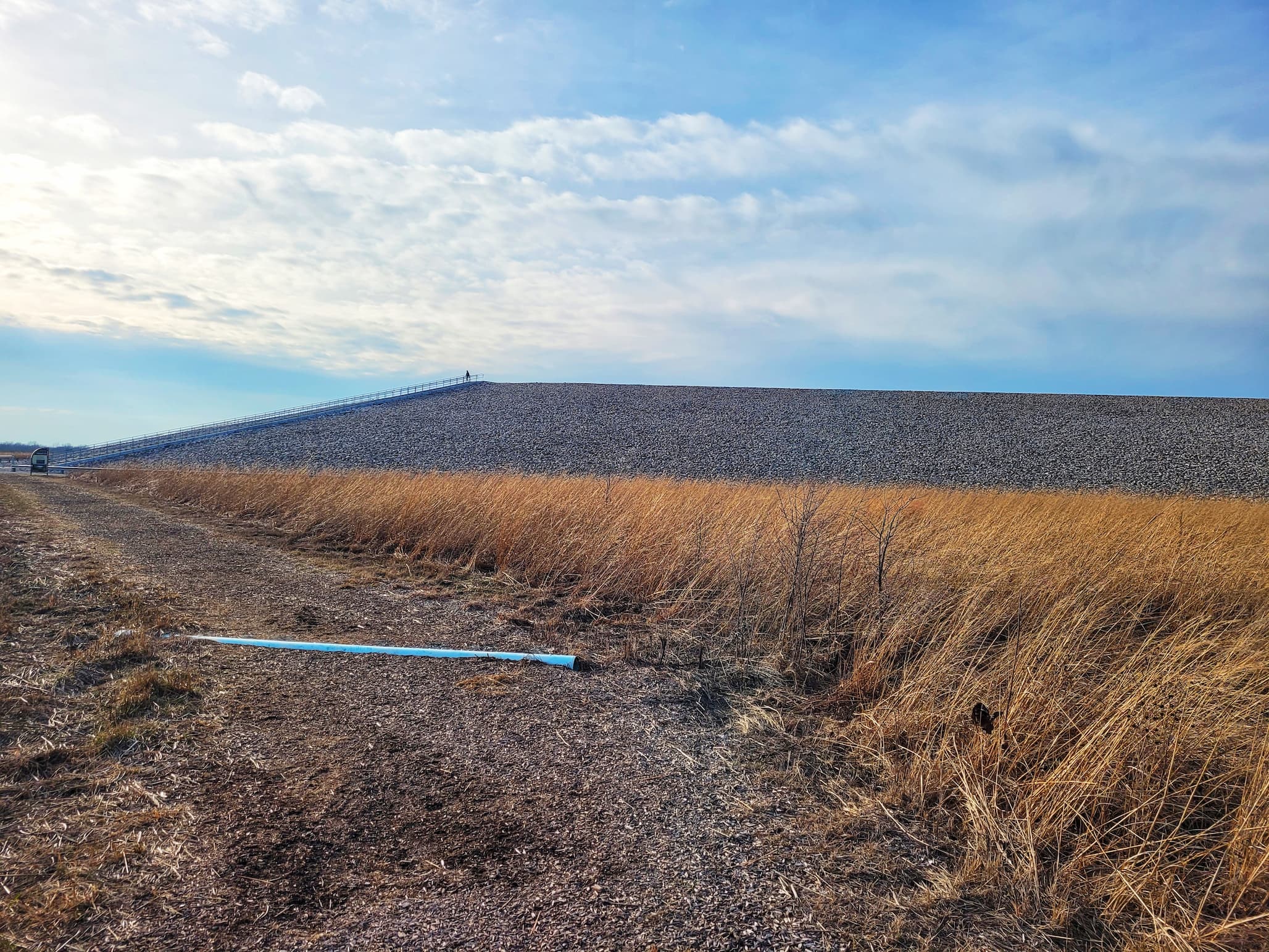
There’s something deeply strange about climbing a 75-foot-tall hill and realizing it isn’t really a hill at all. At the Weldon Spring Disposal Cell, what looks like a stark, limestone-capped monument rising from the prairie is actually a carefully engineered resting place for 1.48 million cubic yards of radioactive and chemical waste. The 41-acre site is open during daylight hours, and you can circle its roughly one-mile circumference on a gravel trail, or commit to the climb and take the long staircase to the top. Three feet beneath the chunky limestone rip-rap under your shoes are multiple layers of liners and natural materials, all sealing in the dismantled remains of two former factories and contaminated soils. It took four years to construct this massive containment cell, and standing on it feels equal parts unsettling and impressive.
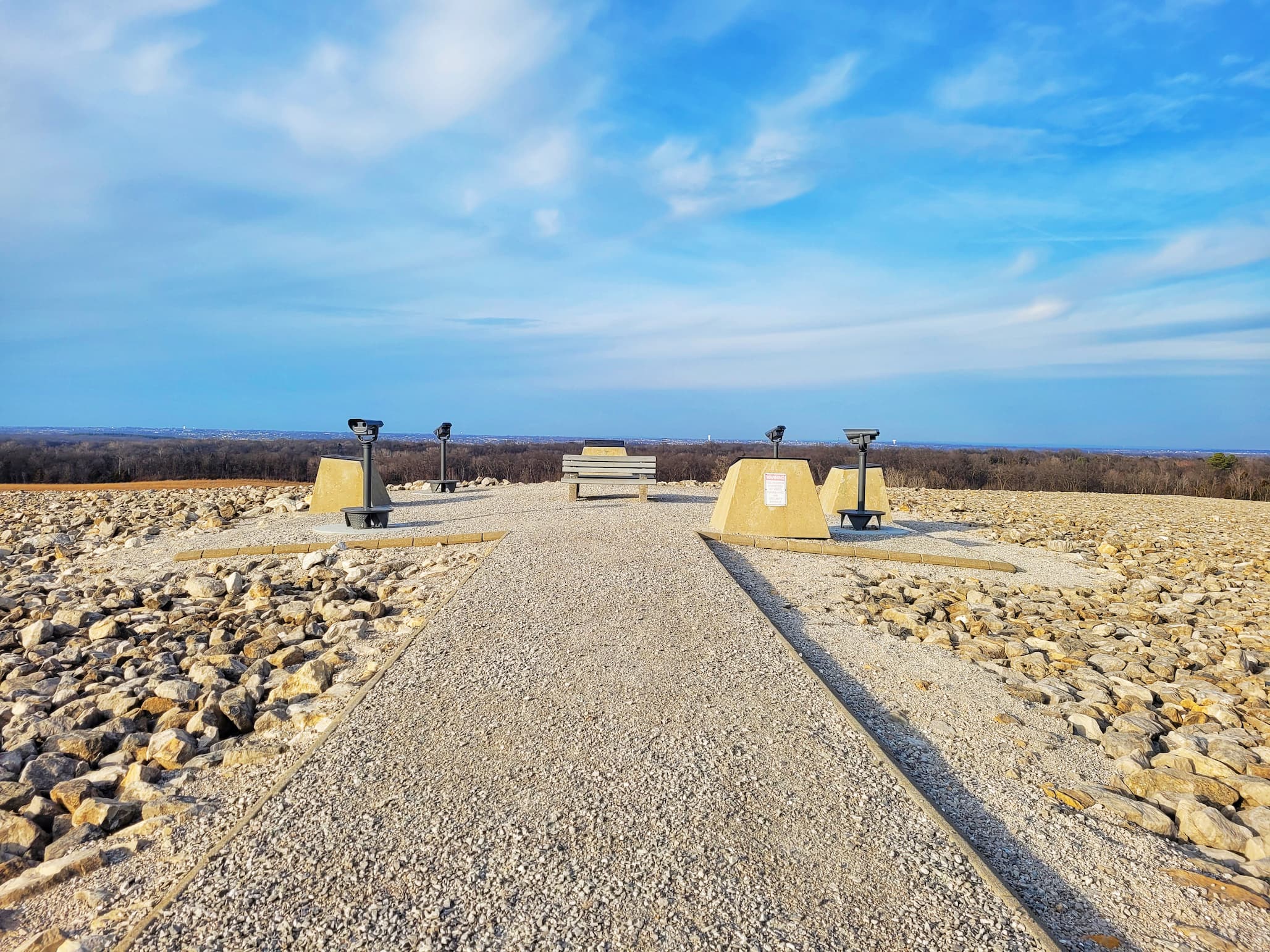
We went on a windy Tuesday afternoon in February, the kind of cold that makes your eyes water on the way up. The stairs seemed endless, but the payoff is the highest publicly accessible point in St. Charles County, with panoramic views stretching across both St. Charles and St. Louis counties. A local woman was using the steps as her personal gym, powering up and down while we stopped to catch our breath and read the signage at the top. If you haven’t already, step inside the interpretive center to see the exhibit explaining how the cell was built, including a hands-on activity where you can try stacking the protective layers yourself. It’s a neat, unexpectedly thought-provoking stop, and absolutely worth the climb.
Nature at Weldon Spring
For a place defined by its industrial past, the landscape today feels surprisingly alive. Just outside the interpretive center, a native plant garden introduces you to the kinds of species that once dominated this region. Beyond it stretches Howell Prairie, a 150-acre restoration seeded with more than 80 species of prairie grasses and wildflowers. First planted in spring 2002, it has grown into one of the largest native plant gardens in the St. Louis area and a popular birding destination, especially during migration. Closer to the building, the eight-acre Jeannie Moe Memorial Native Plant Education Garden features winding walking paths, benches, and clearly marked signs to help identify Missouri-native plants.
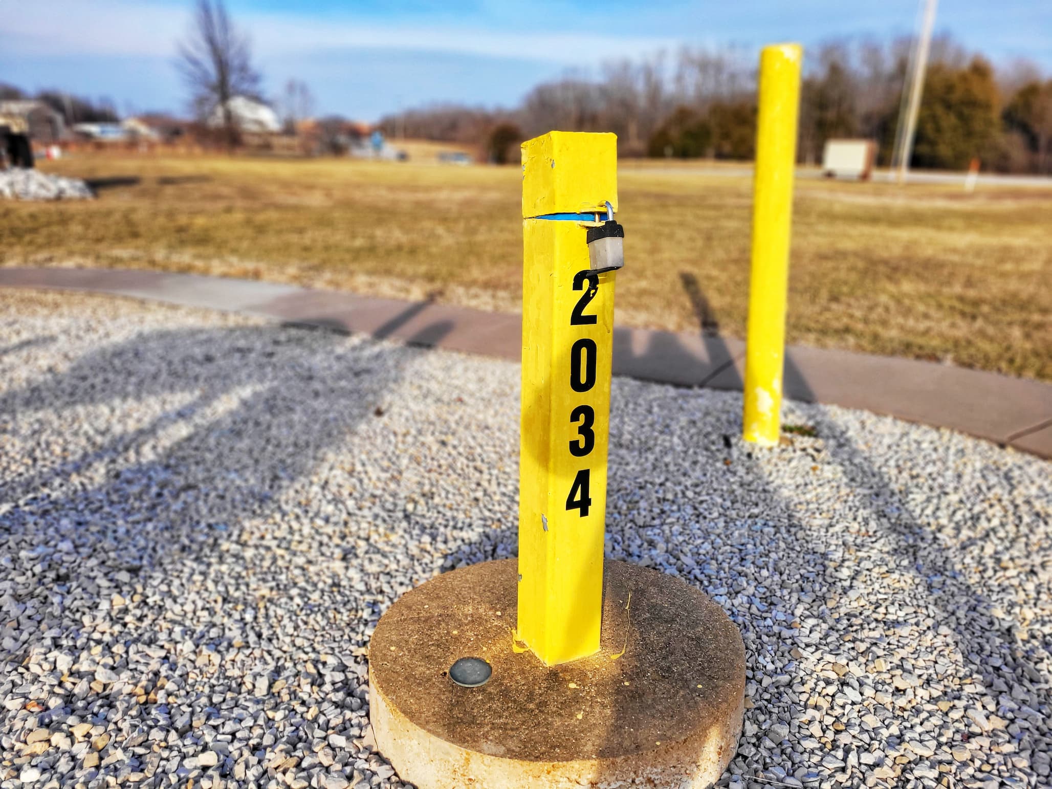
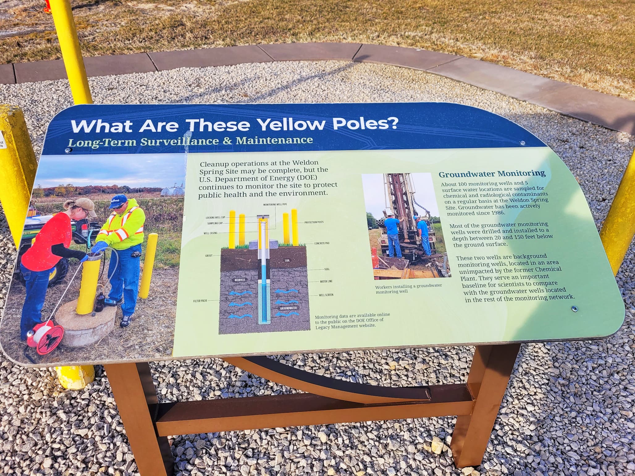
The prairie wraps around the disposal cell, softening its stark geometry with big sky and tall grasses. A trailhead here also connects to the six-mile Hamburg Trail, which links into a broader network including Missouri Department of Conservation trails, the Great Rivers Greenway system, and even the Katy Trail State Park- one of the longest developed rail-trails in the country. Look closely as you explore and you’ll notice yellow poles encircling a single locked pipe: these mark groundwater monitoring wells. While the bulk of contamination has been contained, some remnants remain in the bedrock below, and wells are routinely sampled to ensure public safety. The entire area is now part of the Busch-Weldon Greenspace partnership, a collaboration among the Weldon Spring Site, the U.S. Department of Energy, Missouri State Parks, St. Charles County Parks, the Missouri Department of Conservation, and Great Rivers Greenway- an ongoing effort to balance restoration, recreation, and long-term stewardship.
Weldon Spring Site Video
More Atomic History
Check out these posts about other atomic history-related places we’ve visited:
Spooky Season 2025 (includes our visit to Los Alamos, NM)