Nestled in the heart of southern Illinois, Ferne Clyffe State Park is full of awaiting adventures. The 18 trails in the park will take you through peaceful woods, over tall bluffs, and to cascading waterfalls. Ferne Clyffe is split into two sections, each with its own unique trails. Trails range from 0.5 – 8 miles and from Easy – Difficult. Our Complete Ferne Clyffe State Park Trail Guide will provide all you need to know to lace up your boots and start hiking.
Ferne Clyffe State Park Trails Overview
(Click on each trail name to go directly to trail description and details)
| Trail Name | Distance | Difficulty | Points of Interest |
| Big Buck Creek Trail | 2 miles | Moderate | Follows along Big Buck Creek |
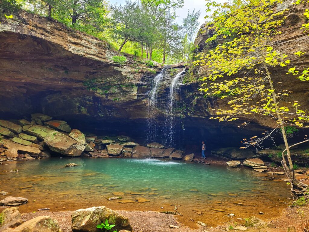
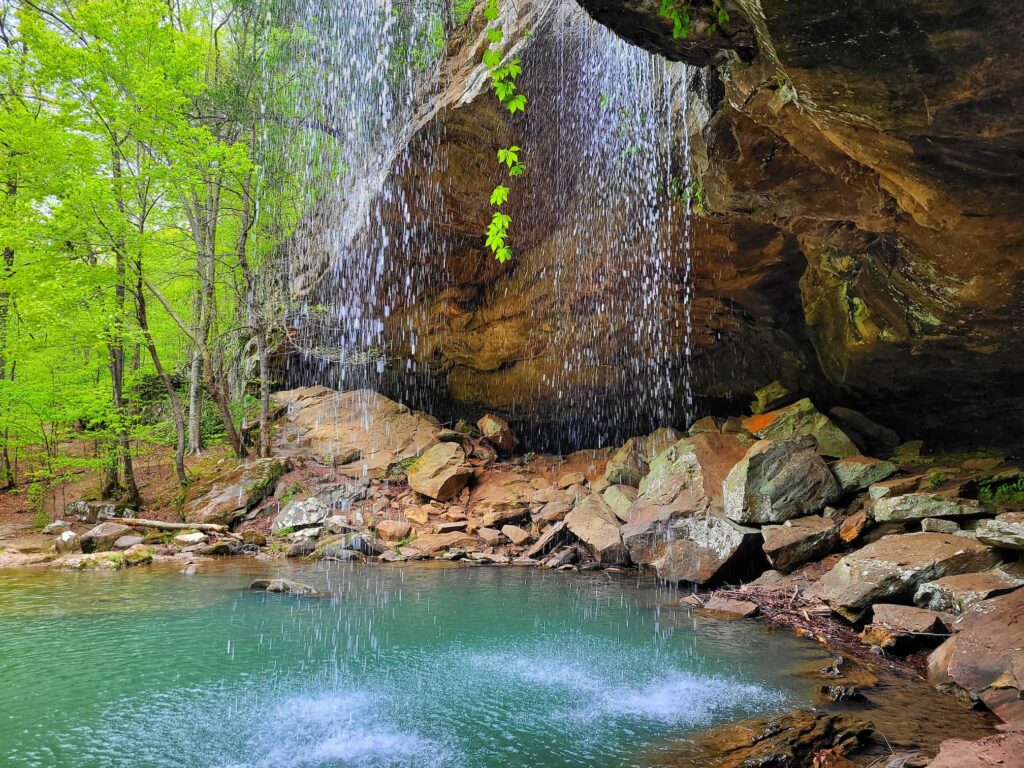
| Big Rocky Hollow Trail | 0.75 miles | Easy | 100-ft tall intermittent waterfall |
| Blackjack Oak Trail | 1 mile | Moderate | Good views from the bluff |
| Bobcat Loop Trail | 1 mile | Moderate | Links Cedar Bluff Trail & Big Buck Creek Trail |
| Bork’s Waterfall Trail | 0.5 miles | Easy | Goes to base of Bork’s waterfall |
| Cedar Bluff Climber’s Access Trail | 0.5 miles | Easy | Access to designated climbing areas |
| Cedar Bluff Trail | 2 miles | Moderate | Scenic views on top the bluff |
| Ferne Clyffe Lake Trail | 1 mile | Easy | Ferne Clyffe Lake |
| Goreville Boy Scout Trail | 0.5 miles | Moderate | Connects to town of Goreville |
| Happy Hollow Horse Trail | 8 miles | Difficult | Shared by hikers & horseback riders |
| Happy Hollow Trail | 5 miles | Difficult | Woods, fields, and several steep climbs |
| High Ridge Trail | 1.5 miles | Moderate | Open to equestrians |
| Hawk’s Cave Trail | 0.5 miles | Easy | One of the largest shelter bluffs in IL |
| Rebman Trail | 0.25 miles | Easy | Plaque dedicated to Emma Rebman |
| Round Bluff Nature Preserve Trail | 1 mile | Moderate | Rare plants and interesting rock formations |
| Waterfall Trail | 0.75 miles | Moderate | Connects Deer Ridge campground to waterfall |
Hiking at Ferne Clyffe State Park is an adventure, but don’t count on cell service in some areas. That’s where AllTrails+ comes in- it lets you download maps for offline use, so you can stay on track no matter where you wander. You can try AllTrails Plus free for 7 days and see how it works for you. Just a heads-up, I’m an AllTrails affiliate, so if you sign up, I may earn a commission at no extra cost to you!
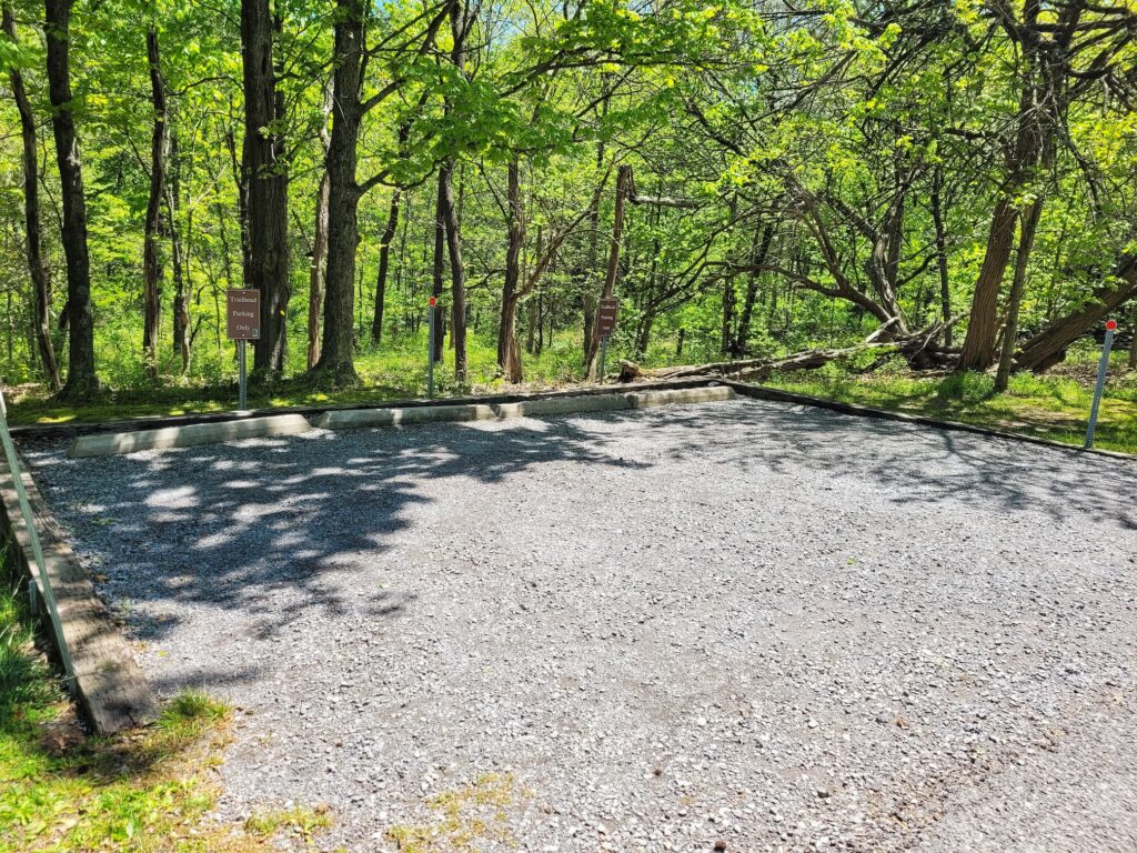
Ferne Clyffe State Park Trail Parking
Ferne Clyffe State Park Trail Map
The IDNR has a state park trail map available for download online here. You can also pick up a paper copy at the kiosk by Boat Rock.
Big Buck Creek Trail
✵
2 miles
✵
Moderate
✵
Out and Back
Parking and Trailhead: 37.5310, -89.0021
The Big Buck Creek Trail connects with the Cedar Bluff and Bobcat Loop trails. You can also connect to Bork’s Falls and High Ridge Trail if you want a longer hike.
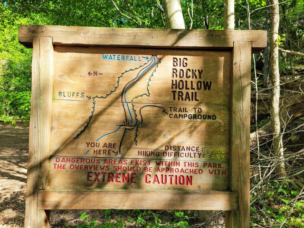
Big Rocky Hollow Trail
✵
0.75 miles
✵
Easy
✵
Out and Back
Trailhead: 37.5428, -88.9797
Parking: 37.5412, -88.9813
Big Rocky Hollow Trail takes you to the same waterfall as Waterfall Trail does from the campsite. If you’re not camping, we suggest using this trail instead as there is much more parking. The same parking area is used for Big Rocky Hollow, Hawk’s Cave, Rebman, and Goreville Boy Scout Trails. It also provides access to climbing areas.
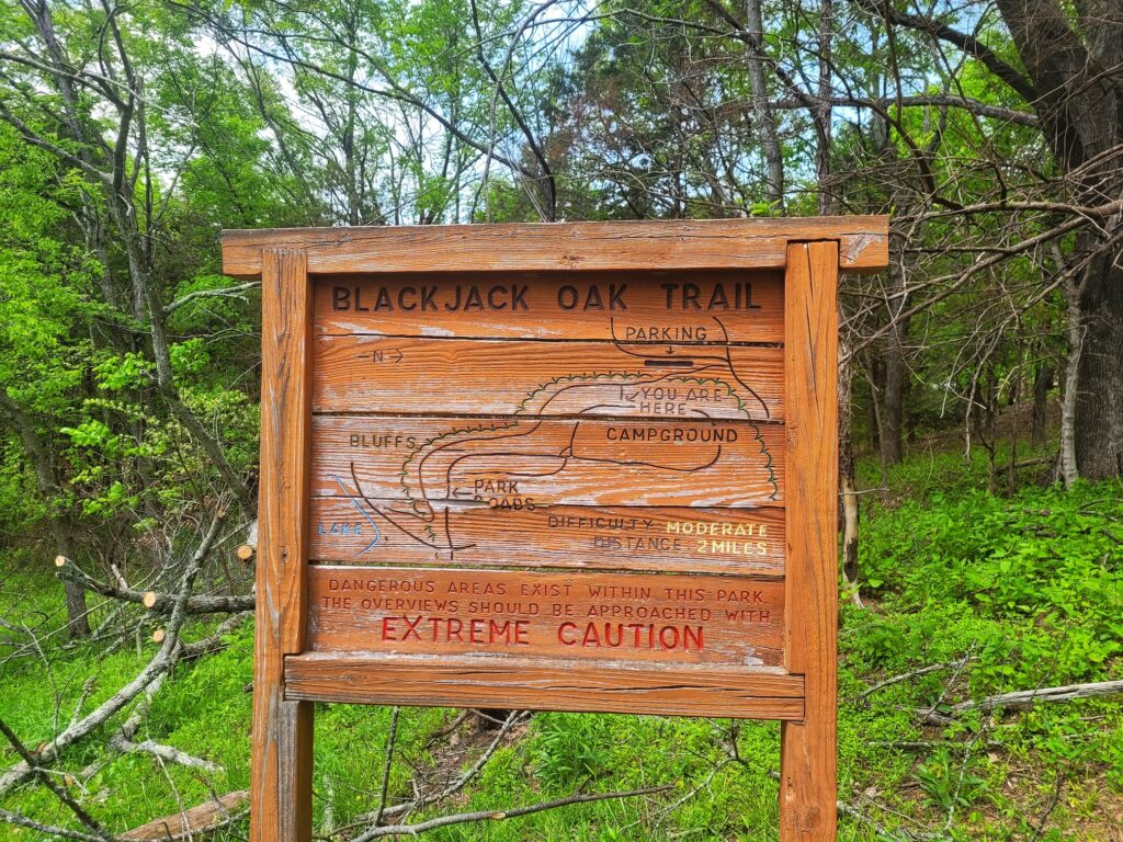
Blackjack Oak Trail
✵
1 mile
✵
Moderate
✵
Out and Back
Trailhead and Parking: Hillside Picnic Shelter (37.5412, -88.9814) OR Ferne Clyffe Lake (37.5348, -88.9758)
The Blackjack Oak Trail connects the lake and Hillside Picnic Shelter. There are also two access access points from Deer Ridge Campground. This trail goes over bluffs and close to cliff edges, which provides amazing views.
Bobcat Loop Trail
✵
1 mile
✵
Moderate
✵
Loop
Parking and Trailhead: Bobcat Loop Trail does not have its own parking. You can connect to it from either the Bork’s Waterfall trailhead, Big Buck Creek trailhead, or Cedar Bluff trailhead.
Bork’s Waterfall Trail
✵
0.5 miles
✵
Easy
✵
Out and Back
Trailhead and Parking: 37.5416, -89.0219
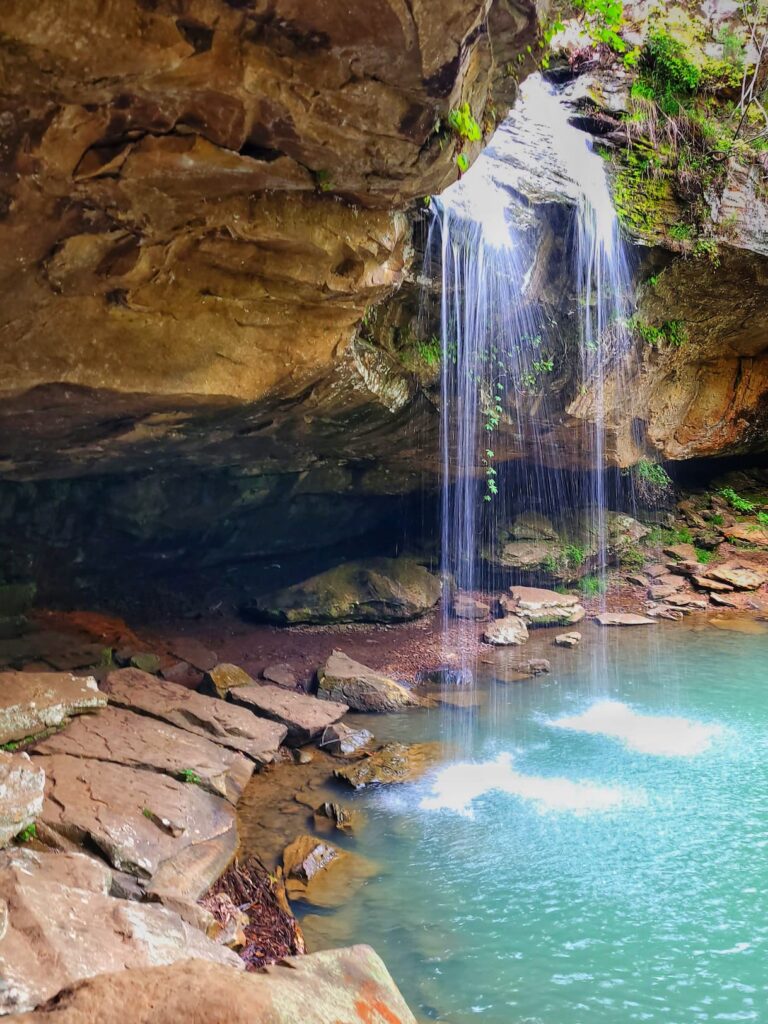
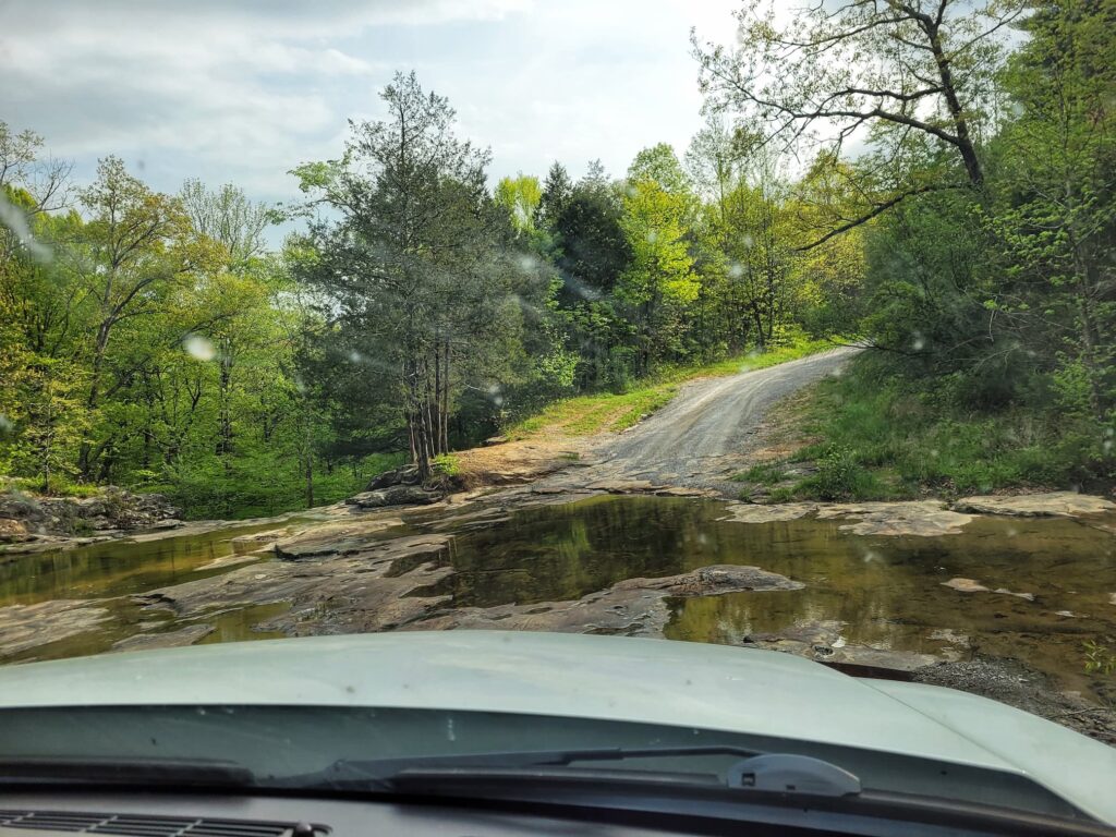
Bork’s Waterfall is in the annex section of Ferne Clyffe State Park. Parking and trailhead is on Regent Lane. To get to the trailhead, you’ll have to drive over the top of the waterfall itself- which is quite an experience! The waterfall here is ~30 feet tall, and when we visited was rushing pretty good. The trail will take you down to the base of the waterfall, but if you don’t mind breaking the rules there are also several shortcuts that will get you there faster.
Cedar Bluff Climber’s Access Trail
✵
0.5 miles
✵
Easy
✵
Out and Back
Trailhead & Parking: 37.5162, -89.0237
The Cedar Bluff Access Trail is used by rock climbers to access designated climbing and rappelling areas in the annex section of Ferne Clyffe State Park.
Cedar Bluff Trail
✵
2 miles
✵
Moderate
✵
Out and Back
Trailhead and Parking: 37.5162, -89.0237
Cedar Bluff is a great trail if you’re looking for a view. The trail will take you to a vista atop Cedar Bluff. Some folks turn around here, and others continue on until the trail descends the bluff and connects with Bobcat Loop Trail. From Bobcat Loop, you can continue on to Bork’s Falls and High Ridge if you want a long hike.
Ferne Clyffe Lake Trail
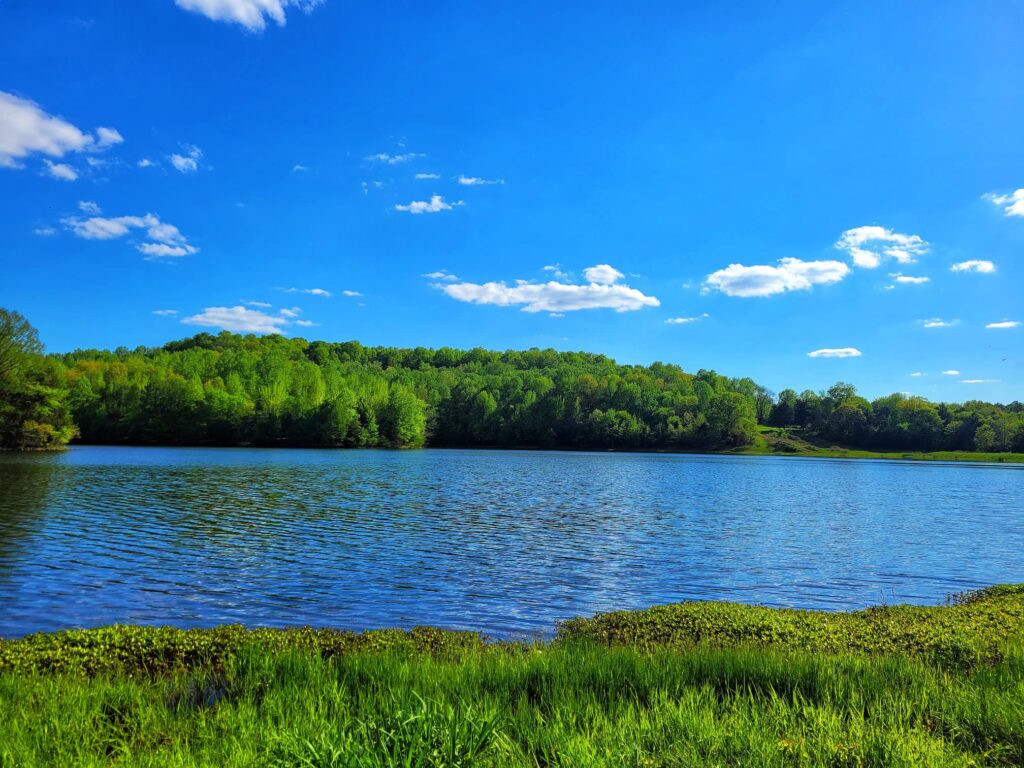
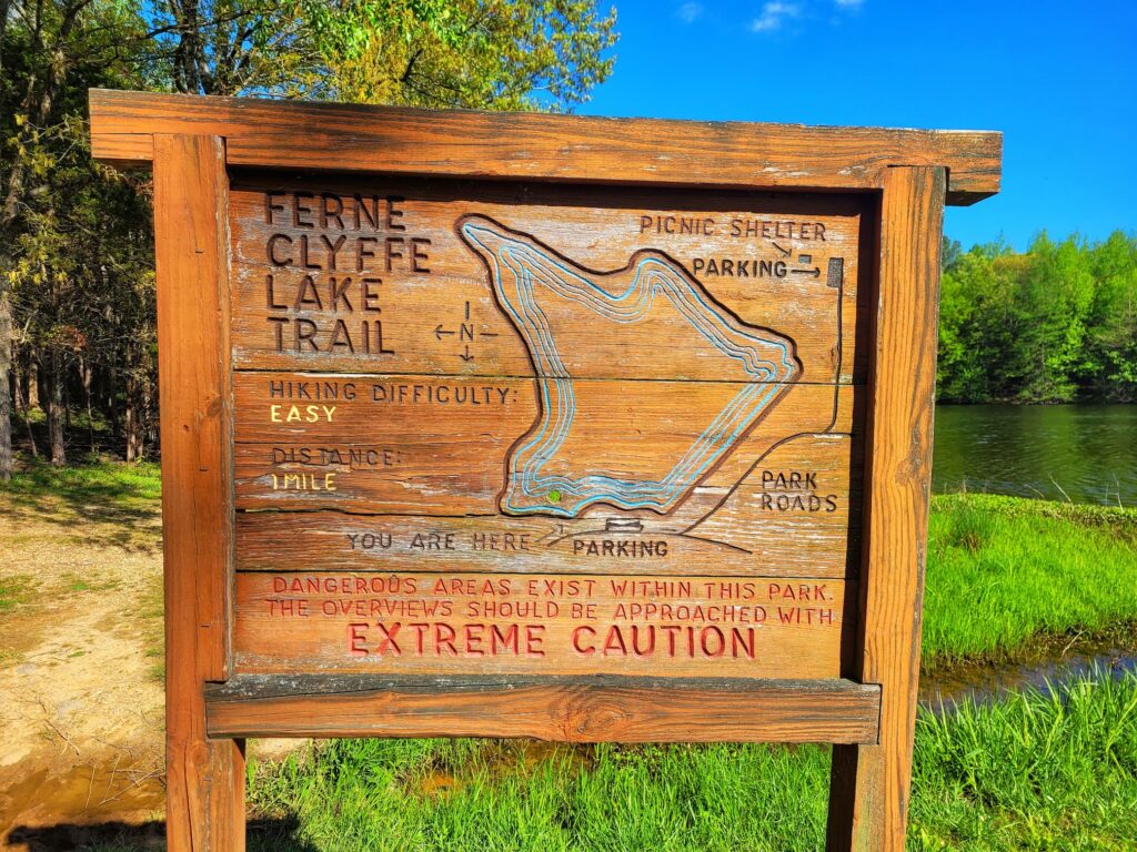
✵
1 mile
✵
Easy
✵
Loop
Trailhead and Parking: 37.5446, -88.9759
Ferne Clyffe Lake Trail circles around the shores of the lake. It’s popular with fishermen, since only bank fishing is allowed in the park. The start of the path is open grass near the lake parking area, but quickly turns into woods. The majority of the trail takes you through the woods a few feet from the lake’s edge.Bobcat Loop Trail
Goreville Boy Scout Trail
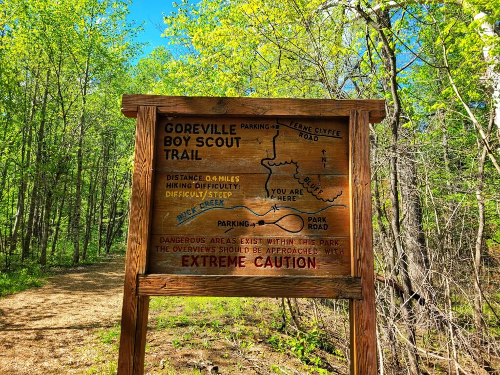
✵
0.5 miles
✵
Moderate
✵
Out and Back
Trailhead: 37.5428, -88.9800
Parking: 37.5412, -88.9813 or 37.5494, -88.9790
The Goreville Boy Scout Trail connects Ferne Clyffe State Park to the town of Goreville. There is a parking lot with room for a few cars at the city end of the trail. This gravel trail is pretty even, but is a steady uphill walk the whole way (if you start from the park end).
Happy Hollow Horse Trail
✵
8 miles
✵
Moderate
✵
Loop
Trailhead: Accessible from equestrian campground at 37.5296, -88.9844
This equestrian trail is accessible from the equestrian campground. Some of the trail overlaps with the Happy Hollow Trail and the River to River Trail, so it is shared with hikers and horseback riders. This trail is closed to horses from November 1 to April 30 every year.
Happy Hollow Trail
✵
5 miles
✵
Difficult
✵
Loop
Trailhead and Parking: 37.5377, -88.9832
Depending on the time of year, there can be a few small waterfalls along the Happy Hollow Trail. There are also a handful of interesting rock formations, such as alligator rock, a natural bridge, and some small arches. The Happy Hollow Horse Trail overlaps with the Happy Hollow Trail.
High Ridge Trail
✵
1.5 miles
✵
Moderate
✵
Out and Back
Parking and Trailhead: 37.5416, -89.0219 or join up the trail midway at 37.5494, -88.9790
High Ridge Trail is open to both hikers and horseback riders. It splits off from Big Buck Creek Trail along a woodland ridge.
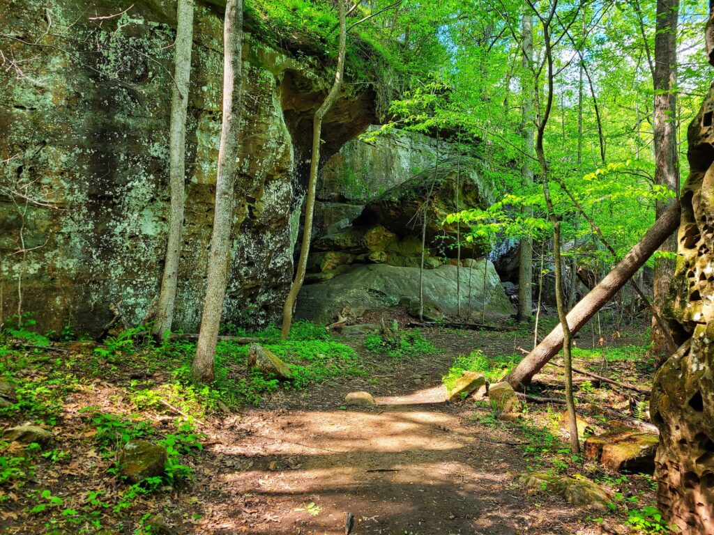
Hawk’s Cave Trail
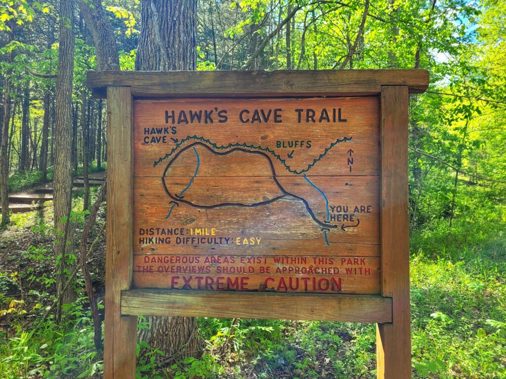
✵
0.5 miles
✵
Easy
✵
Loop
Trailhead: 37.5428, -88.9797
Parking: 37.5412, -88.9813
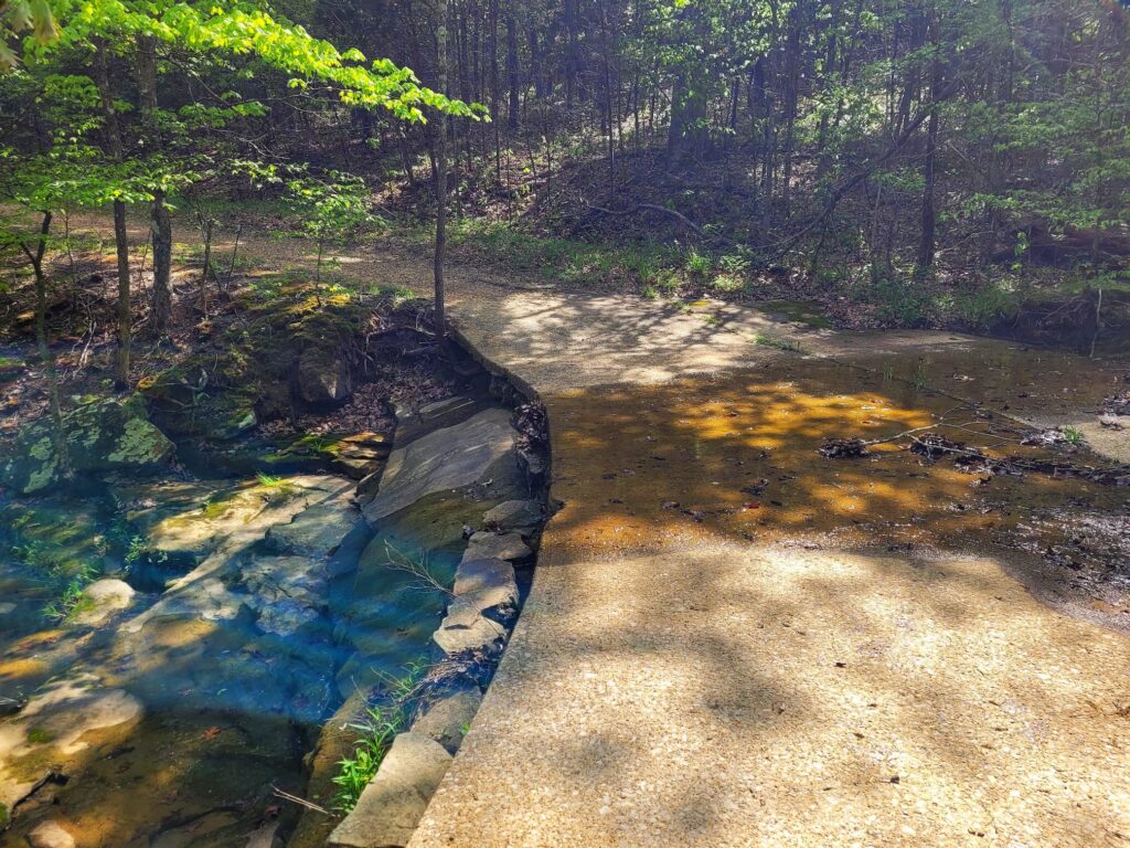
Hawk’s Cave Trail takes you through the woods to one of the largest rock shelters in Illinois. Depending on the time of year, you may see a small waterfall or two also.
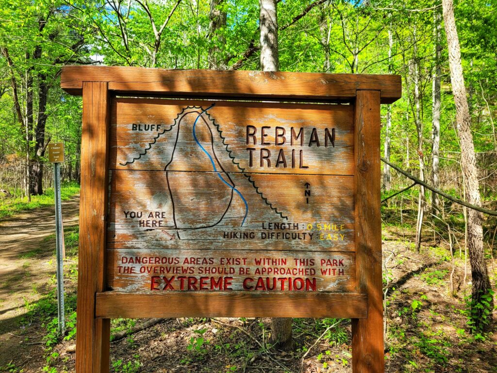
Rebman Trail
✵
0.25 miles
✵
Easy
✵
Loop
Trailhead: 37.5428. -88.9800
Parking: 37.5412, -88.9813
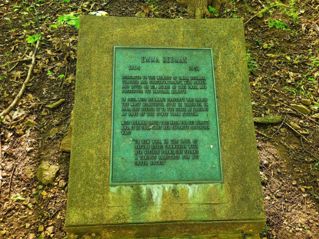
Rebman Trail is named for Emma Rebman, the owner of Ferne Clyffe who sold the property to the state. There is a plaque dedicated to her along the trail and two small waterfalls along the trail, depending on rainfall. This trail also serves as access for rock climbers to the Rebman walls.
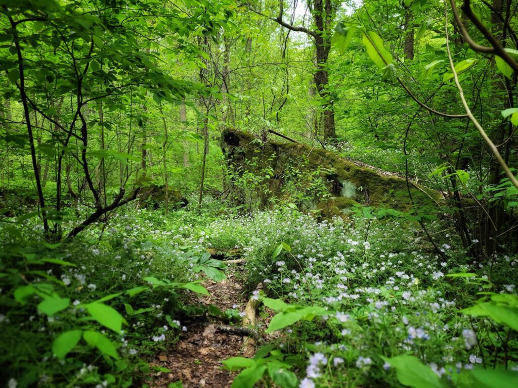
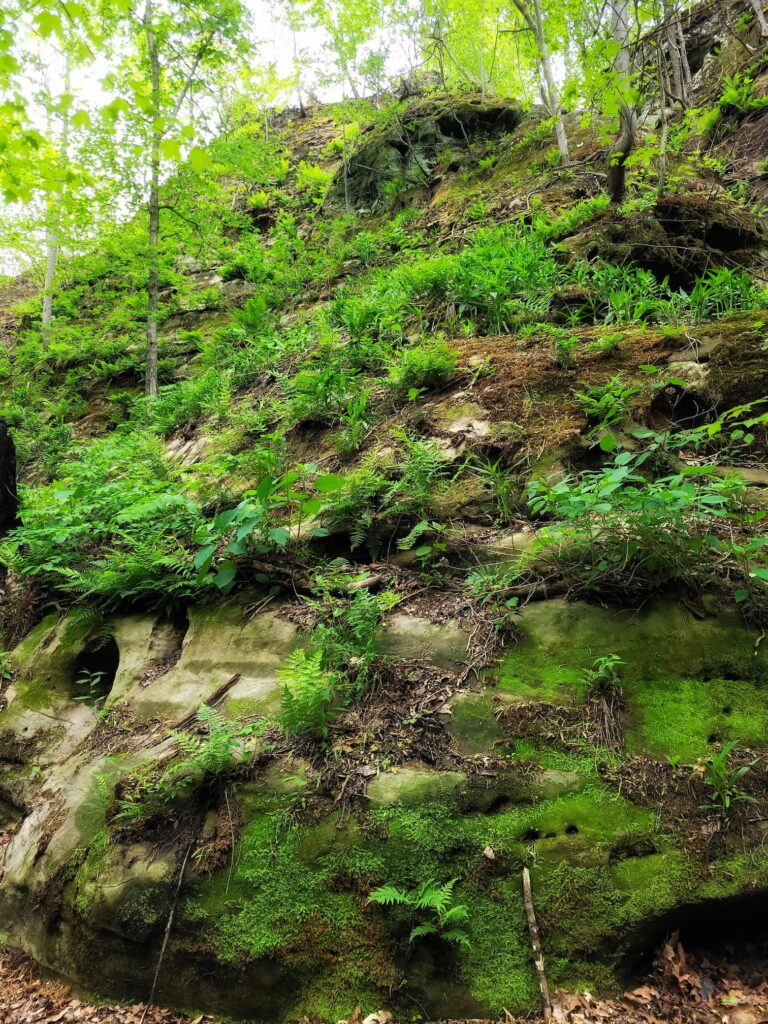
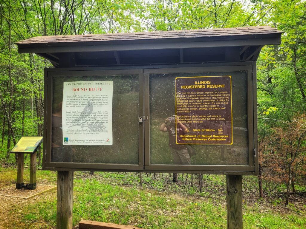
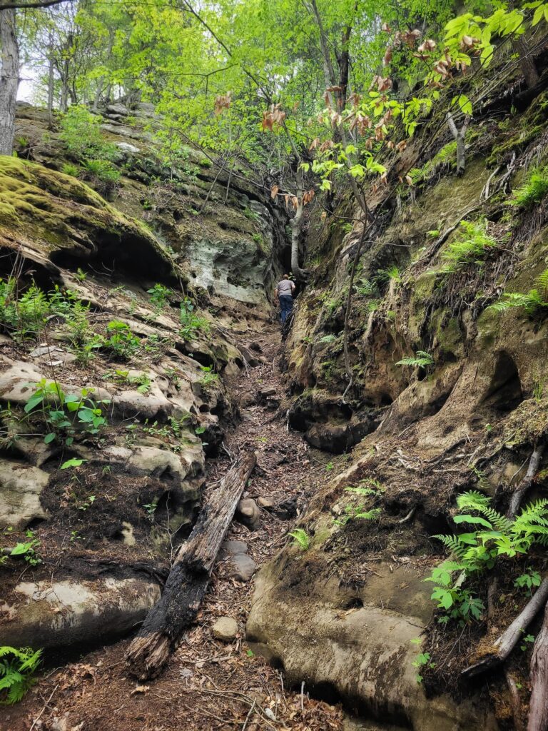
Round Bluff Nature Preserve Trail
✵
1 mile
✵
Moderate
✵
Loop
Parking and Trailhead: Lakeview Shelter- 37.5318, -88.9789
Round Bluff Nature Preserve is an Illinois designated Nature Preserve withing Ferne Clyffe State Park. Starting from Lakeview Shelter, this loop trail will take you through the preserve and around the namesake round bluffs.
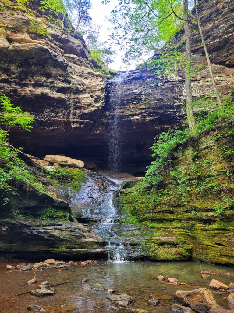
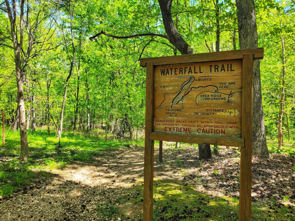
Waterfall Trail
✵
0.75 miles
✵
Moderate
✵
Out and Back
Trailhead and Parking: 37.5394, -88.9774
The trailhead and small parking lot for Waterfall Trail is inside Deer Ridge Campground. This trail takes you over the tops of bluffs and then down to see the 100 foot intermittent waterfall. If you’re not camping, you’ll find more parking near the Big Rocky Hollow trailhead, which also leads to the same waterfall. There are also climbing walls accessible from both the Waterfall Trail and Big Rocky Hollow.
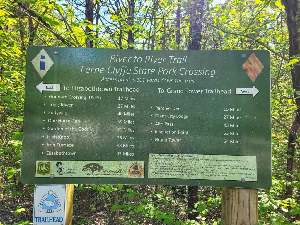
Bonus: River to River Trail
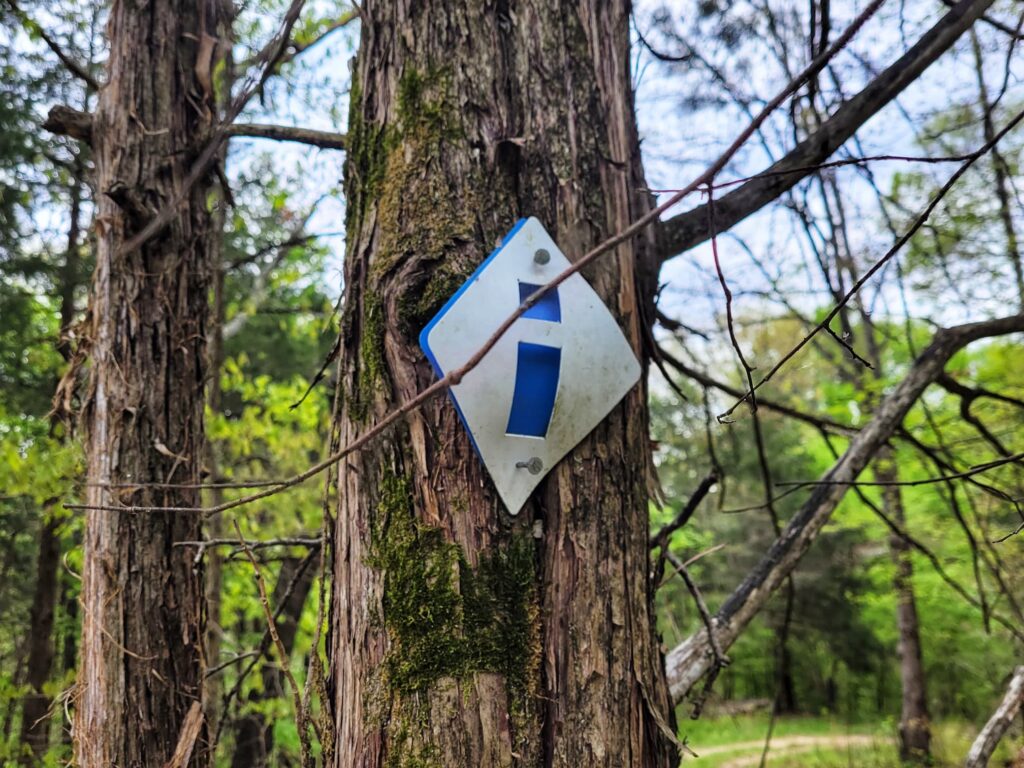
The River to River Trail. The trail crosses through Ferne Clyffe State Park and overlaps trails in several places. The River to River Trail is marked with a blue i inside a white diamond. The photo of the trail sign below was taking at the parking lot at 37.5314, -88.9817, but you can join up with it at several other places as well.
Camping at Ferne Clyffe State Park
Ferne Clyffe has campsites for RVs, tents, and equestrians. Check out our complete Ferne Clyffe State Park camping guide here: A Nature Lover’s Paradise: The Ultimate Ferne Clyffe State Park Campground Guide


2 Comments on “The Complete Ferne Clyffe State Park Trail Guide”
Comments are closed.